
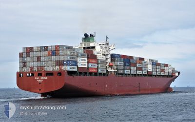
MSC SHANELLE V
Container Ship
Current Trip
| Time Travelled | 15 days |
|---|---|
| Remaining Time | --- |
| Distance Travelled | 4918.70 nm |
| Remaining Distance | --- |
| AVG Speed | 15.6 Knots |
| MAX Speed | 19 Knots |
| AVG Wind | 9.6 knots |
| MAX Wind | 24 knots |
| MIN Temp | 15.1°C / 59.18°F |
| MAX Temp | 30.5°C / 86.9°F |
| Draught | 9.4 m |
| Position Received | 5 h, 43 m ago |
Current Position
| Longitude | -126.57485° |
|---|---|
| Latitude | 32.00870° |
| Status | Under way using engine |
| Speed | 18.3 Knots |
| Course | 289° |
| Area | North Pacific Ocean |
| Station | T-AIS |
| Position Received | 5 h, 43 m ago |
Info
Information
The current position of MSC SHANELLE V is in North Pacific Ocean with coordinates 32.00870° / -126.57485° as reported on 2024-06-01 04:23 by AIS to our vessel tracker app. The vessel's current speed is 18.3 Knots and is heading at the port of QINGDAO. The estimated time of arrival as calculated by vessel tracking app is 2024-06-13 12:00 LT
The vessel MSC SHANELLE V (IMO: 9292175, MMSI: 353111000) is a Container Ship that was built in 2004 ( 20 years old ). It's sailing under the flag of [PA] Panama.
In this page you can find informations about the vessels current position, last detected port calls, and current voyage information. If the vessels is not in coverage by AIS you will find the latest position.
The current position of MSC SHANELLE V is detected by our AIS receivers and we are not responsible for the reliability of the data. The last position was recorded while the vessel was in Coverage by the Ais receivers of our vessel tracking app.
The current draught of MSC SHANELLE V as reported by AIS is 9.4 meters
Weather
| Temperature | 15.4°C / 59.72°F |
|---|---|
| Wind Speed | 15 knots |
| Direction | 348° NNW |
| Pressure | 1021.9 hPa |
| Humidity | 87.9 % |
| Cloud Coverage | --- |
Featured Company
Last Port Calls
| Port | Arrival | Departure | Time In Port |
|---|---|---|---|
| 2024-05-16 11:19 | 2024-05-17 07:25 | 20 h | |
| 2024-04-28 16:09 | 2024-04-29 19:34 | 1 d | |
| 2024-04-26 11:37 | 2024-04-27 13:08 | 1 d | |
| 2024-04-22 16:17 | 2024-04-23 08:12 | 15 h | |
| 2024-04-21 10:47 | 2024-04-22 09:20 | 22 h | |
| 2024-04-18 02:43 | 2024-04-19 04:29 | 1 d | |
| 2024-04-01 19:14 | 2024-04-02 15:08 | 19 h |
Most Visited Ports (Last year)
| Port | Arrivals | |
|---|---|---|
| 13 | ||
| 10 | ||
| 6 | ||
| 6 | ||
| 5 | ||
| 5 |
Last Trips
| Origin | Departure | Destination | Arrival | Distance | |
|---|---|---|---|---|---|
| 2024-04-29 21:34 | 2024-05-16 06:19 | 5648.79 nm | |||
| 2024-04-27 15:08 | 2024-04-28 18:09 | 376.84 nm | |||
| 2024-04-23 10:12 | 2024-04-26 13:37 | 717.01 nm | |||
| 2024-04-22 11:20 | 2024-04-22 18:17 | 83.45 nm | |||
| 2024-04-19 06:29 | 2024-04-21 12:47 | 750.61 nm | |||
| 2024-04-02 09:08 | 2024-04-18 04:43 | 5588.44 nm | |||
| 2024-03-14 04:41 | 2024-04-01 13:14 | 5740.82 nm |
Events
| Time | Event | Details | Position / Dest | Info |
|---|---|---|---|---|
| 2024-06-01 04:27 | Status Changed | Default Under way using engine |
32.01600 / -126.59863
PAPTY>CNTAO
|
Speed: 18.3 kn Course: 289° |
| 2024-06-01 04:23 | OUT of Coverage |
32.00870 / -126.57485
North Pacific Ocean
PAPTY>CNTAO
|
Speed: 18.3 kn Course: 289° |
|
| 2024-06-01 04:21 | Status Changed | Under way using engine Default |
32.00657 / -126.56797
PAPTY>CNTAO
|
Speed: 18.4 kn Course: 289° |
| 2024-06-01 04:19 | IN Coverage |
32.00870 / -126.57485
North Pacific Ocean
PAPTY>CNTAO
|
Speed: 18.3 kn Course: 289° |
|
| 2024-06-01 00:52 | Status Changed | Default Under way using engine |
31.63243 / -125.38372
PAPTY>CNTAO
|
Speed: 18.1 kn Course: 290° |
| 2024-06-01 00:45 | OUT of Coverage |
31.62040 / -125.34707
North Pacific Ocean
PAPTY>CNTAO
|
Speed: 18.1 kn Course: 290° |
|
| 2024-06-01 00:38 | Status Changed | Under way using engine Default |
31.60578 / -125.30287
PAPTY>CNTAO
|
Speed: 17.9 kn Course: 290° |
| 2024-06-01 00:32 | IN Coverage |
31.60578 / -125.30287
North Pacific Ocean
PAPTY>CNTAO
|
Speed: 18.1 kn Course: 290° |
|
| 2024-05-31 22:47 | Status Changed | Default Under way using engine |
31.39893 / -124.70570
PAPTY>CNTAO
|
Speed: 17.8 kn Course: 292° |
| 2024-05-31 22:41 | OUT of Coverage |
31.38793 / -124.67527
North Pacific Ocean
PAPTY>CNTAO
|
Speed: 17.8 kn Course: 292° |