
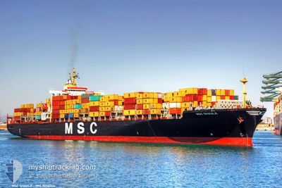
MSC SHAULA
Container Ship
Current Trip
| Time Travelled | 5 h, 48 mins |
|---|---|
| Remaining Time | 16 days |
| Distance Travelled | 84.41 nm |
| Remaining Distance | 6350.05 nm |
| AVG Speed | 14.4 Knots |
| MAX Speed | 17.7 Knots |
| AVG Wind | 12 knots |
| MAX Wind | 15 knots |
| MIN Temp | 23.1°C / 73.58°F |
| MAX Temp | 26.4°C / 79.52°F |
| Draught | 12.3 m |
| Position Received | Now |
Current Position
| Longitude | 130.14223° |
|---|---|
| Latitude | 35.41683° |
| Status | Under way using engine |
| Speed | 15.7 Knots |
| Course | 31.8° |
| Area | Japan Sea |
| Station | T-AIS |
| Position Received | Now |
Info
Information
The current position of MSC SHAULA is in Japan Sea with coordinates 35.41683° / 130.14223° as reported on 2024-06-16 13:27 by AIS to our vessel tracker app. The vessel's current speed is 15.7 Knots and is heading at the port of MANZANILLO. The estimated time of arrival as calculated by vessel tracking app is 2024-07-02 14:43 LT
The vessel MSC SHAULA (IMO: 9036002, MMSI: 636017346) is a Container Ship that was built in 1992 ( 32 years old ). It's sailing under the flag of [LR] Liberia.
In this page you can find informations about the vessels current position, last detected port calls, and current voyage information. If the vessels is not in coverage by AIS you will find the latest position.
The current position of MSC SHAULA is detected by our AIS receivers and we are not responsible for the reliability of the data. The last position was recorded while the vessel was in Coverage by the Ais receivers of our vessel tracking app.
The current draught of MSC SHAULA as reported by AIS is 12.3 meters
Weather
| Temperature | 23.3°C / 73.94°F |
|---|---|
| Wind Speed | 9 knots |
| Direction | 219° SW |
| Pressure | 1008.2 hPa |
| Humidity | 82 % |
| Cloud Coverage | 100 % |
Featured Company
Last Port Calls
| Port | Arrival | Departure | Time In Port |
|---|---|---|---|
| 2024-06-15 08:40 | 2024-06-16 07:40 | 22 h | |
| 2024-06-06 22:04 | |||
| 2024-06-03 06:02 | 2024-06-04 03:53 | 21 h | |
| 2024-05-10 16:44 | 2024-05-12 18:28 | 2 d | |
| 2024-05-02 10:36 | 2024-05-03 07:04 | 20 h | |
| 2024-04-20 05:04 | 2024-04-21 14:21 | 1 d | |
| 2024-04-10 13:32 | 2024-04-11 14:33 | 1 d |
Most Visited Ports (Last year)
| Port | Arrivals | |
|---|---|---|
| 5 | ||
| 5 | ||
| 4 | ||
| 4 | ||
| 3 | ||
| 3 |
Last Trips
| Origin | Departure | Destination | Arrival | Distance | |
|---|---|---|---|---|---|
| 2024-06-07 06:04 | 2024-06-15 17:40 | 1152.92 nm | |||
| 2024-05-12 21:28 | 2024-06-03 15:02 | 7118.27 nm | |||
| 2024-05-03 12:34 | 2024-05-10 19:44 | 2229.45 nm | |||
| 2024-04-21 22:21 | 2024-05-02 16:06 | 1772.41 nm | |||
| 2024-04-11 22:33 | 2024-04-20 13:04 | 455.82 nm | |||
| 2024-03-30 04:10 | 2024-04-10 21:32 | 3827.97 nm |
Events
| Time | Event | Details | Position / Dest | Info |
|---|---|---|---|---|
| 2024-06-16 08:39 | Draught Changed | 12.3 11.2 |
34.89131 / 128.87233
KRPUS>MXZLO
|
Speed: 11.7 kn Course: 135.8° |
| 2024-06-16 08:39 | Destination Changed | KRPUS>MXZLO CNNGB>KRPUS |
34.89131 / 128.87233
KRPUS>MXZLO
|
Speed: 11.7 kn Course: 135.8° |
| 2024-06-16 08:39 | ETA Changed | 2024/07/02 07:00 2024/06/15 07:45 |
34.89131 / 128.87233
KRPUS>MXZLO
|
Speed: 11.7 kn Course: 135.8° |
| 2024-06-16 08:09 | Status Changed | Under way using engine Default |
34.97561 / 128.80204
CNNGB>KRPUS
|
Speed: 9.1 kn Course: 164° |
| 2024-06-16 07:52 | IN Coverage |
34.97561 / 128.80204
Japan Sea
|
Speed: 10.8 kn Course: 161° |
|
| 2024-06-16 07:40 | PORT DEPARTURE |
|
35.04833 / 128.77834
CNNGB>KRPUS
|
Speed: 11.3 kn Course: 200° |
| 2024-06-16 07:21 | START Moving |
35.07451 / 128.82147
[KR] BUSAN NEW PORT
|
Speed: 3.5 kn Course: 272° |
|
| 2024-06-15 16:28 | Status Changed | Default Moored |
35.07748 / 128.82523
[KR] BUSAN NEW PORT
|
Speed: Course: 89° |
| 2024-06-15 16:22 | Status Changed | Moored Default |
35.07752 / 128.82527
[KR] BUSAN NEW PORT
|
Speed: Course: 89° |
| 2024-06-15 16:22 | OUT of Coverage |
35.07752 / 128.82527
Japan Sea
[KR] BUSAN NEW PORT
|
Speed: Course: 189.6° |