
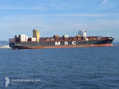
MSC SHREYA B
Not available
Current Trip
| Trip Time | 1 day |
|---|---|
| Trip Distance | 419.24 nm |
| AVG Speed | 11.3 Knots |
| MAX Speed | 11.3 Knots |
| Draught | 11.8 m |
| AVG Wind | 15.5 knots |
| MAX Wind | 22 knots |
| MIN Temp | 11.1°C / 51.98°F |
| MAX Temp | 17.3°C / 63.14°F |
| Position Received | 2 m ago |
Current Position
| Longitude | 9.93737° |
|---|---|
| Latitude | 53.50702° |
| Status | Moored |
| Speed | |
| Course | 356° |
| Area | North Sea |
| Station | T-AIS |
| Position Received | 2 m ago |
Info
Information
The current position of MSC SHREYA B is in North Sea with coordinates 53.50702° / 9.93737° as reported on 2024-06-07 00:17 by AIS to our vessel tracker app. The vessel's current speed is 0 Knots and is currently inside the port of HAMBURG.
The vessel MSC SHREYA B (IMO: 9778105, MMSI: 255806028) is a Not available It's sailing under the flag of [PT] Portugal.
In this page you can find informations about the vessels current position, last detected port calls, and current voyage information. If the vessels is not in coverage by AIS you will find the latest position.
The current position of MSC SHREYA B is detected by our AIS receivers and we are not responsible for the reliability of the data. The last position was recorded while the vessel was in Coverage by the Ais receivers of our vessel tracking app.
The current draught of MSC SHREYA B as reported by AIS is 11.8 meters
Weather
| Temperature | 7.4°C / 45.32°F |
|---|---|
| Wind Speed | 1 knots |
| Direction | 239° WSW |
| Pressure | 1017.9 hPa |
| Humidity | 92.4 % |
| Cloud Coverage | 32 % |
Featured Company
Last Port Calls
| Port | Arrival | Departure | Time In Port |
|---|---|---|---|
| 2024-06-06 16:20 | |||
| 2024-06-03 03:08 | 2024-06-04 19:03 | 1 d | |
| 2024-06-01 06:09 | 2024-06-02 18:06 | 1 d | |
| 2024-05-30 12:29 | 2024-05-31 13:33 | 1 d | |
| 2024-05-17 07:18 | 2024-05-18 20:34 | 1 d | |
| 2024-05-14 23:58 | 2024-05-16 12:06 | 1 d | |
| 2024-05-13 09:14 | 2024-05-14 12:18 | 1 d | |
| 2024-05-09 04:53 | 2024-05-09 13:13 | 8 h | |
| 2024-05-04 01:08 | 2024-05-05 01:45 | 1 d | |
| 2024-04-29 19:20 | 2024-04-30 13:00 | 17 h |
Most Visited Ports (Last year)
| Port | Arrivals | |
|---|---|---|
| 8 | ||
| 5 | ||
| 5 | ||
| 4 | ||
| 4 | ||
| 4 |
Last Trips
| Origin | Departure | Destination | Arrival | Distance | |
|---|---|---|---|---|---|
| 2024-06-04 21:03 | 2024-06-06 18:20 | 419.24 nm | |||
| 2024-06-02 20:06 | 2024-06-03 05:08 | 127.58 nm | |||
| 2024-05-31 14:33 | 2024-06-01 08:09 | 205.09 nm | |||
| 2024-05-18 15:34 | 2024-05-30 13:29 | 4834.32 nm | |||
| 2024-05-16 07:06 | 2024-05-17 02:18 | 34.34 nm | |||
| 2024-05-14 07:18 | 2024-05-14 18:58 | 47.04 nm | |||
| 2024-05-09 08:13 | 2024-05-13 04:14 | 1366.59 nm | |||
| 2024-05-04 21:45 | 2024-05-08 23:53 | 1346.73 nm | |||
| 2024-04-30 09:00 | 2024-05-03 21:08 | 548.08 nm | |||
| 2024-04-26 11:09 | 2024-04-29 15:20 | 1342.32 nm |
Events
| Time | Event | Details | Position / Dest | Info |
|---|---|---|---|---|
| 2024-06-06 17:47 | Status Changed | Moored Under way using engine |
53.50699 / 9.93746
[DE] HAMBURG
|
Speed: Course: 356° |
| 2024-06-06 17:29 | STOP Moving |
53.50697 / 9.93766
[DE] HAMBURG
|
Speed: 0.3 kn Course: 353° |
|
| 2024-06-06 16:20 | PORT ARRIVAL |
|
53.54461 / 9.85854
[DE] HAMBURG
|
Speed: 7.8 kn Course: 105.4° |
| 2024-06-06 09:21 | Status Changed | Under way using engine Default |
54.05617 / 7.88267
DEHAM
|
Speed: 10.6 kn Course: 121° |
| 2024-06-06 09:21 | IN Coverage |
54.05320 / 7.89107
North Sea
DEHAM
|
Speed: 10.5 kn Course: 121.8° |
|
| 2024-06-06 05:08 | OUT of Coverage |
54.24942 / 7.42170
North Sea
DEHAM
|
Speed: 1.6 kn Course: 107.4° |
|
| 2024-06-06 00:33 | Draught Changed | 11.8 12.2 |
54.14914 / 6.96326
DEHAM
|
Speed: 9 kn Course: 88.5° |
| 2024-06-06 00:33 | ETA Changed | 2024/06/06 09:30 2024/06/06 05:00 |
54.14914 / 6.96326
DEHAM
|
Speed: 9 kn Course: 88.5° |
| 2024-06-06 00:26 | Change Sea Area | German part of the North Sea Dutch part of the North Sea |
54.14910 / 6.93476
North Sea
DEHAM
|
Speed: 9 kn Course: 90.4° |
| 2024-06-06 00:24 | IN Coverage |
54.14910 / 6.93476
North Sea
DEHAM
|
Speed: 9 kn Course: 90.4° |