
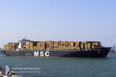
MSC SINDY
Container Ship
Current Trip
| Time Travelled | 6 days |
|---|---|
| Remaining Time | --- |
| Distance Travelled | 2885.60 nm |
| Remaining Distance | --- |
| AVG Speed | 18.2 Knots |
| MAX Speed | 20 Knots |
| AVG Wind | 9.7 knots |
| MAX Wind | 18.8 knots |
| MIN Temp | 26.8°C / 80.24°F |
| MAX Temp | 28.8°C / 83.84°F |
| Draught | 14.2 m |
| Position Received | 6 d ago |
Current Position
| Longitude | -77.68767° |
|---|---|
| Latitude | 25.92301° |
| Status | Under way using engine |
| Speed | 18.7 Knots |
| Course | 119.3° |
| Area | North Atlantic Ocean |
| Station | T-AIS |
| Position Received | 6 d ago |
Info
Information
The current position of MSC SINDY is in North Atlantic Ocean with coordinates 25.92301° / -77.68767° as reported on 2024-06-16 01:52 by AIS to our vessel tracker app. The vessel's current speed is 18.7 Knots and is heading at the port of ABU DHABI. The estimated time of arrival as calculated by vessel tracking app is 2024-07-12 15:00 LT
The vessel MSC SINDY (IMO: 9336048, MMSI: 372736000) is a Container Ship that was built in 2007 ( 17 years old ). It's sailing under the flag of [PA] Panama.
In this page you can find informations about the vessels current position, last detected port calls, and current voyage information. If the vessels is not in coverage by AIS you will find the latest position.
The current position of MSC SINDY is detected by our AIS receivers and we are not responsible for the reliability of the data. The last position was recorded while the vessel was in Coverage by the Ais receivers of our vessel tracking app.
The current draught of MSC SINDY as reported by AIS is 14.2 meters
Weather
| Temperature | 26.8°C / 80.24°F |
|---|---|
| Wind Speed | 11 knots |
| Direction | 110° ESE |
| Pressure | 1012.9 hPa |
| Humidity | 81.7 % |
| Cloud Coverage | 51 % |
Featured Company
Last Port Calls
| Port | Arrival | Departure | Time In Port |
|---|---|---|---|
| 2024-06-12 23:27 | 2024-06-15 21:19 | 2 d | |
| 2024-06-09 14:16 | 2024-06-10 11:25 | 21 h | |
| 2024-06-07 07:01 | 2024-06-08 04:21 | 21 h | |
| 2024-06-04 08:33 | 2024-06-06 03:50 | 1 d | |
| 2024-05-06 15:23 | 2024-05-07 16:16 | 1 d | |
| 2024-04-29 04:23 | 2024-05-01 12:09 | 2 d | |
| 2024-04-27 07:32 | 2024-04-28 04:16 | 20 h | |
| 2024-04-24 04:42 | 2024-04-25 06:59 | 1 d | |
| 2024-04-20 04:32 | 2024-04-22 00:33 | 1 d |
Last Trips
| Origin | Departure | Destination | Arrival | Distance | |
|---|---|---|---|---|---|
| 2024-06-10 07:25 | 2024-06-12 19:27 | 422.88 nm | |||
| 2024-06-08 00:21 | 2024-06-09 10:16 | 526.23 nm | |||
| 2024-06-05 23:50 | 2024-06-07 03:01 | 294.37 nm | |||
| 2024-05-07 21:46 | 2024-06-04 04:33 | 11186.13 nm | |||
| 2024-05-01 17:39 | 2024-05-06 20:53 | 1258.21 nm | |||
| 2024-04-28 09:46 | 2024-04-29 09:53 | 420.82 nm | |||
| 2024-04-25 11:59 | 2024-04-27 13:02 | 565.52 nm | |||
| 2024-04-22 04:33 | 2024-04-24 09:42 | 881.25 nm | |||
| 2024-03-18 03:30 | 2024-04-20 08:32 | 11467.07 nm |
Events
| Time | Event | Details | Position / Dest | Info |
|---|---|---|---|---|
| 2024-06-16 01:58 | Status Changed | Default Under way using engine |
25.90667 / -77.65500
AEAUH
|
Speed: 18.7 kn Course: 119.3° |
| 2024-06-16 01:52 | Status Changed | Under way using engine Default |
25.92301 / -77.68767
AEAUH
|
Speed: 18 kn Course: 118° |
| 2024-06-16 01:52 | OUT of Coverage |
25.92301 / -77.68767
North Atlantic Ocean
AEAUH
|
Speed: 18.7 kn Course: 119.3° |
|
| 2024-06-16 01:40 | IN Coverage |
25.92301 / -77.68767
North Atlantic Ocean
AEAUH
|
Speed: 18.7 kn Course: 119.3° |
|
| 2024-06-16 00:07 | Status Changed | Default Under way using engine |
26.18500 / -78.21500
AEAUH
|
Speed: 18.3 kn Course: 118.9° |
| 2024-06-16 00:00 | OUT of Coverage |
26.20487 / -78.25352
North Atlantic Ocean
AEAUH
|
Speed: 18.3 kn Course: 118.9° |
|
| 2024-06-15 23:49 | Draught Changed | 14.2 10.8 |
26.23257 / -78.30844
AEAUH
|
Speed: 17.8 kn Course: 120.4° |
| 2024-06-15 23:49 | Destination Changed | AEAUH BSFPO |
26.23257 / -78.30844
AEAUH
|
Speed: 17.8 kn Course: 120.4° |
| 2024-06-15 23:49 | ETA Changed | 2024/07/12 15:00 2024/06/12 09:00 |
26.23257 / -78.30844
AEAUH
|
Speed: 17.8 kn Course: 120.4° |
| 2024-06-15 23:44 | Status Changed | Under way using engine Default |
26.24283 / -78.32904
BSFPO
|
Speed: 16.7 kn Course: 116° |