
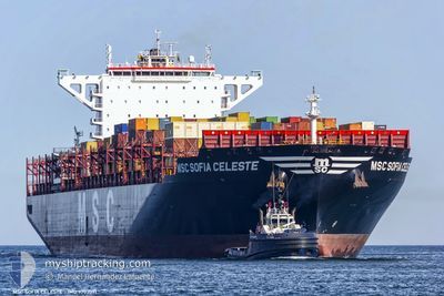
MSC SOFIA CELESTE
Cargo A
Current Trip
| Time Travelled | 1 day |
|---|---|
| Remaining Time | --- |
| Distance Travelled | 226.43 nm |
| Remaining Distance | --- |
| AVG Speed | 12.3 Knots |
| MAX Speed | 17.3 Knots |
| AVG Wind | 8.1 knots |
| MAX Wind | 18 knots |
| MIN Temp | 22.7°C / 72.86°F |
| MAX Temp | 26.3°C / 79.34°F |
| Draught | 12.5 m |
| Position Received | 12 h, 45 m ago |
Current Position
| Longitude | -43.70752° |
|---|---|
| Latitude | -23.38882° |
| Status | Under way using engine |
| Speed | 17.1 Knots |
| Course | 238.6° |
| Area | South Atlantic Ocean |
| Station | T-AIS |
| Position Received | 12 h, 45 m ago |
Info
Information
The current position of MSC SOFIA CELESTE is in South Atlantic Ocean with coordinates -23.38882° / -43.70752° as reported on 2024-05-22 17:04 by AIS to our vessel tracker app. The vessel's current speed is 17.1 Knots
The vessel MSC SOFIA CELESTE (IMO: 9702091, MMSI: 255806495) is a Cargo A It's sailing under the flag of [PT] Portugal.
In this page you can find informations about the vessels current position, last detected port calls, and current voyage information. If the vessels is not in coverage by AIS you will find the latest position.
The current position of MSC SOFIA CELESTE is detected by our AIS receivers and we are not responsible for the reliability of the data. The last position was recorded while the vessel was in Coverage by the Ais receivers of our vessel tracking app.
The current draught of MSC SOFIA CELESTE as reported by AIS is 12.5 meters
Weather
| Temperature | 23.1°C / 73.58°F |
|---|---|
| Wind Speed | 10 knots |
| Direction | 60° ENE |
| Pressure | 1015.7 hPa |
| Humidity | 90.1 % |
| Cloud Coverage | 5 % |
Featured Company
Last Port Calls
| Port | Arrival | Departure | Time In Port |
|---|---|---|---|
| 2024-05-21 16:43 | 2024-05-21 16:49 | 6 m | |
| 2024-05-09 09:38 | 2024-05-10 14:34 | 1 d | |
| 2024-05-05 02:03 | 2024-05-05 21:03 | 19 h | |
| 2024-05-02 18:44 | 2024-05-04 01:28 | 1 d | |
| 2024-04-26 22:03 | 2024-04-27 08:59 | 10 h | |
| 2024-04-25 19:22 | 2024-04-26 13:48 | 18 h | |
| 2024-04-23 14:15 | 2024-04-24 08:08 | 17 h | |
| 2024-04-21 04:38 | 2024-04-22 18:07 | 1 d | |
| 2024-04-06 15:56 | 2024-04-07 03:38 | 11 h | |
| 2024-04-03 19:04 | 2024-04-03 19:10 | 6 m |
Most Visited Ports (Last year)
| Port | Arrivals | |
|---|---|---|
| 13 | ||
| 9 | ||
| 7 | ||
| 5 | ||
| 5 | ||
| 5 |
Last Trips
| Origin | Departure | Destination | Arrival | Distance | |
|---|---|---|---|---|---|
| 2024-05-10 15:34 | 2024-05-21 13:43 | 4344.88 nm | |||
| 2024-05-05 23:03 | 2024-05-09 10:38 | 1016.02 nm | |||
| 2024-05-04 03:28 | 2024-05-05 04:03 | 291.20 nm | |||
| 2024-04-27 10:59 | 2024-05-02 20:44 | 609.60 nm | |||
| 2024-04-26 15:48 | 2024-04-27 00:03 | 116.79 nm | |||
| 2024-04-24 09:08 | 2024-04-25 21:22 | 437.68 nm | |||
| 2024-04-22 20:07 | 2024-04-23 15:15 | 151.93 nm | |||
| 2024-04-07 00:38 | 2024-04-21 06:38 | 4962.62 nm | |||
| 2024-04-03 16:10 | 2024-04-06 12:56 | 779.35 nm | |||
| 2024-04-02 01:00 | 2024-04-03 16:04 | 253.41 nm |
Events
| Time | Event | Details | Position / Dest | Info |
|---|---|---|---|---|
| 2024-05-23 03:57 | STOP Moving | 20.01 nm, South East of ITANHAEM |
-24.38333 / -46.49833
BRSSZ
|
Speed: Course: -1° |
| 2024-05-22 17:08 | Status Changed | Default Under way using engine |
-23.39936 / -43.72674
BRSSZ
|
Speed: 17.1 kn Course: 238.6° |
| 2024-05-22 17:04 | OUT of Coverage |
-23.38882 / -43.70752
South Atlantic Ocean
BRSSZ
|
Speed: 17.1 kn Course: 238.6° |
|
| 2024-05-22 17:02 | Status Changed | Under way using engine Default |
-23.38442 / -43.69959
BRSSZ
|
Speed: 17 kn Course: 239° |
| 2024-05-22 17:00 | Status Changed | Default Under way using engine |
-23.37833 / -43.68833
BRSSZ
|
Speed: 17.2 kn Course: 239.2° |
| 2024-05-22 16:48 | Status Changed | Under way using engine Default |
-23.35093 / -43.63891
BRSSZ
|
Speed: 17 kn Course: 239° |
| 2024-05-22 16:39 | Status Changed | Default Under way using engine |
-23.32885 / -43.59765
BRSSZ
|
Speed: 17.1 kn Course: 240° |
| 2024-05-22 14:37 | ETA Changed | 2024/05/23 05:00 2024/05/22 18:00 |
-23.01087 / -43.16448
BRSSZ
|
Speed: 13.8 kn Course: 187.6° |
| 2024-05-22 13:30 | START Moving | 2.75 nm, North West of RIO DE JANEIRO |
-22.87704 / -43.20470
BRSSZ
|
Speed: 3.1 kn Course: 58° |
| 2024-05-22 13:13 | Status Changed | Under way using engine Moored |
-22.87819 / -43.20741
BRSSZ
|
Speed: Course: 41° |