
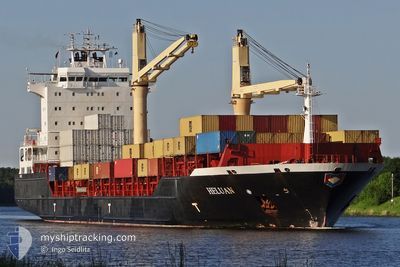
MSC TAMISHKA F
Container Ship
Current Trip
| Time Travelled | 1 day |
|---|---|
| Remaining Time | 1 day |
| Distance Travelled | 435.50 nm |
| Remaining Distance | 291.08 nm |
| AVG Speed | 8.8 Knots |
| MAX Speed | 16.2 Knots |
| AVG Wind | 16.4 knots |
| MAX Wind | 22.1 knots |
| MIN Temp | 11.8°C / 53.24°F |
| MAX Temp | 15.3°C / 59.54°F |
| Draught | 9.8 m |
| Position Received | Now |
Current Position
| Longitude | 5.86430° |
|---|---|
| Latitude | 55.19033° |
| Status | Under way using engine |
| Speed | 6.2 Knots |
| Course | 205° |
| Area | North Sea |
| Station | T-AIS |
| Position Received | Now |
Info
Information
The current position of MSC TAMISHKA F is in North Sea with coordinates 55.19033° / 5.86430° as reported on 2024-05-18 00:01 by AIS to our vessel tracker app. The vessel's current speed is 6.2 Knots and is heading at the port of ANTWERP. The estimated time of arrival as calculated by vessel tracking app is 2024-05-19 22:53 LT
The vessel MSC TAMISHKA F (IMO: 9358905, MMSI: 636019364) is a Container Ship that was built in 2007 ( 17 years old ). It's sailing under the flag of [LR] Liberia.
In this page you can find informations about the vessels current position, last detected port calls, and current voyage information. If the vessels is not in coverage by AIS you will find the latest position.
The current position of MSC TAMISHKA F is detected by our AIS receivers and we are not responsible for the reliability of the data. The last position was recorded while the vessel was in Coverage by the Ais receivers of our vessel tracking app.
The current draught of MSC TAMISHKA F as reported by AIS is 9.8 meters
Weather
| Temperature | 12.9°C / 55.22°F |
|---|---|
| Wind Speed | 15 knots |
| Direction | 72° ENE |
| Pressure | 1012.8 hPa |
| Humidity | 82.2 % |
| Cloud Coverage | 89 % |
Featured Company
Last Port Calls
| Port | Arrival | Departure | Time In Port |
|---|---|---|---|
| 2024-05-15 12:10 | 2024-05-16 00:57 | 12 h | |
| 2024-05-14 14:17 | 2024-05-15 05:27 | 15 h | |
| 2024-05-11 06:17 | 2024-05-12 13:00 | 1 d | |
| 2024-05-07 23:10 | 2024-05-08 19:19 | 20 h | |
| 2024-05-07 02:19 | 2024-05-07 15:52 | 13 h | |
| 2024-05-03 22:57 | 2024-05-04 21:09 | 22 h | |
| 2024-04-29 05:07 | 2024-04-29 17:53 | 12 h | |
| 2024-04-28 16:47 | 2024-04-28 22:35 | 5 h | |
| 2024-04-26 03:51 | 2024-04-26 10:23 | 6 h | |
| 2024-04-24 09:41 | 2024-04-25 12:45 | 1 d |
Last Trips
| Origin | Departure | Destination | Arrival | Distance | |
|---|---|---|---|---|---|
| 2024-05-15 07:27 | 2024-05-15 14:10 | 83.80 nm | |||
| 2024-05-12 15:00 | 2024-05-14 16:17 | 700.07 nm | |||
| 2024-05-08 21:19 | 2024-05-11 08:17 | 732.62 nm | |||
| 2024-05-07 17:52 | 2024-05-08 01:10 | 82.03 nm | |||
| 2024-05-04 23:09 | 2024-05-07 04:19 | 701.30 nm | |||
| 2024-04-29 19:53 | 2024-05-04 00:57 | 814.64 nm | |||
| 2024-04-29 00:35 | 2024-04-29 07:07 | 83.76 nm | |||
| 2024-04-26 11:23 | 2024-04-28 18:47 | 754.55 nm | |||
| 2024-04-25 14:45 | 2024-04-26 04:51 | 167.47 nm | |||
| 2024-04-21 17:55 | 2024-04-24 11:41 | 351.28 nm |
Events
| Time | Event | Details | Position / Dest | Info |
|---|---|---|---|---|
| 2024-05-17 21:11 | Change Sea Area | German part of the North Sea Danish part of the North Sea |
55.44781 / 6.07871
North Sea
BEANR
|
Speed: 5.8 kn Course: 204.4° |
| 2024-05-17 16:28 | Status Changed | Under way using engine Default |
55.87080 / 6.48203
BEANR
|
Speed: 6.3 kn Course: 208° |
| 2024-05-17 15:38 | Status Changed | Default Under way using engine |
55.94709 / 6.55349
BEANR
|
Speed: 6.2 kn Course: 208.2° |
| 2024-05-17 13:54 | Status Changed | Under way using engine Default |
56.04908 / 6.62819
BEANR
|
Speed: 6.2 kn Course: 205° |
| 2024-05-17 13:48 | Status Changed | Default Under way using engine |
56.05837 / 6.63628
BEANR
|
Speed: 6.2 kn Course: 206.2° |
| 2024-05-17 13:45 | Status Changed | Under way using engine Default |
56.06308 / 6.64052
BEANR
|
Speed: 6.3 kn Course: 207° |
| 2024-05-17 13:37 | Status Changed | Default Under way using engine |
56.07445 / 6.65073
BEANR
|
Speed: 6.3 kn Course: 207.2° |
| 2024-05-17 08:00 | ETA Changed | 2024/05/19 04:00 2024/05/18 15:00 |
56.52780 / 7.23665
BEANR
|
Speed: 7.4 kn Course: 222.9° |
| 2024-05-16 23:35 | Change Sea Area | Danish part of the North Sea Danish part of the Skaggerak |
57.32707 / 8.23096
North Sea
BEANR
|
Speed: 7 kn Course: 216.6° |
| 2024-05-16 15:12 | ETA Changed | 2024/05/18 15:00 2024/05/18 04:00 |
57.84813 / 10.63878
BEANR
|
Speed: 15.3 kn Course: 270.3° |