
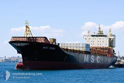
MSC TANIA
Container Ship
Current Trip
| Time Travelled | 2 days |
|---|---|
| Remaining Time | 2 days |
| Distance Travelled | 911.55 nm |
| Remaining Distance | 883.11 nm |
| AVG Speed | 16.8 Knots |
| MAX Speed | 21 Knots |
| AVG Wind | 8.6 knots |
| MAX Wind | 12 knots |
| MIN Temp | 15.5°C / 59.9°F |
| MAX Temp | 22.7°C / 72.86°F |
| Draught | 10.1 m |
| Position Received | 1 d ago |
Current Position
| Longitude | 117.90233° |
|---|---|
| Latitude | -35.71752° |
| Status | Under way using engine |
| Speed | 17.2 Knots |
| Course | 98.3° |
| Area | Indian Ocean |
| Station | T-AIS |
| Position Received | 1 d ago |
Info
Information
The current position of MSC TANIA is in Indian Ocean with coordinates -35.71752° / 117.90233° as reported on 2024-05-21 09:15 by AIS to our vessel tracker app. The vessel's current speed is 17.2 Knots and is heading at the port of BELL BAY. The estimated time of arrival as calculated by vessel tracking app is 2024-05-24 21:28 LT
The vessel MSC TANIA (IMO: 9316373, MMSI: 636018603) is a Container Ship that was built in 2006 ( 18 years old ). It's sailing under the flag of [LR] Liberia.
In this page you can find informations about the vessels current position, last detected port calls, and current voyage information. If the vessels is not in coverage by AIS you will find the latest position.
The current position of MSC TANIA is detected by our AIS receivers and we are not responsible for the reliability of the data. The last position was recorded while the vessel was in Coverage by the Ais receivers of our vessel tracking app.
The current draught of MSC TANIA as reported by AIS is 10.1 meters
Weather
| Temperature | 16°C / 60.8°F |
|---|---|
| Wind Speed | 7 knots |
| Direction | 330° NNW |
| Pressure | 1024.8 hPa |
| Humidity | 72.6 % |
| Cloud Coverage | 100 % |
Featured Company
Last Port Calls
| Port | Arrival | Departure | Time In Port |
|---|---|---|---|
| 2024-05-18 13:08 | 2024-05-20 13:03 | 1 d | |
| 2024-05-07 18:46 | 2024-05-08 20:53 | 1 d | |
| 2024-05-05 08:19 | 2024-05-06 05:22 | 21 h | |
| 2024-04-27 06:20 | 2024-04-28 19:18 | 1 d | |
| 2024-04-13 17:27 | 2024-04-15 17:15 | 1 d | |
| 2024-04-04 06:09 | 2024-04-07 23:29 | 3 d | |
| 2024-03-29 00:32 | 2024-03-29 09:12 | 8 h | |
| 2024-03-27 00:29 | 2024-03-27 09:37 | 9 h | |
| 2024-03-26 06:59 | 2024-03-26 21:58 | 14 h | |
| 2024-03-24 04:52 | 2024-03-26 04:40 | 1 d |
Most Visited Ports (Last year)
| Port | Arrivals | |
|---|---|---|
| 18 | ||
| 11 | ||
| 6 | ||
| 4 | ||
| 4 | ||
| 4 |
Last Trips
| Origin | Departure | Destination | Arrival | Distance | |
|---|---|---|---|---|---|
| 2024-05-09 04:53 | 2024-05-18 21:08 | 2382.92 nm | |||
| 2024-05-06 13:22 | 2024-05-08 02:46 | 34.79 nm | |||
| 2024-04-29 03:18 | 2024-05-05 16:19 | 118.38 nm | |||
| 2024-04-16 03:15 | 2024-04-27 14:20 | 4445.40 nm | |||
| 2024-04-08 07:29 | 2024-04-14 03:27 | 2272.42 nm | |||
| 2024-03-29 16:12 | 2024-04-04 14:09 | 1810.76 nm | |||
| 2024-03-27 17:37 | 2024-03-29 07:32 | 608.87 nm | |||
| 2024-03-27 05:58 | 2024-03-27 08:29 | 21.49 nm | |||
| 2024-03-26 12:40 | 2024-03-26 14:59 | 11.00 nm | |||
| 2024-03-20 01:34 | 2024-03-24 12:52 | 867.06 nm |
Events
| Time | Event | Details | Position / Dest | Info |
|---|---|---|---|---|
| 2024-05-21 09:23 | Status Changed | Default Under way using engine |
-35.72340 / 117.94522
AUBEL
|
Speed: 17.2 kn Course: 98.3° |
| 2024-05-21 09:15 | OUT of Coverage |
-35.71752 / 117.90233
Indian Ocean
AUBEL
|
Speed: 17.2 kn Course: 98.3° |
|
| 2024-05-21 07:44 | ETA Changed | 2024/05/25 01:00 2024/05/25 12:00 |
-35.64705 / 117.38029
AUBEL
|
Speed: 17.9 kn Course: 97.6° |
| 2024-05-21 06:59 | Status Changed | Under way using engine Default |
-35.61238 / 117.09998
AUBEL
|
Speed: 19.5 kn Course: 99° |
| 2024-05-21 06:59 | IN Coverage |
-35.61326 / 117.10647
Indian Ocean
AUBEL
|
Speed: 19.3 kn Course: 99.7° |
|
| 2024-05-20 18:24 | Status Changed | Default Under way using engine |
-32.97664 / 114.92764
AUBEL
|
Speed: 18 kn Course: 197.1° |
| 2024-05-20 18:17 | OUT of Coverage |
-32.94438 / 114.93935
Indian Ocean
AUBEL
|
Speed: 18 kn Course: 197.1° |
|
| 2024-05-20 17:53 | Status Changed | Under way using engine Default |
-32.82768 / 114.97820
AUBEL
|
Speed: 18.4 kn Course: 195° |
| 2024-05-20 17:35 | Status Changed | Default Under way using engine |
-32.73764 / 115.00834
AUBEL
|
Speed: 18.6 kn Course: 196.8° |
| 2024-05-20 14:11 | Status Changed | Under way using engine Default |
-31.91955 / 115.58599
AUBEL
|
Speed: 15.4 kn Course: 300° |