
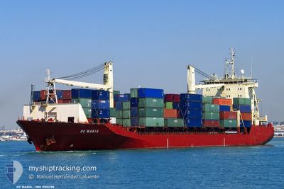
MSC TIANA F
Container Ship
Current Trip
| Trip Time | 2 days |
|---|---|
| Trip Distance | 681.12 nm |
| AVG Speed | 12.3 Knots |
| MAX Speed | 15 Knots |
| Draught | 9.1 m |
| AVG Wind | 13.8 knots |
| MAX Wind | 19 knots |
| MIN Temp | 14.7°C / 58.46°F |
| MAX Temp | 21°C / 69.8°F |
| Position Received | 2 d ago |
Current Position
| Longitude | -15.23421° |
|---|---|
| Latitude | 27.47657° |
| Status | Under way using engine |
| Speed | 14.2 Knots |
| Course | 183.8° |
| Area | North Atlantic Ocean |
| Station | T-AIS |
| Position Received | 2 d ago |
Info
Information
The current position of MSC TIANA F is in North Atlantic Ocean with coordinates 27.47657° / -15.23421° as reported on 2024-05-17 03:41 by AIS to our vessel tracker app. The vessel's current speed is 14.2 Knots and is currently inside the port of NOUAKCHOTT.
The vessel MSC TIANA F (IMO: 9108398, MMSI: 636020919) is a Container Ship that was built in 1996 ( 28 years old ). It's sailing under the flag of [LR] Liberia.
In this page you can find informations about the vessels current position, last detected port calls, and current voyage information. If the vessels is not in coverage by AIS you will find the latest position.
The current position of MSC TIANA F is detected by our AIS receivers and we are not responsible for the reliability of the data. The last position was recorded while the vessel was in Coverage by the Ais receivers of our vessel tracking app.
The current draught of MSC TIANA F as reported by AIS is 9.1 meters
Weather
| Temperature | 20.2°C / 68.36°F |
|---|---|
| Wind Speed | 14 knots |
| Direction | 335° NNW |
| Pressure | 1010.6 hPa |
| Humidity | 78 % |
| Cloud Coverage | 1 % |
Featured Company
Last Port Calls
| Port | Arrival | Departure | Time In Port |
|---|---|---|---|
| 2024-05-19 08:40 | |||
| 2024-05-16 02:52 | 2024-05-17 00:35 | 21 h | |
| 2024-05-10 21:36 | 2024-05-11 11:42 | 14 h | |
| 2024-05-09 01:32 | 2024-05-09 13:06 | 11 h | |
| 2024-05-01 20:20 | 2024-05-02 17:34 | 21 h | |
| 2024-04-26 09:48 | 2024-04-27 16:54 | 1 d | |
| 2024-04-18 09:47 | 2024-04-19 15:11 | 1 d | |
| 2024-04-11 05:16 | 2024-04-12 04:40 | 23 h | |
| 2024-04-08 11:27 | 2024-04-09 18:19 | 1 d | |
| 2024-04-02 18:17 | 2024-04-03 12:48 | 18 h |
Most Visited Ports (Last year)
| Port | Arrivals | |
|---|---|---|
| 14 | ||
| 13 | ||
| 9 | ||
| 7 | ||
| 6 | ||
| 5 |
Last Trips
| Origin | Departure | Destination | Arrival | Distance | |
|---|---|---|---|---|---|
| 2024-05-17 01:35 | 2024-05-19 08:40 | 681.12 nm | |||
| 2024-05-11 13:42 | 2024-05-16 03:52 | 1170.67 nm | |||
| 2024-05-09 15:06 | 2024-05-10 23:36 | 59.68 nm | |||
| 2024-05-02 17:34 | 2024-05-09 03:32 | 1948.81 nm | |||
| 2024-04-27 16:54 | 2024-05-01 20:20 | 284.22 nm | |||
| 2024-04-19 17:11 | 2024-04-26 09:48 | 1789.76 nm | |||
| 2024-04-12 04:40 | 2024-04-18 11:47 | 1944.77 nm | |||
| 2024-04-09 18:19 | 2024-04-11 05:16 | 268.97 nm | |||
| 2024-04-03 13:48 | 2024-04-08 11:27 | 728.37 nm | |||
| 2024-03-28 06:21 | 2024-04-02 19:17 | 1199.53 nm |
Events
| Time | Event | Details | Position / Dest | Info |
|---|---|---|---|---|
| 2024-05-19 08:40 | STOP Moving |
17.98603 / -16.03444
[MR] NOUAKCHOTT
|
Speed: 0.1 kn Course: 90° |
|
| 2024-05-19 08:40 | PORT ARRIVAL |
|
17.98603 / -16.03444
[MR] NOUAKCHOTT
|
Speed: 2 kn Course: -1° |
| 2024-05-19 07:42 | START Moving | 4.54 nm, West of NOUAKCHOTT |
17.97372 / -16.10784
MRNKC
|
Speed: 3.1 kn Course: 65° |
| 2024-05-19 06:22 | STOP Moving | 5.12 nm, West of NOUAKCHOTT |
17.97500 / -16.11833
MRNKC
|
Speed: Course: -1° |
| 2024-05-17 03:46 | Status Changed | Default Under way using engine |
27.45503 / -15.23538
MRNKC
|
Speed: 14.2 kn Course: 183.8° |
| 2024-05-17 03:41 | OUT of Coverage |
27.47657 / -15.23421
North Atlantic Ocean
MRNKC
|
Speed: 14.2 kn Course: 183.8° |
|
| 2024-05-17 00:59 | ETA Changed | 2024/05/19 03:30 2024/05/19 03:00 |
28.08997 / -15.33230
MRNKC
|
Speed: 12.5 kn Course: 149.8° |
| 2024-05-17 00:35 | PORT DEPARTURE |
|
28.11520 / -15.40631
MRNKC
|
Speed: 7.5 kn Course: 116° |
| 2024-05-17 00:22 | START Moving |
28.13048 / -15.41953
[ES] LAS PALMAS
|
Speed: 3.5 kn Course: 173° |
|
| 2024-05-16 23:59 | Status Changed | Under way using engine Moored |
28.13188 / -15.41776
[ES] LAS PALMAS
|
Speed: Course: 1° |