
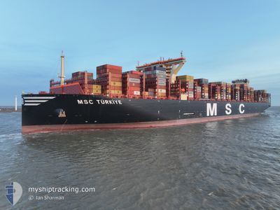
MSC TURKIYE
Cargo D
Current Trip
| Time Travelled | 9 days |
|---|---|
| Remaining Time | --- |
| Distance Travelled | 2950.72 nm |
| Remaining Distance | --- |
| AVG Speed | 15.2 Knots |
| MAX Speed | 20.4 Knots |
| AVG Wind | 13.1 knots |
| MAX Wind | 20 knots |
| MIN Temp | 10.4°C / 50.72°F |
| MAX Temp | 25°C / 77°F |
| Draught | 14.3 m |
| Position Received | 2 d ago |
Current Position
| Longitude | -18.37381° |
|---|---|
| Latitude | 28.68479° |
| Status | Under way using engine |
| Speed | 18.6 Knots |
| Course | 185° |
| Area | North Atlantic Ocean |
| Station | T-AIS |
| Position Received | 2 d ago |
Info
Information
The current position of MSC TURKIYE is in North Atlantic Ocean with coordinates 28.68479° / -18.37381° as reported on 2024-05-29 19:32 by AIS to our vessel tracker app. The vessel's current speed is 18.6 Knots and is heading at the port of SINGAPORE. The estimated time of arrival as calculated by vessel tracking app is 2024-06-21 21:30 LT
The vessel MSC TURKIYE (IMO: 9931288, MMSI: 636023099) is a Cargo D It's sailing under the flag of [LR] Liberia.
In this page you can find informations about the vessels current position, last detected port calls, and current voyage information. If the vessels is not in coverage by AIS you will find the latest position.
The current position of MSC TURKIYE is detected by our AIS receivers and we are not responsible for the reliability of the data. The last position was recorded while the vessel was in Coverage by the Ais receivers of our vessel tracking app.
The current draught of MSC TURKIYE as reported by AIS is 14.3 meters
Weather
| Temperature | 25.1°C / 77.18°F |
|---|---|
| Wind Speed | 8 knots |
| Direction | 307° NW |
| Pressure | 1014 hPa |
| Humidity | 79.3 % |
| Cloud Coverage | 100 % |
Featured Company
Last Port Calls
| Port | Arrival | Departure | Time In Port |
|---|---|---|---|
| 2024-05-19 13:57 | 2024-05-22 22:25 | 3 d | |
| 2024-05-12 00:06 | 2024-05-13 04:07 | 1 d | |
| 2024-05-06 20:18 | 2024-05-09 09:09 | 2 d | |
| 2024-04-06 16:12 | 2024-04-08 08:52 | 1 d | |
| 2024-04-01 15:05 |
Most Visited Ports (Last year)
| Port | Arrivals | |
|---|---|---|
| 34 | ||
| 4 | ||
| 3 | ||
| 3 | ||
| 3 | ||
| 2 |
Last Trips
| Origin | Departure | Destination | Arrival | Distance | |
|---|---|---|---|---|---|
| 2024-05-13 06:07 | 2024-05-19 15:57 | 330.61 nm | |||
| 2024-05-09 10:09 | 2024-05-12 02:06 | 1162.80 nm | |||
| 2024-04-08 16:52 | 2024-05-06 21:18 | 11158.30 nm | |||
| 2024-04-01 23:05 | 2024-04-07 00:12 | 1499.37 nm |
Events
| Time | Event | Details | Position / Dest | Info |
|---|---|---|---|---|
| 2024-05-29 19:39 | Status Changed | Default Under way using engine |
28.64667 / -18.37667
SGSIN
|
Speed: 18.6 kn Course: 185° |
| 2024-05-29 19:32 | OUT of Coverage |
28.68479 / -18.37381
North Atlantic Ocean
SGSIN
|
Speed: 18.6 kn Course: 185° |
|
| 2024-05-29 19:30 | Status Changed | Under way using engine Default |
28.69570 / -18.37281
SGSIN
|
Speed: 18 kn Course: 185° |
| 2024-05-29 18:45 | Status Changed | Default Under way using engine |
28.92500 / -18.34166
SGSIN
|
Speed: 18.1 kn Course: 187° |
| 2024-05-29 18:34 | Status Changed | Under way using engine Default |
28.98409 / -18.33350
SGSIN
|
Speed: 18.3 kn Course: 199° |
| 2024-05-29 18:24 | IN Coverage |
28.98063 / -18.33402
North Atlantic Ocean
SGSIN
|
Speed: 17.8 kn Course: 187.4° |
|
| 2024-05-29 16:58 | Status Changed | Default Under way using engine |
29.41792 / -18.06588
SGSIN
|
Speed: 18.3 kn Course: 209.2° |
| 2024-05-29 16:53 | OUT of Coverage |
29.44074 / -18.05123
North Atlantic Ocean
SGSIN
|
Speed: 18.3 kn Course: 209.2° |
|
| 2024-05-29 16:49 | Status Changed | Under way using engine Default |
29.45639 / -18.04101
SGSIN
|
Speed: 18.4 kn Course: 210° |
| 2024-05-29 16:32 | Status Changed | Default Under way using engine |
29.53349 / -17.99049
SGSIN
|
Speed: 18.5 kn Course: 209.8° |