
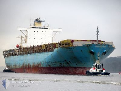
MSC YAMUNA VI
Container Ship
Current Trip
| Time Travelled | 13 days |
|---|---|
| Remaining Time | 5 days |
| Distance Travelled | 4984.03 nm |
| Remaining Distance | 2544.11 nm |
| AVG Speed | 16.4 Knots |
| MAX Speed | 20.9 Knots |
| AVG Wind | 14.5 knots |
| MAX Wind | 23 knots |
| MIN Temp | 14.9°C / 58.82°F |
| MAX Temp | 35.1°C / 95.18°F |
| Draught | 13.9 m |
| Position Received | 3 d ago |
Current Position
| Longitude | 31.70805° |
|---|---|
| Latitude | -29.87685° |
| Status | Under way using engine |
| Speed | 15.3 Knots |
| Course | 39.8° |
| Area | Indian Ocean |
| Station | T-AIS |
| Position Received | 3 d ago |
Info
Information
The current position of MSC YAMUNA VI is in Indian Ocean with coordinates -29.87685° / 31.70805° as reported on 2024-05-14 06:09 by AIS to our vessel tracker app. The vessel's current speed is 15.3 Knots and is heading at the port of KHALIFA. The estimated time of arrival as calculated by vessel tracking app is 2024-05-23 19:45 LT
The vessel MSC YAMUNA VI (IMO: 9288409, MMSI: 255980000) is a Container Ship that was built in 2004 ( 20 years old ). It's sailing under the flag of [PT] Portugal.
In this page you can find informations about the vessels current position, last detected port calls, and current voyage information. If the vessels is not in coverage by AIS you will find the latest position.
The current position of MSC YAMUNA VI is detected by our AIS receivers and we are not responsible for the reliability of the data. The last position was recorded while the vessel was in Coverage by the Ais receivers of our vessel tracking app.
The current draught of MSC YAMUNA VI as reported by AIS is 13.9 meters
Weather
| Temperature | 28.2°C / 82.76°F |
|---|---|
| Wind Speed | 16 knots |
| Direction | 214° SW |
| Pressure | 1008.7 hPa |
| Humidity | 76.8 % |
| Cloud Coverage | 15 % |
Featured Company
Last Port Calls
| Port | Arrival | Departure | Time In Port |
|---|---|---|---|
| 2024-05-01 08:56 | 2024-05-04 11:28 | 3 d | |
| 2024-04-22 19:08 | 2024-04-23 15:28 | 20 h | |
| 2024-04-19 19:54 | 2024-04-20 11:10 | 15 h | |
| 2024-04-15 00:52 | 2024-04-15 18:13 | 17 h | |
| 2024-04-12 05:44 | 2024-04-12 18:49 | 13 h | |
| 2024-04-06 23:28 | 2024-04-07 13:51 | 14 h | |
| 2024-04-03 05:05 | 2024-04-05 10:15 | 2 d | |
| 2024-03-31 07:23 | 2024-04-01 22:24 | 1 d | |
| 2024-03-27 04:02 | 2024-03-28 07:24 | 1 d | |
| 2024-03-24 21:25 | 2024-03-26 21:20 | 1 d |
Most Visited Ports (Last year)
| Port | Arrivals | |
|---|---|---|
| 6 | ||
| 5 | ||
| 4 | ||
| 3 | ||
| 2 | ||
| 2 |
Last Trips
| Origin | Departure | Destination | Arrival | Distance | |
|---|---|---|---|---|---|
| 2024-04-23 15:28 | 2024-05-01 08:56 | 24.68 nm | |||
| 2024-04-20 11:10 | 2024-04-22 19:08 | 440.04 nm | |||
| 2024-04-15 18:13 | 2024-04-19 19:54 | 1214.51 nm | |||
| 2024-04-12 19:49 | 2024-04-15 00:52 | 865.18 nm | |||
| 2024-04-07 15:51 | 2024-04-12 06:44 | 1160.03 nm | |||
| 2024-04-05 12:15 | 2024-04-07 01:28 | 520.42 nm | |||
| 2024-04-02 00:24 | 2024-04-03 07:05 | 490.61 nm | |||
| 2024-03-28 10:24 | 2024-03-31 09:23 | 1074.06 nm | |||
| 2024-03-27 00:20 | 2024-03-27 07:02 | 90.32 nm | |||
| 2024-03-23 15:51 | 2024-03-25 00:25 | 352.88 nm |
Events
| Time | Event | Details | Position / Dest | Info |
|---|---|---|---|---|
| 2024-05-17 04:29 | START Moving |
-12.36754 / 42.92421
AEKHL
|
Speed: 3.3 kn Course: 75° |
|
| 2024-05-17 04:03 | STOP Moving |
-12.36845 / 42.92677
AEKHL
|
Speed: 0.2 kn Course: 109° |
|
| 2024-05-14 06:14 | Status Changed | Default Under way using engine |
-29.86016 / 31.72526
AEKHL
|
Speed: 15.3 kn Course: 39.8° |
| 2024-05-14 06:09 | OUT of Coverage |
-29.87685 / 31.70805
Indian Ocean
AEKHL
|
Speed: 15.3 kn Course: 39.8° |
|
| 2024-05-14 03:45 | Detected in Sea | South African part of the Indian Ocean |
-30.32762 / 31.23568
Indian Ocean
AEKHL
|
Speed: 14.8 kn Course: 41.8° |
| 2024-05-14 03:44 | Status Changed | Under way using engine Default |
-30.33318 / 31.22954
AEKHL
|
Speed: 14.5 kn Course: 46° |
| 2024-05-14 03:33 | IN Coverage |
-30.32762 / 31.23568
Indian Ocean
AEKHL
|
Speed: 14.8 kn Course: 41.8° |
|
| 2024-05-12 08:25 | Status Changed | Default Under way using engine |
-34.85889 / 19.44123
AEKHL
|
Speed: 17.4 kn Course: 111.6° |
| 2024-05-12 08:21 | OUT of Coverage |
-34.85088 / 19.42213
South Atlantic Ocean
AEKHL
|
Speed: 17.4 kn Course: 111.6° |
|
| 2024-05-12 08:02 | Status Changed | Under way using engine Default |
-34.81338 / 19.31349
AEKHL
|
Speed: 17.6 kn Course: 110° |