
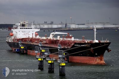
MTM DUBLIN
Oil/Chemical Tanker
Current Trip
| Time Travelled | 8 days |
|---|---|
| Remaining Time | --- |
| Distance Travelled | 1873.61 nm |
| Remaining Distance | 0.27 nm |
| AVG Speed | 11 Knots |
| MAX Speed | 14.5 Knots |
| AVG Wind | 7.2 knots |
| MAX Wind | 21.4 knots |
| MIN Temp | 10.5°C / 50.9°F |
| MAX Temp | 21.2°C / 70.16°F |
| Draught | 11.4 m |
| Position Received | 3 m ago |
Current Position
| Longitude | -5.37072° |
|---|---|
| Latitude | 36.14455° |
| Status | At anchor |
| Speed | 0.1 Knots |
| Course | 339° |
| Area | Strait of Gibraltar |
| Station | T-AIS |
| Position Received | 3 m ago |
Info
Information
The current position of MTM DUBLIN is in Strait of Gibraltar with coordinates 36.14455° / -5.37072° as reported on 2024-05-24 22:07 by AIS to our vessel tracker app. The vessel's current speed is 0.1 Knots and is heading at the port of GIBRALTAR. The estimated time of arrival as calculated by vessel tracking app is 2024-05-24 06:00 LT
The vessel MTM DUBLIN (IMO: 9335824, MMSI: 563104400) is a Oil/Chemical Tanker that was built in 2007 ( 17 years old ). It's sailing under the flag of [SG] Singapore.
In this page you can find informations about the vessels current position, last detected port calls, and current voyage information. If the vessels is not in coverage by AIS you will find the latest position.
The current position of MTM DUBLIN is detected by our AIS receivers and we are not responsible for the reliability of the data. The last position was recorded while the vessel was in Coverage by the Ais receivers of our vessel tracking app.
The current draught of MTM DUBLIN as reported by AIS is 11.4 meters
Weather
| Temperature | 17.9°C / 64.22°F |
|---|---|
| Wind Speed | --- |
| Direction | 229° SW |
| Pressure | 1015.9 hPa |
| Humidity | 85.2 % |
| Cloud Coverage | --- |
Featured Company
Last Port Calls
| Port | Arrival | Departure | Time In Port |
|---|---|---|---|
| 2024-05-16 08:43 | 2024-05-16 09:53 | 1 h | |
| 2024-05-07 05:36 | 2024-05-13 13:00 | 6 d | |
| 2024-04-29 16:32 | 2024-04-30 19:27 | 1 d | |
| 2024-04-25 18:40 | 2024-04-28 08:12 | 2 d | |
| 2024-04-17 06:13 | 2024-04-21 19:53 | 4 d | |
| 2024-04-15 04:28 | 2024-04-15 16:19 | 11 h | |
| 2024-04-13 12:46 | 2024-04-15 02:54 | 1 d | |
| 2024-03-13 17:42 | 2024-03-15 12:53 | 1 d | |
| 2024-03-10 15:33 | 2024-03-12 15:39 | 2 d |
Most Visited Ports (Last year)
| Port | Arrivals | |
|---|---|---|
| 3 | ||
| 2 | ||
| 2 | ||
| 2 | ||
| 1 | ||
| 1 |
Last Trips
| Origin | Departure | Destination | Arrival | Distance | |
|---|---|---|---|---|---|
| 2024-05-13 16:00 | 2024-05-16 11:43 | 195.75 nm | |||
| 2024-04-30 21:27 | 2024-05-07 08:36 | 1033.11 nm | |||
| 2024-04-28 11:12 | 2024-04-29 18:32 | 468.62 nm | |||
| 2024-04-21 22:53 | 2024-04-25 21:40 | 936.43 nm | |||
| 2024-04-15 19:19 | 2024-04-17 09:13 | 94.96 nm | |||
| 2024-04-15 05:54 | 2024-04-15 07:28 | 14.47 nm | |||
| 2024-03-15 07:53 | 2024-04-13 15:46 | 6888.33 nm | |||
| 2024-03-12 10:39 | 2024-03-13 12:42 | 246.80 nm | |||
| 2024-02-25 05:33 | 2024-03-10 10:33 | 2338.19 nm |
Events
| Time | Event | Details | Position / Dest | Info |
|---|---|---|---|---|
| 2024-05-24 21:37 | STOP Moving | 0.51 nm, West of GIBRALTAR |
36.14493 / -5.37270
GIBRALTAR
|
Speed: 0.3 kn Course: 43° |
| 2024-05-24 21:37 | Draught Changed | 11.4 11.6 |
36.14495 / -5.37268
GIBRALTAR
|
Speed: 0.4 kn Course: 43° |
| 2024-05-24 21:37 | Status Changed | At anchor Under way using engine |
36.14495 / -5.37268
GIBRALTAR
|
Speed: 0.4 kn Course: 43° |
| 2024-05-24 20:29 | Change Sea Area | Gibraltarian part of the Strait of Gibraltar Gibraltarian part of the Alboran Sea |
36.07820 / -5.33598
Strait of Gibraltar
|
Speed: 8.3 kn Course: 284° |
| 2024-05-24 19:20 | Change Sea Area | Gibraltarian part of the Alboran Sea Spanish part of the Alboran Sea |
36.13028 / -5.10453
Alboran Sea
|
Speed: 10.8 kn Course: 232° |
| 2024-05-24 18:39 | START Moving | 16.97 nm, East of GIBRALTAR |
36.21978 / -5.02478
GIBRALTAR
|
Speed: 3.1 kn Course: 200° |
| 2024-05-24 05:45 | STOP Moving | 16.67 nm, East of GIBRALTAR |
36.14307 / -5.01968
GIBRALTAR
|
Speed: 0.3 kn Course: 63° |
| 2024-05-24 04:17 | Change Sea Area | Spanish part of the Alboran Sea Gibraltarian part of the Alboran Sea |
36.11410 / -5.00652
Alboran Sea
GIBRALTAR
|
Speed: 5.6 kn Course: 340° |
| 2024-05-24 04:11 | Detected in Sea | Gibraltarian part of the Alboran Sea |
36.10868 / -4.99563
Alboran Sea
GIBRALTAR
|
Speed: 8.4 kn Course: 257° |
| 2024-05-24 01:25 | Status Changed | Under way using engine Default |
36.13370 / -4.50733
GIBRALTAR
|
Speed: 8.9 kn Course: 265° |