
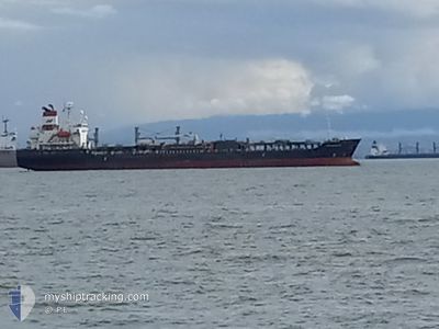
MTM HOUSTON
Oil/Chemical Tanker
Current Trip
| Time Travelled | 2 days |
|---|---|
| Remaining Time | --- |
| Distance Travelled | 648.94 nm |
| Remaining Distance | --- |
| AVG Speed | 10.9 Knots |
| MAX Speed | 12.4 Knots |
| AVG Wind | 12.8 knots |
| MAX Wind | 22 knots |
| MIN Temp | 11.6°C / 52.88°F |
| MAX Temp | 14.3°C / 57.74°F |
| Draught | 6.6 m |
| Position Received | 1 d ago |
Current Position
| Longitude | -124.29882° |
|---|---|
| Latitude | 37.56360° |
| Status | Under way using engine |
| Speed | 9.7 Knots |
| Course | 266° |
| Area | North Pacific Ocean |
| Station | T-AIS |
| Position Received | 1 d ago |
Info
Information
The current position of MTM HOUSTON is in North Pacific Ocean with coordinates 37.56360° / -124.29882° as reported on 2024-05-16 21:43 by AIS to our vessel tracker app. The vessel's current speed is 9.7 Knots and is heading at the port of ONSAN. The estimated time of arrival as calculated by vessel tracking app is 2024-06-05 12:00 LT
The vessel MTM HOUSTON (IMO: 9505924, MMSI: 566306000) is a Oil/Chemical Tanker that was built in 2010 ( 14 years old ). It's sailing under the flag of [SG] Singapore.
In this page you can find informations about the vessels current position, last detected port calls, and current voyage information. If the vessels is not in coverage by AIS you will find the latest position.
The current position of MTM HOUSTON is detected by our AIS receivers and we are not responsible for the reliability of the data. The last position was recorded while the vessel was in Coverage by the Ais receivers of our vessel tracking app.
The current draught of MTM HOUSTON as reported by AIS is 6.6 meters
Weather
| Temperature | 13.4°C / 56.12°F |
|---|---|
| Wind Speed | 15 knots |
| Direction | 24° NNE |
| Pressure | 1029.3 hPa |
| Humidity | 71.7 % |
| Cloud Coverage | 32 % |
Featured Company
Events
| Time | Event | Details | Position / Dest | Info |
|---|---|---|---|---|
| 2024-05-16 21:49 | Status Changed | Default Under way using engine |
37.56325 / -124.31907
KR USN
|
Speed: 9.7 kn Course: 266° |
| 2024-05-16 21:43 | OUT of Coverage |
37.56360 / -124.29882
North Pacific Ocean
KR USN
|
Speed: 9.7 kn Course: 266° |
|
| 2024-05-16 21:30 | Status Changed | Under way using engine Default |
37.56432 / -124.25607
KR USN
|
Speed: 9.8 kn Course: 273° |
| 2024-05-16 21:21 | Status Changed | Default Under way using engine |
37.56440 / -124.22485
KR USN
|
Speed: 9.4 kn Course: 267° |
| 2024-05-16 21:15 | Status Changed | Under way using engine Default |
37.56418 / -124.20573
KR USN
|
Speed: 10.1 kn Course: 270° |
| 2024-05-16 21:08 | Status Changed | Default Under way using engine |
37.56417 / -124.17968
KR USN
|
Speed: 10 kn Course: 266° |
| 2024-05-16 21:03 | Status Changed | Under way using engine Default |
37.56460 / -124.16327
KR USN
|
Speed: 10.4 kn Course: 268° |
| 2024-05-16 20:57 | Status Changed | Default Under way using engine |
37.56560 / -124.13934
KR USN
|
Speed: 10.3 kn Course: 267° |
| 2024-05-16 20:53 | Status Changed | Under way using engine Default |
37.56617 / -124.12483
KR USN
|
Speed: 10.4 kn Course: 267° |
| 2024-05-16 20:41 | Status Changed | Default Under way using engine |
37.56745 / -124.08203
KR USN
|
Speed: 10.1 kn Course: 272° |