
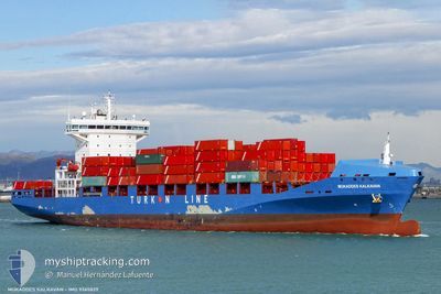
MUKADDES KALKAVAN
Container Ship
Current Trip
| Time Travelled | 6 days |
|---|---|
| Remaining Time | --- |
| Distance Travelled | 2279.49 nm |
| Remaining Distance | --- |
| AVG Speed | 14.3 Knots |
| MAX Speed | 19 Knots |
| AVG Wind | 8.7 knots |
| MAX Wind | 22 knots |
| MIN Temp | 12.5°C / 54.5°F |
| MAX Temp | 24.1°C / 75.38°F |
| Draught | 10.9 m |
| Position Received | 5 d ago |
Current Position
| Longitude | -76.81480° |
|---|---|
| Latitude | 33.39553° |
| Status | Under way using engine |
| Speed | 17.3 Knots |
| Course | 65.6° |
| Area | North Atlantic Ocean |
| Station | T-AIS |
| Position Received | 5 d ago |
Info
Information
The current position of MUKADDES KALKAVAN is in North Atlantic Ocean with coordinates 33.39553° / -76.81480° as reported on 2024-05-03 21:19 by AIS to our vessel tracker app. The vessel's current speed is 17.3 Knots and is heading at the port of TANGER MED. The estimated time of arrival as calculated by vessel tracking app is 2024-05-13 04:00 LT
The vessel MUKADDES KALKAVAN (IMO: 9365829, MMSI: 538005042) is a Container Ship that was built in 2008 ( 16 years old ). It's sailing under the flag of [MH] Marshall Is.
In this page you can find informations about the vessels current position, last detected port calls, and current voyage information. If the vessels is not in coverage by AIS you will find the latest position.
The current position of MUKADDES KALKAVAN is detected by our AIS receivers and we are not responsible for the reliability of the data. The last position was recorded while the vessel was in Coverage by the Ais receivers of our vessel tracking app.
The current draught of MUKADDES KALKAVAN as reported by AIS is 10.9 meters
Weather
| Temperature | 17.2°C / 62.96°F |
|---|---|
| Wind Speed | 21 knots |
| Direction | 231° SW |
| Pressure | 1015.5 hPa |
| Humidity | 78.7 % |
| Cloud Coverage | 92 % |
Featured Company
Last Port Calls
| Port | Arrival | Departure | Time In Port |
|---|---|---|---|
| 2024-05-02 08:15 | 2024-05-03 05:17 | 21 h | |
| 2024-04-27 20:20 | 2024-04-28 09:33 | 13 h | |
| 2024-04-25 07:21 | 2024-04-26 10:32 | 1 d | |
| 2024-04-15 17:05 | 2024-04-16 01:06 | 8 h | |
| 2024-04-07 18:08 | 2024-04-08 07:54 | 13 h | |
| 2024-04-06 13:21 | 2024-04-06 23:23 | 10 h | |
| 2024-04-05 17:49 | 2024-04-06 07:59 | 14 h | |
| 2024-04-04 07:36 | 2024-04-05 13:22 | 1 d | |
| 2024-03-31 13:37 | 2024-04-01 16:25 | 1 d | |
| 2024-03-10 08:31 | 2024-03-11 03:53 | 19 h |
Last Trips
| Origin | Departure | Destination | Arrival | Distance | |
|---|---|---|---|---|---|
| 2024-04-28 05:33 | 2024-05-02 04:15 | 503.00 nm | |||
| 2024-04-26 06:32 | 2024-04-27 16:20 | 288.01 nm | |||
| 2024-04-16 03:06 | 2024-04-25 03:21 | 3232.16 nm | |||
| 2024-04-08 10:54 | 2024-04-15 19:05 | 1743.96 nm | |||
| 2024-04-07 02:23 | 2024-04-07 21:08 | 275.39 nm | |||
| 2024-04-06 10:59 | 2024-04-06 16:21 | 70.91 nm | |||
| 2024-04-05 16:22 | 2024-04-05 20:49 | 56.53 nm | |||
| 2024-04-01 19:25 | 2024-04-04 10:36 | 788.89 nm | |||
| 2024-03-10 23:53 | 2024-03-31 16:37 | 5881.80 nm | |||
| 2024-03-08 16:34 | 2024-03-10 04:31 | 471.72 nm |
Events
| Time | Event | Details | Position / Dest | Info |
|---|---|---|---|---|
| 2024-05-03 21:33 | Status Changed | Default Under way using engine |
33.42244 / -76.74226
MAPTM
|
Speed: 17.3 kn Course: 65.6° |
| 2024-05-03 21:19 | OUT of Coverage |
33.39553 / -76.81480
North Atlantic Ocean
MAPTM
|
Speed: 17.3 kn Course: 65.6° |
|
| 2024-05-03 18:02 | IN Coverage |
33.04075 / -77.77375
North Atlantic Ocean
MAPTM
|
Speed: 15.9 kn Course: 67.2° |
|
| 2024-05-03 09:30 | Status Changed | Default Under way using engine |
32.04310 / -80.19819
MAPTM
|
Speed: 16.5 kn Course: 48.6° |
| 2024-05-03 09:22 | OUT of Coverage |
32.01973 / -80.23419
North Atlantic Ocean
MAPTM
|
Speed: 16.5 kn Course: 48.6° |
|
| 2024-05-03 09:21 | Status Changed | Under way using engine Default |
32.01615 / -80.23896
MAPTM
|
Speed: 16.5 kn Course: 46° |
| 2024-05-03 08:58 | Status Changed | Default Under way using engine |
31.95419 / -80.33749
MAPTM
|
Speed: 16.2 kn Course: 78° |
| 2024-05-03 08:51 | Status Changed | Under way using engine Default |
31.94824 / -80.37122
MAPTM
|
Speed: 15.9 kn Course: 81° |
| 2024-05-03 08:46 | Status Changed | Default Under way using engine |
31.94444 / -80.39832
MAPTM
|
Speed: 13.4 kn Course: 83° |
| 2024-05-03 08:33 | Status Changed | Under way using engine Default |
31.93792 / -80.45293
MAPTM
|
Speed: 10.8 kn Course: 82° |