
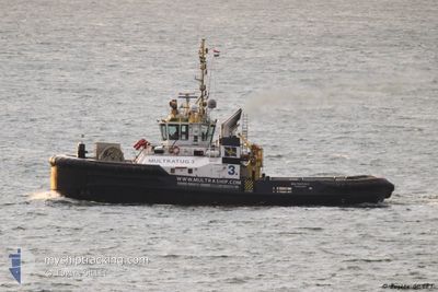
MULTRATUG 3
Tug
Current Trip
| Time Travelled | 4 days |
|---|---|
| Remaining Time | 18 h, 32 mins |
| Distance Travelled | 600.23 nm |
| Remaining Distance | 89.89 nm |
| AVG Speed | 5.8 Knots |
| MAX Speed | 10.2 Knots |
| AVG Wind | 11 knots |
| MAX Wind | 21 knots |
| MIN Temp | 13.9°C / 57.02°F |
| MAX Temp | 18.6°C / 65.48°F |
| Draught | 6.4 m |
| Position Received | 1 m ago |
Current Position
| Longitude | 2.09629° |
|---|---|
| Latitude | 51.38655° |
| Status | Restricted manoeuverability |
| Speed | 4.9 Knots |
| Course | 44° |
| Area | North Sea |
| Station | T-AIS |
| Position Received | 1 m ago |
Info
Information
The current position of MULTRATUG 3 is in North Sea with coordinates 51.38655° / 2.09629° as reported on 2024-06-21 20:19 by AIS to our vessel tracker app. The vessel's current speed is 4.9 Knots and is heading at the port of ROTTERDAM. The estimated time of arrival as calculated by vessel tracking app is 2024-06-22 14:53 LT
The vessel MULTRATUG 3 (IMO: 9537408, MMSI: 244890607) is a Tug that was built in 2010 ( 14 years old ). It's sailing under the flag of [NL] Netherlands.
In this page you can find informations about the vessels current position, last detected port calls, and current voyage information. If the vessels is not in coverage by AIS you will find the latest position.
The current position of MULTRATUG 3 is detected by our AIS receivers and we are not responsible for the reliability of the data. The last position was recorded while the vessel was in Coverage by the Ais receivers of our vessel tracking app.
The current draught of MULTRATUG 3 as reported by AIS is 6.4 meters
Weather
| Temperature | 15.9°C / 60.62°F |
|---|---|
| Wind Speed | 14 knots |
| Direction | 223° SW |
| Pressure | 1011.5 hPa |
| Humidity | 84.8 % |
| Cloud Coverage | 35 % |
Featured Company
Last Port Calls
| Port | Arrival | Departure | Time In Port |
|---|---|---|---|
| 2024-06-12 18:54 | 2024-06-17 12:31 | 4 d | |
| 2024-06-10 18:05 | 2024-06-10 19:28 | 1 h | |
| 2024-05-29 08:43 | 2024-06-06 16:08 | 8 d | |
| 2024-05-20 11:36 | 2024-05-21 15:20 | 1 d | |
| 2024-05-19 19:47 | 2024-05-20 11:12 | 15 h | |
| 2024-05-10 14:29 | 2024-05-12 22:18 | 2 d | |
| 2024-04-28 06:03 | 2024-05-03 13:00 | 5 d | |
| 2024-04-23 09:27 | 2024-04-24 11:59 | 1 d | |
| 2024-04-18 00:00 | 2024-04-18 12:02 | 12 h | |
| 2024-04-17 22:33 | 2024-04-17 23:13 | 40 m |
Most Visited Ports (Last year)
| Port | Arrivals | |
|---|---|---|
| 87 | ||
| 34 | ||
| 16 | ||
| 6 | ||
| 5 | ||
| 4 |
Last Trips
| Origin | Departure | Destination | Arrival | Distance | |
|---|---|---|---|---|---|
| 2024-06-10 21:28 | 2024-06-12 20:54 | 225.11 nm | |||
| 2024-06-06 18:08 | 2024-06-10 20:05 | 203.92 nm | |||
| 2024-05-21 17:20 | 2024-05-29 10:43 | 961.62 nm | |||
| 2024-05-20 13:12 | 2024-05-20 13:36 | 2.00 nm | |||
| 2024-05-13 00:18 | 2024-05-19 21:47 | 1344.10 nm | |||
| 2024-05-03 14:00 | 2024-05-10 16:29 | 591.72 nm | |||
| 2024-04-24 12:59 | 2024-04-28 07:03 | 330.15 nm | |||
| 2024-04-18 14:02 | 2024-04-23 10:27 | 671.72 nm | |||
| 2024-04-18 01:13 | 2024-04-18 02:00 | 7.13 nm | |||
| 2024-04-17 23:02 | 2024-04-18 00:33 | 7.84 nm |
Events
| Time | Event | Details | Position / Dest | Info |
|---|---|---|---|---|
| 2024-06-21 19:44 | Change Sea Area | French part of the North Sea United Kingdom part of the North Sea |
51.34978 / 2.04753
North Sea
NLRTM
|
Speed: 4.7 kn Course: 40.6° |
| 2024-06-21 15:47 | Change Sea Area | United Kingdom part of the North Sea French part of the North Sea |
51.07443 / 1.65132
North Sea
NLRTM
|
Speed: 8 kn Course: 38.7° |
| 2024-06-21 15:19 | ETA Changed | 2024/06/22 08:00 2024/06/22 13:00 |
51.02625 / 1.58694
NLRTM
|
Speed: 8.4 kn Course: 41.7° |
| 2024-06-21 15:16 | Change Sea Area | French part of the North Sea French part of the English Channel |
51.02150 / 1.58020
North Sea
NLRTM
|
Speed: 8.5 kn Course: 41.4° |
| 2024-06-21 14:38 | Status Changed | Restricted manoeuverability Default |
50.95143 / 1.48258
NLRTM
|
Speed: 9.3 kn Course: 37° |
| 2024-06-21 14:29 | Status Changed | Default Restricted manoeuverability |
50.93402 / 1.46078
NLRTM
|
Speed: 9.2 kn Course: 37.5° |
| 2024-06-21 13:54 | Status Changed | Restricted manoeuverability Default |
50.85548 / 1.39332
NLRTM
|
Speed: 9.1 kn Course: 19° |
| 2024-06-21 13:05 | Status Changed | Default Restricted manoeuverability |
50.74268 / 1.33064
NLRTM
|
Speed: 8.6 kn Course: 19.8° |
| 2024-06-21 12:50 | Detected in Sea | French part of the English Channel |
50.71043 / 1.30557
English Channel
NLRTM
|
Speed: 8.7 kn Course: 51.2° |
| 2024-06-21 12:50 | Status Changed | Restricted manoeuverability Default |
50.70945 / 1.30361
NLRTM
|
Speed: 8.8 kn Course: 52° |