
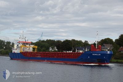
MV SCHILLIG
General Cargo
Aktuelle Reise
| Bisherige Reisezeit | 1 Tag |
|---|---|
| Verbleibende Reisezeit | 22 h, 58 Minuten |
| Zurückgelegte Distanz | 300.88 nm |
| Verbleibende Distanz | 73.15 nm |
| Durchschnittliche Geschwindigkeit | 7.2 Knoten |
| Maximale Geschwindigkeit | 9 Knoten |
| Durchschnittliche Windgeschwindigkeit | 27.7 Knoten |
| Maximale Windgeschwindigkeit | 34.1 Knoten |
| Minimale Temperatur | 7.9°C / 46.22°F |
| Maximale Temperatur | 10.8°C / 51.44°F |
| Tiefgang | 5.5 m |
| Position erhalten | Jetzt |
Aktuelle Position
| Länge | --- |
|---|---|
| Breite | --- |
| Zustand | Under way using engine |
| Geschwindigkeit | 3.1 Knoten |
| Kurs | 264° |
| Gebiet | Skaggerak |
| Station | T-AIS |
| Position erhalten | Jetzt |
Schiffsdetails
Information
Die MV SCHILLIG befindet sich derzeit in Skaggerak mit den Koordinaten 58.72208° / 10.47529°, Diese Position wurde am 2024-11-17 09:18 von unserer Schiffsverfolgungs-App über AIS erfasst. Das Schiff fährt momentan mit einer Geschwindigkeit von 3.1 Knoten und fahrt in den Hafen von OSLO. Die geschatzte Ankunftszeit, berechnet von der -App zur Schiffsverfolgung, ist 2024-11-18 08:17 LT
Das Schiff MV SCHILLIG (IMO: 9505405, MMSI: 236111817) ist General Cargo das wurde im Jahr 2012 ( 12 Jahre alt ) gebaut. und fährt unter der Flagge von [GI] Gibraltar.
Auf dieser Seite erhalten Sie Informationen zur aktuellen Position des Schiffes, zu den letzten bekannten Hafenanläufen und zu den aktuellen Reiseinformationen. Sollte das Schiff nicht durch AIS abgedeckt sein, wird die zuletzt erfasste Position angezeigt.
Die MV SCHILLIG wird durch unsere AIS-Empfänger ermittelt. Wir übernehmen keine Gewähr für die Richtigkeit der Daten. Die letzte Position wurde von unseren AIS-Empfängern aufgezeichnet, während das Schiff in Reichweite war.
Der aktuelle Entwurf von MV SCHILLIG, wie von AIS gemeldet, betragt 5.5 meter
Wetter
| Temperatur | 8.9°C / 48.02°F |
|---|---|
| Windgeschwindigkeit | 25 Knoten |
| Windrichtung | 275° W |
| Luftdruck | 987.4 hPa |
| Luftfeuchtigkeit | 60.7 % |
| Wolken | 50 % |
Featured Company
Letzte Hafenanläufe
| Hafen | Ankunft | Abfahrt | Time In Port |
|---|---|---|---|
| 2024-11-14 03:54 | 2024-11-15 15:21 | 1 d | |
| 2024-11-11 03:34 | 2024-11-12 13:54 | 1 d | |
| 2024-11-08 06:22 | 2024-11-09 15:47 | 1 d | |
| 2024-11-04 04:37 | 2024-11-06 12:07 | 2 d | |
| 2024-11-01 03:23 | 2024-11-02 14:49 | 1 d | |
| 2024-10-27 22:58 | 2024-10-30 16:25 | 2 d | |
| 2024-10-24 04:40 | 2024-10-26 11:14 | 2 d | |
| 2024-10-14 21:03 | 2024-10-16 19:13 | 1 d | |
| 2024-10-13 16:17 | 2024-10-14 18:05 | 1 d | |
| 2024-09-28 14:14 | 2024-10-02 19:16 | 4 d |
Letzte Reisen
| Herkunft | Abfahrt | Ziel | Ankunft | Distanz | |
|---|---|---|---|---|---|
| 2024-11-12 14:54 | 2024-11-14 04:54 | 368.89 nm | |||
| 2024-11-09 16:47 | 2024-11-11 04:34 | 366.57 nm | |||
| 2024-11-06 13:07 | 2024-11-08 07:22 | 375.42 nm | |||
| 2024-11-02 15:49 | 2024-11-04 05:37 | 367.07 nm | |||
| 2024-10-30 17:25 | 2024-11-01 04:23 | 367.81 nm | |||
| 2024-10-26 13:14 | 2024-10-27 23:58 | 367.07 nm | |||
| 2024-10-16 19:13 | 2024-10-24 06:40 | 1543.89 nm | |||
| 2024-10-14 18:05 | 2024-10-14 21:03 | 15.82 nm | |||
| 2024-10-02 22:16 | 2024-10-13 16:17 | 1827.09 nm | |||
| 2024-09-23 19:09 | 2024-09-28 17:14 | 1180.78 nm |
Events
| Zeit | Ereignis | Details | Position / Ziel | Information |
|---|---|---|---|---|
| 2024-11-17 08:54 | Ändere Seegebiet | Norwegian part of the Skaggerak Swedish part of the Skaggerak |
58.71692 / 10.51307
Skaggerak
OSLO
|
Geschwindigkeit: 3.5 kn Kurs: 294.8° |
| 2024-11-17 00:56 | Ändere Seegebiet | Swedish part of the Skaggerak Swedish part of the Kattegat |
57.86290 / 11.22302
Skaggerak
OSLO
|
Geschwindigkeit: 7.1 kn Kurs: 343° |
| 2024-11-16 06:05 | Ändere Seegebiet | Swedish part of the Kattegat Danish part of the Kattegat |
55.81695 / 12.72153
Kattegat
OSLO
|
Geschwindigkeit: 7.7 kn Kurs: 7° |
| 2024-11-16 03:17 | Ändere Seegebiet | Danish part of the Kattegat Swedish part of the Kattegat |
55.48935 / 12.71229
Kattegat
OSLO
|
Geschwindigkeit: 7.9 kn Kurs: 3.2° |
| 2024-11-16 02:11 | Ändere Seegebiet | Swedish part of the Kattegat Swedish part of the Baltic Sea |
55.34006 / 12.68270
Kattegat
OSLO
|
Geschwindigkeit: 7.8 kn Kurs: 13.1° |
| 2024-11-15 21:34 | Ändere Seegebiet | Swedish part of the Baltic Sea German part of the Baltic Sea |
55.01517 / 13.38513
Baltic Sea
OSLO
|
Geschwindigkeit: 7.1 kn Kurs: 313.8° |
| 2024-11-15 19:50 | geänderter Status | Under way using engine Default |
54.85136 / 13.49441
OSLO
|
Geschwindigkeit: 6.7 kn Kurs: 331° |
| 2024-11-15 19:48 | geänderter Status | Default Under way using engine |
54.84900 / 13.49689
OSLO
|
Geschwindigkeit: 6.7 kn Kurs: 322.1° |
| 2024-11-15 19:33 | geänderter Status | Under way using engine Default |
54.82611 / 13.52737
OSLO
|
Geschwindigkeit: 6.9 kn Kurs: 310° |
| 2024-11-15 19:16 | geänderter Status | Default Under way using engine |
54.80818 / 13.57233
OSLO
|
Geschwindigkeit: 6.9 kn Kurs: 300.9° |