
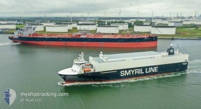
MYKINES
Vehicles Carrier
Current Trip
| Time Travelled | 2 days |
|---|---|
| Remaining Time | 6 h, 25 mins |
| Distance Travelled | 954.40 nm |
| Remaining Distance | 140.15 nm |
| AVG Speed | 15.5 Knots |
| MAX Speed | 17.8 Knots |
| AVG Wind | 14.3 knots |
| MAX Wind | 25 knots |
| MIN Temp | 7.8°C / 46.04°F |
| MAX Temp | 13.9°C / 57.02°F |
| Draught | 6.2 m |
| Position Received | 2 h, 4 m ago |
Current Position
| Longitude | 1.61584° |
|---|---|
| Latitude | 53.65329° |
| Status | Under way using engine |
| Speed | 16.5 Knots |
| Course | 146.6° |
| Area | North Sea |
| Station | T-AIS |
| Position Received | 2 h, 4 m ago |
Info
Information
The current position of MYKINES is in North Sea with coordinates 53.65329° / 1.61584° as reported on 2024-06-03 07:07 by AIS to our vessel tracker app. The vessel's current speed is 16.5 Knots and is heading at the port of ROTTERDAM. The estimated time of arrival as calculated by vessel tracking app is 2024-06-03 15:37 LT
The vessel MYKINES (IMO: 9121998, MMSI: 231002000) is a Vehicles Carrier that was built in 1996 ( 28 years old ). It's sailing under the flag of [FO] Faroe Is.
In this page you can find informations about the vessels current position, last detected port calls, and current voyage information. If the vessels is not in coverage by AIS you will find the latest position.
The current position of MYKINES is detected by our AIS receivers and we are not responsible for the reliability of the data. The last position was recorded while the vessel was in Coverage by the Ais receivers of our vessel tracking app.
The current draught of MYKINES as reported by AIS is 6.2 meters
Weather
| Temperature | 12.8°C / 55.04°F |
|---|---|
| Wind Speed | 9 knots |
| Direction | 311° NW |
| Pressure | 1020.1 hPa |
| Humidity | 92.5 % |
| Cloud Coverage | 100 % |
Featured Company
Last Port Calls
| Port | Arrival | Departure | Time In Port |
|---|---|---|---|
| 2024-05-31 07:38 | 2024-05-31 21:43 | 14 h | |
| 2024-05-29 22:00 | 2024-05-30 03:14 | 5 h | |
| 2024-05-27 19:33 | 2024-05-28 01:25 | 5 h | |
| 2024-05-27 18:44 | 2024-05-27 19:26 | 42 m | |
| 2024-05-24 03:25 | 2024-05-25 03:25 | 23 h | |
| 2024-05-20 16:54 | 2024-05-21 03:59 | 11 h | |
| 2024-05-20 16:00 | 2024-05-20 16:46 | 45 m | |
| 2024-05-17 07:58 | 2024-05-17 21:57 | 13 h | |
| 2024-05-15 21:11 | 2024-05-16 03:23 | 6 h | |
| 2024-05-13 16:40 | 2024-05-13 23:56 | 7 h |
Last Trips
| Origin | Departure | Destination | Arrival | Distance | |
|---|---|---|---|---|---|
| 2024-05-30 04:14 | 2024-05-31 07:38 | 429.21 nm | |||
| 2024-05-28 03:25 | 2024-05-29 23:00 | 720.64 nm | |||
| 2024-05-27 21:26 | 2024-05-27 21:33 | 0.30 nm | |||
| 2024-05-25 03:25 | 2024-05-27 20:44 | 1098.02 nm | |||
| 2024-05-21 05:59 | 2024-05-24 03:25 | 1104.00 nm | |||
| 2024-05-20 18:46 | 2024-05-20 18:54 | 0.33 nm | |||
| 2024-05-17 21:57 | 2024-05-20 18:00 | 1098.83 nm | |||
| 2024-05-16 04:23 | 2024-05-17 07:58 | 429.08 nm | |||
| 2024-05-14 01:56 | 2024-05-15 22:11 | 719.55 nm | |||
| 2024-05-10 21:36 | 2024-05-13 18:40 | 1106.29 nm |
Events
| Time | Event | Details | Position / Dest | Info |
|---|---|---|---|---|
| 2024-06-03 07:13 | Status Changed | Default Under way using engine |
53.62833 / 1.64167
NLRTM - MC BUOY
|
Speed: 16.5 kn Course: 146.6° |
| 2024-06-03 07:07 | OUT of Coverage |
53.65329 / 1.61584
North Sea
NLRTM - MC BUOY
|
Speed: 16.5 kn Course: 146.6° |
|
| 2024-06-03 04:41 | Draught Changed | 6.2 6 |
54.26207 / 1.19521
NLRTM - MC BUOY
|
Speed: 16.6 kn Course: 152° |
| 2024-06-03 04:32 | Status Changed | Under way using engine Default |
54.29512 / 1.16552
NLRTM - MC BUOY
|
Speed: 16 kn Course: 152° |
| 2024-06-03 04:32 | IN Coverage |
54.28614 / 1.17353
North Sea
NLRTM - MC BUOY
|
Speed: 16.6 kn Course: 152.2° |
|
| 2024-06-02 17:34 | Status Changed | Default Under way using engine |
57.10349 / -1.23016
NLRTM - MC BUOY
|
Speed: 17.4 kn Course: 155.1° |
| 2024-06-02 17:26 | OUT of Coverage |
57.13998 / -1.26022
North Sea
NLRTM - MC BUOY
|
Speed: 17.4 kn Course: 155.1° |
|
| 2024-06-02 14:09 | Status Changed | Under way using engine Default |
57.93017 / -2.09032
NLRTM - MC BUOY
|
Speed: 16.5 kn Course: 148° |
| 2024-06-02 14:00 | IN Coverage |
57.92552 / -2.08487
North Sea
NLRTM - MC BUOY
|
Speed: 16.6 kn Course: 149° |
|
| 2024-06-02 11:33 | OUT of Coverage |
58.52690 / -2.79189
North Sea
NLRTM - MC BUOY
|
Speed: 15.4 kn Course: 148.5° |