
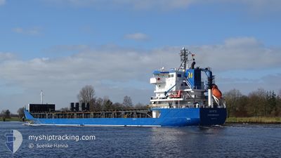
MYRTE
General Cargo
Current Trip
| Time Travelled | 10 h, 46 mins |
|---|---|
| Remaining Time | 13 h, 40 mins |
| Distance Travelled | 140.26 nm |
| Remaining Distance | 189.01 nm |
| AVG Speed | 13.2 Knots |
| MAX Speed | 13.6 Knots |
| AVG Wind | 7.3 knots |
| MAX Wind | 9.3 knots |
| MIN Temp | 5.9°C / 42.62°F |
| MAX Temp | 9.1°C / 48.38°F |
| Draught | 5.4 m |
| Position Received | Now |
Current Position
| Longitude | 19.80504° |
|---|---|
| Latitude | 59.70654° |
| Status | Under way using engine |
| Speed | 13.1 Knots |
| Course | 141° |
| Area | Baltic Sea |
| Station | T-AIS |
| Position Received | Now |
Info
Information
The current position of MYRTE is in Baltic Sea with coordinates 59.70654° / 19.80504° as reported on 2024-05-14 00:58 by AIS to our vessel tracker app. The vessel's current speed is 13.1 Knots and is heading at the port of MONSTERAS. The estimated time of arrival as calculated by vessel tracking app is 2024-05-14 14:39 LT
The vessel MYRTE (IMO: 9364136, MMSI: 246110000) is a General Cargo that was built in 2008 ( 16 years old ). It's sailing under the flag of [NL] Netherlands.
In this page you can find informations about the vessels current position, last detected port calls, and current voyage information. If the vessels is not in coverage by AIS you will find the latest position.
The current position of MYRTE is detected by our AIS receivers and we are not responsible for the reliability of the data. The last position was recorded while the vessel was in Coverage by the Ais receivers of our vessel tracking app.
The current draught of MYRTE as reported by AIS is 5.4 meters
Weather
| Temperature | 7.1°C / 44.78°F |
|---|---|
| Wind Speed | 7 knots |
| Direction | 232° SW |
| Pressure | 1020.5 hPa |
| Humidity | 82.7 % |
| Cloud Coverage | 12 % |
Featured Company
Last Port Calls
| Port | Arrival | Departure | Time In Port |
|---|---|---|---|
| 2024-05-11 06:42 | 2024-05-13 14:13 | 2 d | |
| 2024-05-05 20:12 | 2024-05-06 17:15 | 21 h | |
| 2024-05-05 18:21 | |||
| 2024-05-03 08:48 | |||
| 2024-05-03 08:48 | |||
| 2024-05-02 17:11 | |||
| 2024-04-23 15:00 | 2024-04-23 21:52 | 6 h | |
| 2024-04-14 01:32 | 2024-04-15 10:32 | 1 d | |
| 2024-04-01 14:33 | 2024-04-06 13:30 | 4 d | |
| 2024-03-29 07:08 | 2024-03-31 13:15 | 2 d |
Last Trips
| Origin | Departure | Destination | Arrival | Distance | |
|---|---|---|---|---|---|
| 2024-05-06 19:15 | 2024-05-11 09:42 | 1001.69 nm | |||
| 2024-05-05 20:21 | 2024-05-05 22:12 | 17.75 nm | |||
| 2024-04-23 23:52 | 2024-05-03 10:48 | 2429.67 nm | |||
| 2024-04-23 23:52 | 2024-05-02 19:11 | 2428.40 nm | |||
| 2024-04-15 13:32 | 2024-04-23 17:00 | 1624.27 nm | |||
| 2024-04-06 15:30 | 2024-04-14 04:32 | 1411.52 nm | |||
| 2024-03-31 15:15 | 2024-04-01 16:33 | 253.99 nm | |||
| 2024-03-27 18:28 | 2024-03-29 08:08 | 342.91 nm | |||
| 2024-03-22 14:15 | 2024-03-27 08:53 | 1468.37 nm | |||
| 2024-03-15 05:58 | 2024-03-22 05:51 | 1977.33 nm |
Events
| Time | Event | Details | Position / Dest | Info |
|---|---|---|---|---|
| 2024-05-14 00:25 | Change Sea Area | Finnish part of the Baltic Sea Swedish part of the Gulf of Bothnia |
59.79967 / 19.64850
Baltic Sea
MONSTERAS
|
Speed: 13.4 kn Course: 138° |
| 2024-05-13 20:35 | Status Changed | Under way using engine Default |
60.51810 / 19.06007
MONSTERAS
|
Speed: 13.3 kn Course: 234° |
| 2024-05-13 20:32 | Status Changed | Default Under way using engine |
60.52420 / 19.07746
MONSTERAS
|
Speed: 13.4 kn Course: 234° |
| 2024-05-13 20:24 | Change Sea Area | Swedish part of the Gulf of Bothnia Finnish part of the Gulf of Bothnia |
60.54283 / 19.13033
Gulf of Bothnia
MONSTERAS
|
Speed: 13.4 kn Course: 235° |
| 2024-05-13 20:22 | Status Changed | Under way using engine Default |
60.54567 / 19.13850
MONSTERAS
|
Speed: 13.3 kn Course: 234° |
| 2024-05-13 20:12 | Status Changed | Default Under way using engine |
60.56667 / 19.19967
MONSTERAS
|
Speed: 13.4 kn Course: 237° |
| 2024-05-13 19:56 | Status Changed | Under way using engine Default |
60.60017 / 19.30333
MONSTERAS
|
Speed: 13.3 kn Course: 237° |
| 2024-05-13 19:45 | IN Coverage |
60.59787 / 19.29601
Gulf of Bothnia
MONSTERAS
|
Speed: 13.4 kn Course: 238° |
|
| 2024-05-13 15:44 | Status Changed | Default Under way using engine |
61.07429 / 20.85914
MONSTERAS
|
Speed: 12.9 kn Course: 239° |
| 2024-05-13 15:38 | OUT of Coverage |
61.08650 / 20.90067
Gulf of Bothnia
MONSTERAS
|
Speed: 12.9 kn Course: 239° |