
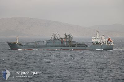
NACC POROS
Bulk Carrier
Current Trip
US SEA
| Time Travelled | 2 days |
|---|---|
| Remaining Time | --- |
| Distance Travelled | 1.63 nm |
| Remaining Distance | --- |
| AVG Speed | --- |
| MAX Speed | --- |
| AVG Wind | 4.8 knots |
| MAX Wind | 6.9 knots |
| MIN Temp | 9.2°C / 48.56°F |
| MAX Temp | 18.3°C / 64.94°F |
| Draught | 7.1 m |
| Position Received | Now |
Current Position
| Longitude | -122.34342° |
|---|---|
| Latitude | 47.55474° |
| Status | Moored |
| Speed | |
| Course | 341° |
| Area | The Coastal Waters of Southeast Alaska and British Columbia |
| Station | T-AIS |
| Position Received | Now |
Info
Information
The current position of NACC POROS is in The Coastal Waters of Southeast Alaska and British Columbia with coordinates 47.55474° / -122.34342° as reported on 2024-05-28 09:40 by AIS to our vessel tracker app. The vessel's current speed is 0 Knots
The vessel NACC POROS (IMO: 9600592, MMSI: 255801370) is a Bulk Carrier that was built in 2012 ( 12 years old ). It's sailing under the flag of [PT] Portugal.
In this page you can find informations about the vessels current position, last detected port calls, and current voyage information. If the vessels is not in coverage by AIS you will find the latest position.
The current position of NACC POROS is detected by our AIS receivers and we are not responsible for the reliability of the data. The last position was recorded while the vessel was in Coverage by the Ais receivers of our vessel tracking app.
The current draught of NACC POROS as reported by AIS is 7.1 meters
Weather
| Temperature | 10.2°C / 50.36°F |
|---|---|
| Wind Speed | 2 knots |
| Direction | 81° E |
| Pressure | 1018 hPa |
| Humidity | 87.5 % |
| Cloud Coverage | 100 % |
Featured Company
Last Port Calls
| Port | Arrival | Departure | Time In Port |
|---|---|---|---|
| 2024-05-26 01:52 | 2024-05-26 02:52 | 59 m | |
| 2024-05-18 06:51 | 2024-05-18 08:04 | 1 h | |
| 2024-05-10 02:03 | 2024-05-10 02:23 | 20 m | |
| 2024-05-04 21:35 | 2024-05-04 22:37 | 1 h | |
| 2024-04-30 19:08 | 2024-04-30 19:31 | 22 m | |
| 2024-04-30 09:59 | 2024-04-30 13:38 | 3 h | |
| 2024-04-29 20:38 | 2024-04-30 04:02 | 7 h | |
| 2024-04-29 11:20 | 2024-04-29 14:20 | 3 h | |
| 2024-04-22 10:39 | 2024-04-22 11:51 | 1 h | |
| 2024-04-11 22:51 | 2024-04-12 00:03 | 1 h |
Most Visited Ports (Last year)
| Port | Arrivals | |
|---|---|---|
| 33 | ||
| 2 | ||
| 1 | ||
| 1 |
Last Trips
| Origin | Departure | Destination | Arrival | Distance | |
|---|---|---|---|---|---|
| 2024-05-18 01:04 | 2024-05-25 18:52 | 319.36 nm | |||
| 2024-05-09 19:23 | 2024-05-17 23:51 | 316.03 nm | |||
| 2024-05-04 15:37 | 2024-05-09 19:03 | 3.01 nm | |||
| 2024-04-30 12:31 | 2024-05-04 14:35 | 312.38 nm | |||
| 2024-04-30 06:38 | 2024-04-30 12:08 | 0.23 nm | |||
| 2024-04-29 21:02 | 2024-04-30 02:59 | 0.36 nm | |||
| 2024-04-29 07:20 | 2024-04-29 13:38 | 0.18 nm | |||
| 2024-04-22 04:51 | 2024-04-29 04:20 | 9.82 nm | |||
| 2024-04-11 17:03 | 2024-04-22 03:39 | 315.13 nm | |||
| 2024-03-28 18:39 | 2024-04-11 15:51 | 340.61 nm |
Events
| Time | Event | Details | Position / Dest | Info |
|---|---|---|---|---|
| 2024-05-27 21:10 | Draught Changed | 7.1 7 |
47.55468 / -122.34341
US SEA
|
Speed: Course: 341° |
| 2024-05-27 21:10 | ETA Changed | 2024/05/26 03:00 |
47.55468 / -122.34341
US SEA
|
Speed: Course: 341° |
| 2024-05-27 21:04 | Draught Changed | 7 7.1 |
47.55473 / -122.34338
US SEA
|
Speed: Course: 341° |
| 2024-05-27 20:16 | Draught Changed | 7.1 7 |
47.55469 / -122.34342
US SEA
|
Speed: Course: 340° |
| 2024-05-27 20:16 | ETA Changed | 2024/05/26 03:00 |
47.55469 / -122.34342
US SEA
|
Speed: Course: 340° |
| 2024-05-27 20:10 | Draught Changed | 7 7.1 |
47.55467 / -122.34343
US SEA
|
Speed: Course: 340° |
| 2024-05-27 19:49 | Status Changed | Moored Default |
47.55473 / -122.34341
US SEA
|
Speed: Course: -1° |
| 2024-05-27 19:46 | Status Changed | Default Moored |
47.55333 / -122.34333
US SEA
|
Speed: Course: 340° |
| 2024-05-27 19:10 | Draught Changed | 7.1 7 |
47.55471 / -122.34340
US SEA
|
Speed: Course: 340° |
| 2024-05-27 19:10 | ETA Changed | 2024/05/26 03:00 |
47.55471 / -122.34340
US SEA
|
Speed: Course: 340° |