
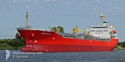
NAEBA GALAXY
Tanker
Current Trip
MA JLF
| Time Travelled | 3 days |
|---|---|
| Remaining Time | --- |
| Distance Travelled | 953.42 nm |
| Remaining Distance | --- |
| AVG Speed | 12.4 Knots |
| MAX Speed | 16.1 Knots |
| AVG Wind | 14.7 knots |
| MAX Wind | 23 knots |
| MIN Temp | 12.1°C / 53.78°F |
| MAX Temp | 16.1°C / 60.98°F |
| Draught | 7 m |
| Position Received | 5 m ago |
Current Position
| Longitude | -10.73599° |
|---|---|
| Latitude | 41.80172° |
| Status | Under way using engine |
| Speed | 14 Knots |
| Course | 176.6° |
| Area | North Atlantic Ocean |
| Station | T-AIS |
| Position Received | 5 m ago |
Info
Information
The current position of NAEBA GALAXY is in North Atlantic Ocean with coordinates 41.80172° / -10.73599° as reported on 2024-05-29 07:42 by AIS to our vessel tracker app. The vessel's current speed is 14 Knots
The vessel NAEBA GALAXY (IMO: 9791169, MMSI: 563054800) is a Tanker It's sailing under the flag of [SG] Singapore.
In this page you can find informations about the vessels current position, last detected port calls, and current voyage information. If the vessels is not in coverage by AIS you will find the latest position.
The current position of NAEBA GALAXY is detected by our AIS receivers and we are not responsible for the reliability of the data. The last position was recorded while the vessel was in Coverage by the Ais receivers of our vessel tracking app.
The current draught of NAEBA GALAXY as reported by AIS is 7 meters
Weather
| Temperature | 16°C / 60.8°F |
|---|---|
| Wind Speed | 13 knots |
| Direction | 353° N |
| Pressure | 1021.1 hPa |
| Humidity | 93.6 % |
| Cloud Coverage | 15 % |
Featured Company
Last Port Calls
| Port | Arrival | Departure | Time In Port |
|---|---|---|---|
| 2024-05-25 03:36 | 2024-05-26 03:38 | 1 d | |
| 2024-05-23 21:03 | 2024-05-25 03:03 | 1 d | |
| 2024-05-23 01:25 | 2024-05-23 20:35 | 19 h | |
| 2024-05-15 21:11 | 2024-05-22 13:01 | 6 d | |
| 2024-04-26 18:02 | 2024-04-27 19:50 | 1 d | |
| 2024-04-22 02:44 | 2024-04-22 03:54 | 1 h | |
| 2024-04-20 16:33 | 2024-04-21 16:06 | 23 h | |
| 2024-04-13 15:03 | 2024-04-14 22:15 | 1 d | |
| 2024-04-05 07:53 | 2024-04-07 08:41 | 2 d | |
| 2024-03-29 09:09 | 2024-03-30 06:45 | 21 h |
Most Visited Ports (Last year)
| Port | Arrivals | |
|---|---|---|
| 12 | ||
| 8 | ||
| 6 | ||
| 3 | ||
| 3 | ||
| 2 |
Last Trips
| Origin | Departure | Destination | Arrival | Distance | |
|---|---|---|---|---|---|
| 2024-05-25 05:03 | 2024-05-25 05:36 | 2.56 nm | |||
| 2024-05-23 22:35 | 2024-05-23 23:03 | 1.57 nm | |||
| 2024-05-22 15:01 | 2024-05-23 03:25 | 127.83 nm | |||
| 2024-04-27 14:50 | 2024-05-15 23:11 | 5144.60 nm | |||
| 2024-04-21 22:54 | 2024-04-26 13:02 | 581.52 nm | |||
| 2024-04-21 11:06 | 2024-04-21 21:44 | 102.65 nm | |||
| 2024-04-14 17:15 | 2024-04-20 11:33 | 70.89 nm | |||
| 2024-04-07 03:41 | 2024-04-13 10:03 | 75.94 nm | |||
| 2024-03-30 02:45 | 2024-04-05 02:53 | 1761.96 nm | |||
| 2024-03-27 12:31 | 2024-03-29 05:09 | 463.28 nm |
Events
| Time | Event | Details | Position / Dest | Info |
|---|---|---|---|---|
| 2024-05-29 07:40 | Status Changed | Under way using engine Default |
41.80906 / -10.73643
MA JLF
|
Speed: 13.9 kn Course: 177° |
| 2024-05-29 07:24 | IN Coverage |
41.80172 / -10.73599
North Atlantic Ocean
MA JLF
|
Speed: 14 kn Course: 176.6° |
|
| 2024-05-29 02:24 | Status Changed | Default Under way using engine |
43.02419 / -10.74768
MA JLF
|
Speed: 13.5 kn Course: 178.3° |
| 2024-05-29 02:20 | OUT of Coverage |
43.04076 / -10.74865
North Atlantic Ocean
MA JLF
|
Speed: 13.5 kn Course: 178.3° |
|
| 2024-05-29 02:14 | Change Sea Area | Spanish part of the North Atlantic Ocean United Kingdom part of the English Channel |
43.06289 / -10.74976
North Atlantic Ocean
MA JLF
|
Speed: 13.7 kn Course: 177.8° |
| 2024-05-29 02:14 | Status Changed | Under way using engine Default |
43.06289 / -10.74976
MA JLF
|
Speed: 13.6 kn Course: 177° |
| 2024-05-29 02:14 | IN Coverage |
43.06289 / -10.74976
North Atlantic Ocean
MA JLF
|
Speed: 13.7 kn Course: 177.8° |
|
| 2024-05-27 11:15 | Status Changed | Default Under way using engine |
49.64788 / -4.88683
MA JLF
|
Speed: 11.9 kn Course: 254.4° |
| 2024-05-27 11:10 | OUT of Coverage |
49.65230 / -4.86292
English Channel
MA JLF
|
Speed: 11.9 kn Course: 254.4° |
|
| 2024-05-27 11:10 | Status Changed | Under way using engine Default |
49.65291 / -4.85956
MA JLF
|
Speed: 12.2 kn Course: 255° |