
NALUHU
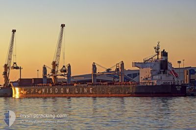
Bulk Carrier
Current Trip
| Time Travelled | 18 h, 3 mins |
|---|---|
| Remaining Time | 19 days |
| Distance Travelled | 183.10 nm |
| Remaining Distance | 4332.32 nm |
| AVG Speed | 9.8 Knots |
| MAX Speed | 12 Knots |
| AVG Wind | 16.9 knots |
| MAX Wind | 24.8 knots |
| MIN Temp | 5.2°C / 41.36°F |
| MAX Temp | 15.3°C / 59.54°F |
| Draught | 12.8 m |
| Position Received | 1 h, 3 m ago |
Current Position
| Longitude | -125.40483° |
|---|---|
| Latitude | 48.25148° |
| Status | Under way using engine |
| Speed | 9.3 Knots |
| Course | 227.4° |
| Area | North Pacific Ocean |
| Station | T-AIS |
| Position Received | 1 h, 3 m ago |
Info
Information
The current position of NALUHU is in North Pacific Ocean with coordinates 48.25148° / -125.40483° as reported on 2024-05-17 16:09 by AIS to our vessel tracker app. The vessel's current speed is 9.3 Knots and is heading at the port of BUENAVENTURA. The estimated time of arrival as calculated by vessel tracking app is 2024-06-05 19:16 LT
The vessel NALUHU (IMO: 9520792, MMSI: 371883000) is a Bulk Carrier that was built in 2010 ( 14 years old ). It's sailing under the flag of [PA] Panama.
In this page you can find informations about the vessels current position, last detected port calls, and current voyage information. If the vessels is not in coverage by AIS you will find the latest position.
The current position of NALUHU is detected by our AIS receivers and we are not responsible for the reliability of the data. The last position was recorded while the vessel was in Coverage by the Ais receivers of our vessel tracking app.
The current draught of NALUHU as reported by AIS is 12.8 meters
Weather
| Temperature | 10.3°C / 50.54°F |
|---|---|
| Wind Speed | 22 knots |
| Direction | 301° WNW |
| Pressure | 1020 hPa |
| Humidity | 83.2 % |
| Cloud Coverage | 7 % |
Featured Company
Last Port Calls
| Port | Arrival | Departure | Time In Port |
|---|---|---|---|
| 2024-05-08 05:39 | 2024-05-16 23:09 | 8 d | |
| 2024-04-18 14:36 | 2024-04-29 15:09 | 11 d | |
| 2024-04-14 10:28 | 2024-04-16 20:23 | 2 d | |
| 2024-04-12 00:07 | 2024-04-14 10:20 | 2 d |
Most Visited Ports (Last year)
| Port | Arrivals | |
|---|---|---|
| 2 | ||
| 2 | ||
| 1 | ||
| 1 | ||
| 1 | ||
| 1 |
Last Trips
| Origin | Departure | Destination | Arrival | Distance | |
|---|---|---|---|---|---|
| 2024-04-29 10:09 | 2024-05-07 22:39 | 2377.00 nm | |||
| 2024-04-16 14:23 | 2024-04-18 09:36 | 506.85 nm | |||
| 2024-04-14 04:20 | 2024-04-14 04:28 | 0.13 nm | |||
| 2024-02-22 04:41 | 2024-04-11 18:07 | 10566.78 nm |
Events
| Time | Event | Details | Position / Dest | Info |
|---|---|---|---|---|
| 2024-05-17 16:14 | Status Changed | Default Under way using engine |
48.24289 / -125.41913
CO BUN
|
Speed: 9.3 kn Course: 227.4° |
| 2024-05-17 16:09 | Status Changed | Under way using engine Default |
48.25148 / -125.40483
CO BUN
|
Speed: 9.2 kn Course: 225° |
| 2024-05-17 16:09 | OUT of Coverage |
48.25148 / -125.40483
North Pacific Ocean
CO BUN
|
Speed: 9.3 kn Course: 227.4° |
|
| 2024-05-17 16:06 | Status Changed | Default Under way using engine |
48.25535 / -125.39864
CO BUN
|
Speed: 9.2 kn Course: 229.1° |
| 2024-05-17 15:59 | Status Changed | Under way using engine Default |
48.26871 / -125.37580
CO BUN
|
Speed: 9.2 kn Course: 232° |
| 2024-05-17 15:42 | Status Changed | Default Under way using engine |
48.29635 / -125.32896
CO BUN
|
Speed: 9.6 kn Course: 229.2° |
| 2024-05-17 15:31 | Status Changed | Under way using engine Default |
48.31500 / -125.29561
CO BUN
|
Speed: 9.4 kn Course: 226° |
| 2024-05-17 15:30 | Status Changed | Default Under way using engine |
48.31655 / -125.29327
CO BUN
|
Speed: 9.8 kn Course: 227.9° |
| 2024-05-17 15:00 | Status Changed | Under way using engine Default |
48.37134 / -125.19827
CO BUN
|
Speed: 10 kn Course: 228° |
| 2024-05-17 14:50 | Status Changed | Default Under way using engine |
48.38862 / -125.16908
CO BUN
|
Speed: 9.8 kn Course: 215.1° |