
NARA
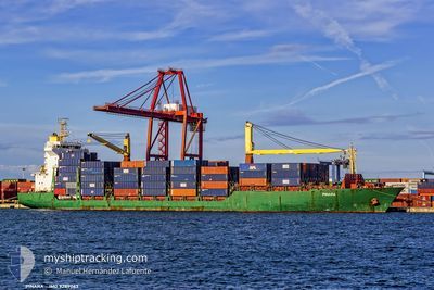
Container Ship
Current Trip
| Time Travelled | 9 days |
|---|---|
| Remaining Time | 1 day |
| Distance Travelled | 3519.46 nm |
| Remaining Distance | 451.99 nm |
| AVG Speed | 15.1 Knots |
| MAX Speed | 18.7 Knots |
| AVG Wind | 13.6 knots |
| MAX Wind | 27.1 knots |
| MIN Temp | 17.5°C / 63.5°F |
| MAX Temp | 36.7°C / 98.06°F |
| Draught | 11.6 m |
| Position Received | 4 d ago |
Current Position
| Longitude | 39.63038° |
|---|---|
| Latitude | 18.42494° |
| Status | Under way using engine |
| Speed | 15.5 Knots |
| Course | 151° |
| Area | Red Sea |
| Station | T-AIS |
| Position Received | 4 d ago |
Info
Information
The current position of NARA is in Red Sea with coordinates 18.42494° / 39.63038° as reported on 2024-06-11 13:29 by AIS to our vessel tracker app. The vessel's current speed is 15.5 Knots and is heading at the port of MUNDRA. The estimated time of arrival as calculated by vessel tracking app is 2024-06-17 13:28 LT
The vessel NARA (IMO: 9289063, MMSI: 271051022) is a Container Ship that was built in 2004 ( 20 years old ). It's sailing under the flag of [TR] Turkey.
In this page you can find informations about the vessels current position, last detected port calls, and current voyage information. If the vessels is not in coverage by AIS you will find the latest position.
The current position of NARA is detected by our AIS receivers and we are not responsible for the reliability of the data. The last position was recorded while the vessel was in Coverage by the Ais receivers of our vessel tracking app.
The current draught of NARA as reported by AIS is 11.6 meters
Weather
| Temperature | 28.6°C / 83.48°F |
|---|---|
| Wind Speed | 12 knots |
| Direction | 210° SSW |
| Pressure | 1002.5 hPa |
| Humidity | 86.8 % |
| Cloud Coverage | 16 % |
Featured Company
Last Port Calls
| Port | Arrival | Departure | Time In Port |
|---|---|---|---|
| 2024-06-09 02:01 | 2024-06-09 11:16 | 9 h | |
| 2024-06-05 17:10 | 2024-06-06 17:50 | 1 d | |
| 2024-06-02 23:38 | 2024-06-03 11:17 | 11 h | |
| 2024-05-30 11:42 | 2024-06-01 02:25 | 1 d | |
| 2024-05-28 14:03 | 2024-05-29 17:59 | 1 d | |
| 2024-05-26 02:05 | 2024-05-26 12:01 | 9 h | |
| 2024-05-17 01:36 | 2024-05-17 09:28 | 7 h | |
| 2024-05-05 07:00 | 2024-05-05 12:56 | 5 h | |
| 2024-04-30 05:10 | 2024-04-30 16:08 | 10 h | |
| 2024-04-26 19:28 | 2024-04-27 12:00 | 16 h |
Most Visited Ports (Last year)
| Port | Arrivals | |
|---|---|---|
| 25 | ||
| 25 | ||
| 24 | ||
| 5 | ||
| 3 | ||
| 2 |
Last Trips
| Origin | Departure | Destination | Arrival | Distance | |
|---|---|---|---|---|---|
| 2024-06-06 20:50 | 2024-06-09 04:01 | 798.66 nm | |||
| 2024-06-03 14:17 | 2024-06-05 20:10 | 51.70 nm | |||
| 2024-06-01 05:25 | 2024-06-03 02:38 | 63.69 nm | |||
| 2024-05-29 20:59 | 2024-05-30 14:42 | 273.09 nm | |||
| 2024-05-17 14:58 | 2024-05-28 17:03 | 3835.92 nm | |||
| 2024-05-17 14:58 | 2024-05-26 04:05 | 3109.15 nm | |||
| 2024-05-05 20:56 | 2024-05-17 07:06 | 3971.26 nm | |||
| 2024-05-01 00:08 | 2024-05-05 15:00 | 1126.34 nm | |||
| 2024-04-27 20:00 | 2024-04-30 13:10 | 455.95 nm | |||
| 2024-04-12 23:28 | 2024-04-27 03:28 | 5016.66 nm |
Events
| Time | Event | Details | Position / Dest | Info |
|---|---|---|---|---|
| 2024-06-11 15:23 | START Moving |
18.18833 / 39.78833
INMUN
|
Speed: 4 kn Course: -1° |
|
| 2024-06-11 14:50 | STOP Moving |
18.19833 / 39.78667
INMUN
|
Speed: Course: -1° |
|
| 2024-06-11 13:34 | Status Changed | Default Under way using engine |
18.40892 / 39.63932
INMUN
|
Speed: 15.5 kn Course: 151° |
| 2024-06-11 13:29 | OUT of Coverage |
18.42494 / 39.63038
Red Sea
INMUN
|
Speed: 15.5 kn Course: 151° |
|
| 2024-06-11 13:26 | Status Changed | Under way using engine Default |
18.43994 / 39.62209
INMUN
|
Speed: 15.5 kn Course: 152° |
| 2024-06-11 13:07 | Status Changed | Default Under way using engine |
18.51208 / 39.58261
INMUN
|
Speed: 15.2 kn Course: 153.9° |
| 2024-06-11 12:34 | Status Changed | Under way using engine Default |
18.63336 / 39.51494
INMUN
|
Speed: 15.2 kn Course: 150° |
| 2024-06-11 12:23 | Status Changed | Default Under way using engine |
18.67464 / 39.49062
INMUN
|
Speed: 15.2 kn Course: 150.8° |
| 2024-06-11 09:07 | Change Sea Area | Sudanese part of the Red Sea Saudi Arabian part of the Red Sea |
19.41223 / 39.03283
Red Sea
INMUN
|
Speed: 15.9 kn Course: 149.1° |
| 2024-06-11 09:07 | Status Changed | Under way using engine Default |
19.41306 / 39.03231
INMUN
|
Speed: 16 kn Course: 148° |