
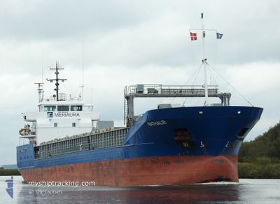
NATHALIE
General Cargo
Current Trip
| Time Travelled | 3 days |
|---|---|
| Remaining Time | 1 day |
| Distance Travelled | 553.50 nm |
| Remaining Distance | 437.40 nm |
| AVG Speed | 9.6 Knots |
| MAX Speed | 10.8 Knots |
| AVG Wind | 8.5 knots |
| MAX Wind | 15 knots |
| MIN Temp | 7.1°C / 44.78°F |
| MAX Temp | 19.6°C / 67.28°F |
| Draught | 4.8 m |
| Position Received | 7 h, 42 m ago |
Current Position
| Longitude | 22.66810° |
|---|---|
| Latitude | 59.24112° |
| Status | Under way using engine |
| Speed | 9.5 Knots |
| Course | 241.5° |
| Area | Baltic Sea |
| Station | T-AIS |
| Position Received | 7 h, 42 m ago |
Info
Information
The current position of NATHALIE is in Baltic Sea with coordinates 59.24112° / 22.66810° as reported on 2024-05-18 01:01 by AIS to our vessel tracker app. The vessel's current speed is 9.5 Knots and is heading at the port of WISMAR. The estimated time of arrival as calculated by vessel tracking app is 2024-05-20 05:43 LT
The vessel NATHALIE (IMO: 9259068, MMSI: 230698000) is a General Cargo that was built in 2003 ( 21 years old ). It's sailing under the flag of [FI] Finland.
In this page you can find informations about the vessels current position, last detected port calls, and current voyage information. If the vessels is not in coverage by AIS you will find the latest position.
The current position of NATHALIE is detected by our AIS receivers and we are not responsible for the reliability of the data. The last position was recorded while the vessel was in Coverage by the Ais receivers of our vessel tracking app.
The current draught of NATHALIE as reported by AIS is 4.8 meters
Weather
| Temperature | 9.2°C / 48.56°F |
|---|---|
| Wind Speed | 6 knots |
| Direction | 60° ENE |
| Pressure | 1019.8 hPa |
| Humidity | 78.6 % |
| Cloud Coverage | 5 % |
Featured Company
Last Port Calls
| Port | Arrival | Departure | Time In Port |
|---|---|---|---|
| 2024-05-11 08:50 | 2024-05-14 17:17 | 3 d | |
| 2024-05-04 08:11 | 2024-05-06 20:39 | 2 d | |
| 2024-05-02 15:45 | 2024-05-03 20:18 | 1 d | |
| 2024-04-26 18:56 | 2024-04-27 11:20 | 16 h | |
| 2024-04-24 22:00 | 2024-04-25 12:28 | 14 h | |
| 2024-04-22 18:32 | 2024-04-23 18:12 | 23 h | |
| 2024-04-18 11:18 | 2024-04-19 17:45 | 1 d | |
| 2024-04-10 12:32 | 2024-04-14 13:01 | 4 d | |
| 2024-04-09 16:38 | 2024-04-10 05:04 | 12 h | |
| 2024-04-08 18:10 | 2024-04-09 16:15 | 22 h |
Last Trips
| Origin | Departure | Destination | Arrival | Distance | |
|---|---|---|---|---|---|
| 2024-05-06 22:39 | 2024-05-11 10:50 | 1022.87 nm | |||
| 2024-05-03 22:18 | 2024-05-04 10:11 | 116.28 nm | |||
| 2024-04-27 14:20 | 2024-05-02 17:45 | 1155.42 nm | |||
| 2024-04-25 15:28 | 2024-04-26 21:56 | 320.79 nm | |||
| 2024-04-23 21:12 | 2024-04-25 01:00 | 252.80 nm | |||
| 2024-04-19 20:45 | 2024-04-22 21:32 | 360.52 nm | |||
| 2024-04-14 15:01 | 2024-04-18 14:18 | 887.40 nm | |||
| 2024-04-10 07:04 | 2024-04-10 14:32 | 72.24 nm | |||
| 2024-04-09 18:15 | 2024-04-09 18:38 | 1.63 nm | |||
| 2024-04-04 23:20 | 2024-04-08 20:10 | 947.03 nm |
Events
| Time | Event | Details | Position / Dest | Info |
|---|---|---|---|---|
| 2024-05-18 01:04 | Status Changed | Default Under way using engine |
59.23661 / 22.65320
WISMAR
|
Speed: 9.5 kn Course: 241.5° |
| 2024-05-18 01:01 | OUT of Coverage |
59.24112 / 22.66810
Baltic Sea
WISMAR
|
Speed: 9.5 kn Course: 241.5° |
|
| 2024-05-17 22:49 | Change Sea Area | Estonian part of the Baltic Sea Estonian part of the Gulf of Finland |
59.41958 / 23.25608
Baltic Sea
WISMAR
|
Speed: 9.5 kn Course: 237.6° |
| 2024-05-17 20:32 | Change Sea Area | Estonian part of the Gulf of Finland Finnish part of the Gulf of Finland |
59.60683 / 23.85790
Gulf of Finland
WISMAR
|
Speed: 9.6 kn Course: 234.9° |
| 2024-05-17 20:14 | Status Changed | Under way using engine Default |
59.63509 / 23.93554
WISMAR
|
Speed: 9.8 kn Course: 235° |
| 2024-05-17 20:12 | Status Changed | Default Under way using engine |
59.63773 / 23.94291
WISMAR
|
Speed: 9.8 kn Course: 236.3° |
| 2024-05-17 19:22 | Status Changed | Under way using engine Default |
59.70958 / 24.16779
WISMAR
|
Speed: 9.5 kn Course: 236° |
| 2024-05-17 19:16 | Status Changed | Default Under way using engine |
59.71733 / 24.19110
WISMAR
|
Speed: 9.6 kn Course: 237° |
| 2024-05-17 19:03 | Status Changed | Under way using engine Default |
59.73616 / 24.25000
WISMAR
|
Speed: 9.6 kn Course: 240° |
| 2024-05-17 19:00 | Status Changed | Default Under way using engine |
59.74004 / 24.26294
WISMAR
|
Speed: 9.6 kn Course: 238.8° |