
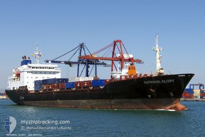
NATIONAL GLORY
Container Ship
Current Trip
SAN JUAN,PR
| Time Travelled | 4 days |
|---|---|
| Remaining Time | --- |
| Distance Travelled | 1581.03 nm |
| Remaining Distance | --- |
| AVG Speed | 16 Knots |
| MAX Speed | 19.3 Knots |
| AVG Wind | 12.4 knots |
| MAX Wind | 19.6 knots |
| MIN Temp | 25.9°C / 78.62°F |
| MAX Temp | 28.7°C / 83.66°F |
| Draught | 8.3 m |
| Position Received | 2 d ago |
Current Position
| Longitude | -77.62042° |
|---|---|
| Latitude | 22.28788° |
| Status | Under way using engine |
| Speed | 16.3 Knots |
| Course | 312.9° |
| Area | North Atlantic Ocean |
| Station | T-AIS |
| Position Received | 2 d ago |
Info
Information
The current position of NATIONAL GLORY is in North Atlantic Ocean with coordinates 22.28788° / -77.62042° as reported on 2024-06-01 04:20 by AIS to our vessel tracker app. The vessel's current speed is 16.3 Knots
The vessel NATIONAL GLORY (IMO: 8302246, MMSI: 367141680) is a Container Ship that was built in 1988 ( 36 years old ). It's sailing under the flag of [US] USA.
In this page you can find informations about the vessels current position, last detected port calls, and current voyage information. If the vessels is not in coverage by AIS you will find the latest position.
The current position of NATIONAL GLORY is detected by our AIS receivers and we are not responsible for the reliability of the data. The last position was recorded while the vessel was in Coverage by the Ais receivers of our vessel tracking app.
The current draught of NATIONAL GLORY as reported by AIS is 8.3 meters
Weather
| Temperature | 27.1°C / 80.78°F |
|---|---|
| Wind Speed | 15 knots |
| Direction | 150° SSE |
| Pressure | 1011.5 hPa |
| Humidity | 85 % |
| Cloud Coverage | 4 % |
Featured Company
Last Port Calls
| Port | Arrival | Departure | Time In Port |
|---|---|---|---|
| 2024-05-29 08:47 | 2024-05-30 10:59 | 1 d | |
| 2024-05-26 09:46 | 2024-05-26 16:50 | 7 h | |
| 2024-05-26 09:19 | 2024-05-26 09:30 | 11 m | |
| 2024-05-20 15:05 | 2024-05-22 12:54 | 1 d | |
| 2024-05-15 09:10 | 2024-05-16 00:43 | 15 h | |
| 2024-05-12 11:19 | 2024-05-12 16:00 | 4 h | |
| 2024-05-12 10:52 | 2024-05-12 11:00 | 8 m | |
| 2024-05-07 10:57 | 2024-05-08 12:55 | 1 d | |
| 2024-05-01 09:25 | 2024-05-02 00:52 | 15 h | |
| 2024-04-28 11:31 | 2024-04-28 16:17 | 4 h |
Most Visited Ports (Last year)
| Port | Arrivals | |
|---|---|---|
| 31 | ||
| 26 | ||
| 25 | ||
| 25 | ||
| 3 | ||
| 1 |
Last Trips
| Origin | Departure | Destination | Arrival | Distance | |
|---|---|---|---|---|---|
| 2024-05-26 12:50 | 2024-05-29 04:47 | 926.91 nm | |||
| 2024-05-26 05:30 | 2024-05-26 05:46 | 0.77 nm | |||
| 2024-05-22 07:54 | 2024-05-26 05:19 | 1012.37 nm | |||
| 2024-05-15 20:43 | 2024-05-20 10:05 | 1776.97 nm | |||
| 2024-05-12 12:00 | 2024-05-15 05:10 | 927.81 nm | |||
| 2024-05-12 07:00 | 2024-05-12 07:19 | 0.96 nm | |||
| 2024-05-08 07:55 | 2024-05-12 06:52 | 1011.06 nm | |||
| 2024-05-01 20:52 | 2024-05-07 05:57 | 1784.65 nm | |||
| 2024-04-28 12:17 | 2024-05-01 05:25 | 928.19 nm | |||
| 2024-04-28 07:12 | 2024-04-28 07:31 | 0.51 nm |
Events
| Time | Event | Details | Position / Dest | Info |
|---|---|---|---|---|
| 2024-06-01 04:35 | Status Changed | Default Under way using engine |
22.33167 / -77.67667
SAN JUAN,PR
|
Speed: 16.3 kn Course: 312.9° |
| 2024-06-01 04:20 | OUT of Coverage |
22.28788 / -77.62042
North Atlantic Ocean
|
Speed: 16.3 kn Course: 312.9° |
|
| 2024-06-01 03:53 | Status Changed | Under way using engine Default |
22.20383 / -77.52351
SAN JUAN,PR
|
Speed: 16 kn Course: 312° |
| 2024-06-01 03:23 | Status Changed | Default Under way using engine |
22.11333 / -77.41167
SAN JUAN,PR
|
Speed: 16.3 kn Course: 310.2° |
| 2024-06-01 02:55 | Change Sea Area | Cuban part of the North Atlantic Ocean Bahamas part of the North Atlantic Ocean |
22.03270 / -77.30850
North Atlantic Ocean
|
Speed: 16.1 kn Course: 309° |
| 2024-06-01 02:55 | Status Changed | Under way using engine Default |
22.03214 / -77.30774
SAN JUAN,PR
|
Speed: 16 kn Course: 309° |
| 2024-06-01 02:47 | IN Coverage |
22.03270 / -77.30850
North Atlantic Ocean
|
Speed: 16.1 kn Course: 309° |
|
| 2024-05-30 10:59 | PORT DEPARTURE |
|
18.48333 / -66.13333
SAN JUAN,PR
|
Speed: 11 kn Course: -1° |
| 2024-05-30 10:26 | START Moving |
18.43500 / -66.09333
[PR] SAN JUAN
|
Speed: 4 kn Course: -1° |
|
| 2024-05-29 09:38 | STOP Moving |
18.43333 / -66.09666
[PR] SAN JUAN
|
Speed: Course: -1° |