
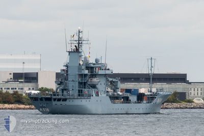
NATO WARSHIP A516
Military ops
Current Trip
Unknown
| Time Travelled | 2 days |
|---|---|
| Remaining Time | --- |
| Distance Travelled | 260.20 nm |
| Remaining Distance | --- |
| AVG Speed | 8.3 Knots |
| MAX Speed | 15.9 Knots |
| AVG Wind | 11.8 knots |
| MAX Wind | 18.7 knots |
| MIN Temp | 11.9°C / 53.42°F |
| MAX Temp | 20.4°C / 68.72°F |
| Draught | 3.9 m |
| Position Received | 3 h, 33 m ago |
Current Position
| Longitude | -5.33117° |
|---|---|
| Latitude | 55.36398° |
| Status | Under way using engine |
| Speed | 7.4 Knots |
| Course | 212° |
| Area | Inner Seas off the West Coast of Scotland |
| Station | T-AIS |
| Position Received | 3 h, 33 m ago |
Info
Information
The current position of NATO WARSHIP A516 is in Inner Seas off the West Coast of Scotland with coordinates 55.36398° / -5.33117° as reported on 2024-06-27 03:43 by AIS to our vessel tracker app. The vessel's current speed is 7.4 Knots
The vessel NATO WARSHIP A516 (MMSI: 211211520) is a Military ops It's sailing under the flag of [DE] Germany.
In this page you can find informations about the vessels current position, last detected port calls, and current voyage information. If the vessels is not in coverage by AIS you will find the latest position.
The current position of NATO WARSHIP A516 is detected by our AIS receivers and we are not responsible for the reliability of the data. The last position was recorded while the vessel was in Coverage by the Ais receivers of our vessel tracking app.
The current draught of NATO WARSHIP A516 as reported by AIS is 3.9 meters
Weather
| Temperature | 13.4°C / 56.12°F |
|---|---|
| Wind Speed | 17 knots |
| Direction | 178° S |
| Pressure | 1001.8 hPa |
| Humidity | 85.3 % |
| Cloud Coverage | 67 % |
Featured Company
Last Port Calls
| Port | Arrival | Departure | Time In Port |
|---|---|---|---|
| 2024-06-21 06:59 | 2024-06-24 15:28 | 3 d | |
| 2024-06-14 07:20 | 2024-06-17 17:12 | 3 d | |
| 2024-06-07 06:50 | 2024-06-11 04:59 | 3 d | |
| 2024-05-31 06:27 | 2024-06-03 05:14 | 2 d | |
| 2024-05-24 07:39 | 2024-05-27 09:01 | 3 d | |
| 2024-05-06 08:57 | 2024-05-20 17:59 | 14 d | |
| 2024-04-29 15:44 | 2024-05-02 08:04 | 2 d | |
| 2024-04-19 06:07 | 2024-04-22 06:09 | 3 d | |
| 2024-04-12 06:17 | 2024-04-15 05:33 | 2 d | |
| 2024-04-05 07:23 | 2024-04-08 08:03 | 3 d |
Most Visited Ports (Last year)
| Port | Arrivals | |
|---|---|---|
| 17 | ||
| 4 | ||
| 3 | ||
| 2 | ||
| 2 | ||
| 1 |
Last Trips
| Origin | Departure | Destination | Arrival | Distance | |
|---|---|---|---|---|---|
| 2024-06-17 18:12 | 2024-06-21 07:59 | 588.77 nm | |||
| 2024-06-11 06:59 | 2024-06-14 08:20 | 448.64 nm | |||
| 2024-06-03 07:14 | 2024-06-07 08:50 | 504.36 nm | |||
| 2024-05-27 10:01 | 2024-05-31 08:27 | 690.93 nm | |||
| 2024-05-20 19:59 | 2024-05-24 08:39 | 575.14 nm | |||
| 2024-05-02 10:04 | 2024-05-06 10:57 | 132.31 nm | |||
| 2024-04-22 09:09 | 2024-04-29 17:44 | 918.70 nm | |||
| 2024-04-15 08:33 | 2024-04-19 09:07 | 315.98 nm | |||
| 2024-04-08 10:03 | 2024-04-12 09:17 | 332.22 nm | |||
| 2024-04-02 11:02 | 2024-04-05 09:23 | 458.65 nm |
Events
| Time | Event | Details | Position / Dest | Info |
|---|---|---|---|---|
| 2024-06-27 03:43 | OUT of Coverage |
55.36398 / -5.33117
Inner Seas off the West Coast of Scotland
|
Speed: 7.4 kn Course: 212° |
|
| 2024-06-27 03:11 | IN Coverage |
55.34339 / -5.24793
Inner Seas off the West Coast of Scotland
|
Speed: 8.6 kn Course: 313.1° |
|
| 2024-06-27 00:50 | OUT of Coverage |
55.20817 / -5.33270
Inner Seas off the West Coast of Scotland
|
Speed: 8.9 kn Course: 346.7° |
|
| 2024-06-27 00:50 | IN Coverage |
55.20817 / -5.33270
Inner Seas off the West Coast of Scotland
|
Speed: 8.9 kn Course: 346.7° |
|
| 2024-06-26 23:47 | OUT of Coverage |
55.11598 / -5.43570
Inner Seas off the West Coast of Scotland
|
Speed: 8.3 kn Course: 93.3° |
|
| 2024-06-26 20:10 | IN Coverage |
55.13903 / -5.28627
Inner Seas off the West Coast of Scotland
|
Speed: 7.3 kn Course: 272.7° |
|
| 2024-06-26 04:49 | OUT of Coverage |
55.06165 / -5.28722
Inner Seas off the West Coast of Scotland
|
Speed: 5.4 kn Course: 79.5° |
|
| 2024-06-26 04:40 | IN Coverage |
55.05965 / -5.31085
Inner Seas off the West Coast of Scotland
|
Speed: 5.4 kn Course: 83.4° |
|
| 2024-06-26 03:34 | OUT of Coverage |
55.00974 / -5.46386
Inner Seas off the West Coast of Scotland
|
Speed: 4.1 kn Course: 115.9° |
|
| 2024-06-25 23:16 | IN Coverage |
55.14643 / -5.19320
Inner Seas off the West Coast of Scotland
|
Speed: 6.5 kn Course: 237.4° |