
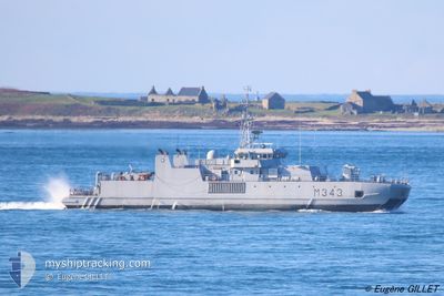
KNM HINNOEY
Passenger
Current Trip
MILITARY OPERATIONS
| Time Travelled | 1 day |
|---|---|
| Remaining Time | --- |
| Distance Travelled | 527.82 nm |
| Remaining Distance | --- |
| AVG Speed | 18.2 Knots |
| MAX Speed | 22.5 Knots |
| AVG Wind | 5.9 knots |
| MAX Wind | 13 knots |
| MIN Temp | 13.9°C / 57.02°F |
| MAX Temp | 18.2°C / 64.76°F |
| Draught | 3 m |
| Position Received | 2 h, 8 m ago |
Current Position
| Longitude | 5.23878° |
|---|---|
| Latitude | 60.33630° |
| Status | Under way using engine |
| Speed | 4.1 Knots |
| Course | 353° |
| Area | North Sea |
| Station | T-AIS |
| Position Received | 2 h, 8 m ago |
Info
Information
The current position of KNM HINNOEY is in North Sea with coordinates 60.33630° / 5.23878° as reported on 2024-06-26 13:46 by AIS to our vessel tracker app. The vessel's current speed is 4.1 Knots
The vessel KNM HINNOEY (MMSI: 259019000) is a Passenger It's sailing under the flag of [NO] Norway.
In this page you can find informations about the vessels current position, last detected port calls, and current voyage information. If the vessels is not in coverage by AIS you will find the latest position.
The current position of KNM HINNOEY is detected by our AIS receivers and we are not responsible for the reliability of the data. The last position was recorded while the vessel was in Coverage by the Ais receivers of our vessel tracking app.
The current draught of KNM HINNOEY as reported by AIS is 3 meters
Weather
| Temperature | 16.5°C / 61.7°F |
|---|---|
| Wind Speed | 9 knots |
| Direction | 324° NW |
| Pressure | 1014.9 hPa |
| Humidity | 76.2 % |
| Cloud Coverage | 4 % |
Featured Company
Events
| Time | Event | Details | Position / Dest | Info |
|---|---|---|---|---|
| 2024-06-26 13:46 | OUT of Coverage |
60.33630 / 5.23878
North Sea
|
Speed: 4.1 kn Course: 354.9° |
|
| 2024-06-26 11:35 | START Moving | 0.99 nm, South of SAGVAG |
59.75720 / 5.37960
MILITARY OPERATIONS
|
Speed: 5.1 kn Course: 345.2° |
| 2024-06-26 10:45 | STOP Moving | 1.19 nm, South of SAGVAG |
59.75456 / 5.37182
MILITARY OPERATIONS
|
Speed: Course: 333° |
| 2024-06-26 09:06 | START Moving | 0.17 nm, South West of VORMEDAL |
59.35126 / 5.31325
MILITARY OPERATIONS
|
Speed: 8 kn Course: 37.2° |
| 2024-06-26 09:00 | STOP Moving | 0.31 nm, South West of VORMEDAL |
59.35016 / 5.30910
MILITARY OPERATIONS
|
Speed: Course: 206° |
| 2024-06-26 03:28 | Change Sea Area | Norwegian part of the North Sea Norwegian part of the Skaggerak |
57.92283 / 7.12760
North Sea
|
Speed: 21 kn Course: 273.2° |
| 2024-06-26 02:25 | START Moving | 0.85 nm, South East of MANDAL |
58.01405 / 7.46825
MILITARY OPERATIONS
|
Speed: 3.6 kn Course: 217° |
| 2024-06-26 01:49 | STOP Moving | 0.76 nm, South East of MANDAL |
58.01584 / 7.46855
MILITARY OPERATIONS
|
Speed: Course: 37° |
| 2024-06-25 22:56 | Change Sea Area | Norwegian part of the Skaggerak Danish part of the Skaggerak |
57.85788 / 9.15916
Skaggerak
|
Speed: 20.6 kn Course: 271.5° |
| 2024-06-25 20:29 | Change Sea Area | Danish part of the Skaggerak Danish part of the Kattegat |
57.76278 / 10.73068
Skaggerak
|
Speed: 20.6 kn Course: 296.6° |