
NAVARE
Not available
Current Trip
VAN A NAAR B
Unknown Port
ETA*
2024-05-30 05:31 UTC
| Time Travelled | 8 h, 22 mins |
|---|---|
| Remaining Time | --- |
| Distance Travelled | 1.16 nm |
| Remaining Distance | --- |
| AVG Speed | 5 Knots |
| MAX Speed | 5.9 Knots |
| AVG Wind | 5.4 knots |
| MAX Wind | 5.8 knots |
| MIN Temp | 19.5°C / 67.1°F |
| MAX Temp | 19.6°C / 67.28°F |
| Draught | 0 m |
| Position Received | 7 h, 44 m ago |
Current Position
| Longitude | 6.85812° |
|---|---|
| Latitude | 51.49308° |
| Status | Under way using engine |
| Speed | 5.5 Knots |
| Course | 69.4° |
| Area | North Sea |
| Station | T-AIS |
| Position Received | 7 h, 44 m ago |
Info
info
Information
The current position of NAVARE is in North Sea with coordinates 51.49308° / 6.85812° as reported on 2024-05-31 15:37 by AIS to our vessel tracker app. The vessel's current speed is 5.5 Knots
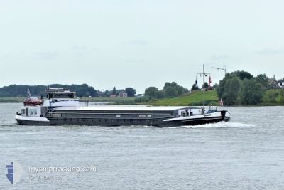
The vessel NAVARE (MMSI: 244660960) is a Not available It's sailing under the flag of [NL] Netherlands.
In this page you can find informations about the vessels current position, last detected port calls, and current voyage information. If the vessels is not in coverage by AIS you will find the latest position.
The current position of NAVARE is detected by our AIS receivers and we are not responsible for the reliability of the data. The last position was recorded while the vessel was in Coverage by the Ais receivers of our vessel tracking app.
Weather
| Temperature | 19.6°C / 67.28°F |
|---|---|
| Wind Speed | 5 knots |
| Direction | 319° NW |
| Pressure | 1010.5 hPa |
| Humidity | 58.3 % |
| Cloud Coverage | 97 % |
Featured Company
Limited time offer - Install a base station receiver to your area and list your company on Free forever!
Last Port Calls
| Port | Arrival | Departure | Time In Port |
|---|---|---|---|
| 2024-05-31 12:36 | 2024-05-31 15:00 | 2 h | |
| 2024-05-28 16:38 | 2024-05-30 05:14 | 1 d | |
| 2024-05-04 14:58 | 2024-05-28 16:07 | 24 d | |
| 2024-05-04 13:56 | 2024-05-04 14:41 | 44 m | |
| 2024-05-01 09:24 | 2024-05-04 04:30 | 2 d | |
| 2024-04-26 09:37 | 2024-04-29 12:28 | 3 d | |
| 2024-04-26 08:14 | 2024-04-26 09:31 | 1 h | |
| 2024-04-20 12:38 | 2024-04-26 06:11 | 5 d | |
| 2024-04-19 18:21 | 2024-04-20 04:08 | 9 h | |
| 2024-04-18 18:04 | 2024-04-19 13:06 | 19 h |
Last Trips
| Origin | Departure | Destination | Arrival | Distance | |
|---|---|---|---|---|---|
| 2024-05-30 07:14 | 2024-05-31 14:36 | 97.33 nm | |||
| 2024-05-28 18:07 | 2024-05-28 18:38 | 3.61 nm | |||
| 2024-05-04 16:41 | 2024-05-04 16:58 | 1.11 nm | |||
| 2024-05-04 06:30 | 2024-05-04 15:56 | 92.39 nm | |||
| 2024-04-29 14:28 | 2024-05-01 11:24 | 90.82 nm | |||
| 2024-04-26 11:31 | 2024-04-26 11:37 | 0.88 nm | |||
| 2024-04-26 08:11 | 2024-04-26 10:14 | 14.24 nm | |||
| 2024-04-20 06:08 | 2024-04-20 14:38 | 58.64 nm | |||
| 2024-04-19 15:06 | 2024-04-19 20:21 | 14.04 nm | |||
| 2024-04-18 16:47 | 2024-04-18 20:04 | 31.97 nm |
Events
| Time | Event | Details | Position / Dest | Info |
|---|---|---|---|---|
| 2024-05-31 15:37 | OUT of Coverage |
51.49308 / 6.85812
North Sea
|
Speed: 5.5 kn Course: 69.4° |
|
| 2024-05-31 15:22 | START Moving | 4.42 nm, North East of DUISBURG |
51.48464 / 6.82609
VAN A NAAR B
|
Speed: 3.7 kn Course: 54.8° |
| 2024-05-31 15:00 | PORT DEPARTURE |
|
51.48145 / 6.81949
VAN A NAAR B
|
Speed: Course: 511° |
| 2024-05-31 14:49 | STOP Moving |
51.47918 / 6.81499
[DE] DUISBURG
|
Speed: Course: 511° |
|
| 2024-05-31 14:04 | START Moving |
51.44646 / 6.76049
[DE] DUISBURG
|
Speed: 3.3 kn Course: 75.6° |
|
| 2024-05-31 12:37 | STOP Moving |
51.44537 / 6.75143
[DE] DUISBURG
|
Speed: 0.3 kn Course: 511° |
|
| 2024-05-31 12:36 | PORT ARRIVAL |
|
51.44536 / 6.75137
[DE] DUISBURG
|
Speed: 0.6 kn Course: 511° |
| 2024-05-31 09:53 | IN Coverage |
51.55044 / 6.68099
North Sea
|
Speed: 3.7 kn Course: 200.3° |
|
| 2024-05-31 05:28 | OUT of Coverage |
51.75421 / 6.39867
North Sea
|
Speed: 5.7 kn Course: 91.3° |
|
| 2024-05-31 04:02 | IN Coverage |
51.82806 / 6.24763
North Sea
|
Speed: 4.6 kn Course: 138.3° |