
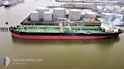
NAVIG8 PERSEVERANCE
Tanker
Current Trip
| Time Travelled | 5 days |
|---|---|
| Remaining Time | 2 days |
| Distance Travelled | 1403.55 nm |
| Remaining Distance | 2273.11 nm |
| AVG Speed | 11.3 Knots |
| MAX Speed | 13.3 Knots |
| AVG Wind | 11 knots |
| MAX Wind | 20.1 knots |
| MIN Temp | 28.4°C / 83.12°F |
| MAX Temp | 35.8°C / 96.44°F |
| Draught | 13.9 m |
| Position Received | 4 d ago |
Current Position
| Longitude | 57.31265° |
|---|---|
| Latitude | 24.96708° |
| Status | Under way using engine |
| Speed | 12.8 Knots |
| Course | 125.1° |
| Area | Gulf of Oman |
| Station | T-AIS |
| Position Received | 4 d ago |
Info
Information
The current position of NAVIG8 PERSEVERANCE is in Gulf of Oman with coordinates 24.96708° / 57.31265° as reported on 2024-05-30 06:52 by AIS to our vessel tracker app. The vessel's current speed is 12.8 Knots and is heading at the port of MOMBASA. The estimated time of arrival as calculated by vessel tracking app is 2024-06-06 14:55 LT
The vessel NAVIG8 PERSEVERANCE (IMO: 9853266, MMSI: 538007961) is a Tanker It's sailing under the flag of [MH] Marshall Is.
In this page you can find informations about the vessels current position, last detected port calls, and current voyage information. If the vessels is not in coverage by AIS you will find the latest position.
The current position of NAVIG8 PERSEVERANCE is detected by our AIS receivers and we are not responsible for the reliability of the data. The last position was recorded while the vessel was in Coverage by the Ais receivers of our vessel tracking app.
The current draught of NAVIG8 PERSEVERANCE as reported by AIS is 13.9 meters
Weather
| Temperature | 29.2°C / 84.56°F |
|---|---|
| Wind Speed | 17 knots |
| Direction | 246° WSW |
| Pressure | 1010.3 hPa |
| Humidity | 75.2 % |
| Cloud Coverage | 45 % |
Featured Company
Most Visited Ports (Last year)
| Port | Arrivals | |
|---|---|---|
| 2 | ||
| 2 | ||
| 2 | ||
| 1 | ||
| 1 | ||
| 1 |
Events
| Time | Event | Details | Position / Dest | Info |
|---|---|---|---|---|
| 2024-05-30 06:57 | Status Changed | Default Under way using engine |
24.95705 / 57.32872
MOMBASA
|
Speed: 12.8 kn Course: 125.1° |
| 2024-05-30 06:52 | OUT of Coverage |
24.96708 / 57.31265
Gulf of Oman
MOMBASA
|
Speed: 12.8 kn Course: 125.1° |
|
| 2024-05-30 05:47 | Change Sea Area | Omani part of the Gulf of Oman United Arab Emirates part of the Gulf of Oman |
25.10798 / 57.10556
Gulf of Oman
MOMBASA
|
Speed: 12.7 kn Course: 125.9° |
| 2024-05-30 02:32 | Change Sea Area | United Arab Emirates part of the Gulf of Oman Omani part of the Gulf of Oman |
25.67275 / 56.71097
Gulf of Oman
MOMBASA
|
Speed: 13.3 kn Course: 172.5° |
| 2024-05-30 01:23 | Change Sea Area | Omani part of the Gulf of Oman Omani part of the Persian Gulf |
25.92300 / 56.68535
Gulf of Oman
MOMBASA
|
Speed: 12.7 kn Course: 175.4° |
| 2024-05-30 01:21 | Status Changed | Under way using engine Default |
25.92774 / 56.68493
MOMBASA
|
Speed: 12.7 kn Course: 175° |
| 2024-05-30 01:18 | IN Coverage |
25.92300 / 56.68535
Gulf of Oman
MOMBASA
|
Speed: 12.7 kn Course: 175.4° |
|
| 2024-05-29 22:02 | Status Changed | Default Under way using engine |
26.55987 / 56.50911
MOMBASA
|
Speed: 11.4 kn Course: 89.4° |
| 2024-05-29 21:58 | Status Changed | Under way using engine Default |
26.55908 / 56.49298
MOMBASA
|
Speed: 11.5 kn Course: 67° |
| 2024-05-29 21:58 | OUT of Coverage |
26.55908 / 56.49298
Persian Gulf
MOMBASA
|
Speed: 11.4 kn Course: 89.4° |