
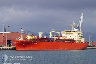
NAVIGATOR GRACE
Lpg Tanker
Current Trip
| Time Travelled | 5 days |
|---|---|
| Remaining Time | --- |
| Distance Travelled | 1685.12 nm |
| Remaining Distance | --- |
| AVG Speed | 12.4 Knots |
| MAX Speed | 15.2 Knots |
| AVG Wind | 9.5 knots |
| MAX Wind | 24 knots |
| MIN Temp | 19.3°C / 66.74°F |
| MAX Temp | 30.4°C / 86.72°F |
| Draught | 8.8 m |
| Position Received | 2 h, 30 m ago |
Current Position
| Longitude | 29.13852° |
|---|---|
| Latitude | 41.49870° |
| Status | Under way using engine |
| Speed | 13.5 Knots |
| Course | 305.7° |
| Area | Black Sea |
| Station | T-AIS |
| Position Received | 2 h, 30 m ago |
Info
Information
The current position of NAVIGATOR GRACE is in Black Sea with coordinates 41.49870° / 29.13852° as reported on 2024-06-17 15:02 by AIS to our vessel tracker app. The vessel's current speed is 13.5 Knots and is heading at the port of VARNA. The estimated time of arrival as calculated by vessel tracking app is 2024-06-18 01:00 LT
The vessel NAVIGATOR GRACE (IMO: 9531478, MMSI: 636015943) is a Lpg Tanker that was built in 2010 ( 14 years old ). It's sailing under the flag of [LR] Liberia.
In this page you can find informations about the vessels current position, last detected port calls, and current voyage information. If the vessels is not in coverage by AIS you will find the latest position.
The current position of NAVIGATOR GRACE is detected by our AIS receivers and we are not responsible for the reliability of the data. The last position was recorded while the vessel was in Coverage by the Ais receivers of our vessel tracking app.
The current draught of NAVIGATOR GRACE as reported by AIS is 8.8 meters
Weather
| Temperature | 23.2°C / 73.76°F |
|---|---|
| Wind Speed | 12 knots |
| Direction | 129° SE |
| Pressure | 1015.1 hPa |
| Humidity | 75.5 % |
| Cloud Coverage | --- |
Featured Company
Last Port Calls
| Port | Arrival | Departure | Time In Port |
|---|---|---|---|
| 2024-06-10 11:52 | 2024-06-11 19:44 | 1 d | |
| 2024-06-10 10:11 | 2024-06-10 10:47 | 36 m | |
| 2024-06-01 19:51 | 2024-06-02 13:16 | 17 h | |
| 2024-05-22 10:28 | 2024-05-24 00:36 | 1 d | |
| 2024-05-14 17:09 | 2024-05-15 10:00 | 16 h | |
| 2024-05-07 05:28 | 2024-05-07 14:42 | 9 h | |
| 2024-05-05 14:15 | 2024-05-06 11:40 | 21 h | |
| 2024-05-05 02:36 | 2024-05-05 11:14 | 8 h | |
| 2024-04-22 11:38 | 2024-04-23 23:56 | 1 d |
Most Visited Ports (Last year)
| Port | Arrivals | |
|---|---|---|
| 12 | ||
| 6 | ||
| 5 | ||
| 4 | ||
| 2 | ||
| 2 |
Last Trips
| Origin | Departure | Destination | Arrival | Distance | |
|---|---|---|---|---|---|
| 2024-06-10 11:47 | 2024-06-10 12:52 | 2.93 nm | |||
| 2024-06-02 15:16 | 2024-06-10 11:11 | 2221.76 nm | |||
| 2024-05-24 02:36 | 2024-06-01 21:51 | 2335.18 nm | |||
| 2024-05-15 12:00 | 2024-05-22 12:28 | 44.04 nm | |||
| 2024-05-06 13:40 | 2024-05-14 19:09 | 1823.57 nm | |||
| 2024-05-06 13:40 | 2024-05-07 07:28 | 31.15 nm | |||
| 2024-04-24 01:56 | 2024-05-05 16:15 | 3499.53 nm | |||
| 2024-04-24 01:56 | 2024-05-05 04:36 | 3387.92 nm | |||
| 2024-03-28 22:20 | 2024-04-22 13:38 | 6076.51 nm |
Events
| Time | Event | Details | Position / Dest | Info |
|---|---|---|---|---|
| 2024-06-17 15:09 | Status Changed | Default Under way using engine |
41.51504 / 29.10831
BGVAR
|
Speed: 13.5 kn Course: 305.7° |
| 2024-06-17 15:02 | OUT of Coverage |
41.49870 / 29.13852
Black Sea
BGVAR
|
Speed: 13.5 kn Course: 305.7° |
|
| 2024-06-17 14:04 | ETA Changed | 2024/06/18 01:00 2024/06/18 02:30 |
41.31218 / 29.21422
BGVAR
|
Speed: 13 kn Course: 27.9° |
| 2024-06-17 13:37 | Change Sea Area | Turkish part of the Black Sea Turkish part of the Sea of Marmara |
41.23408 / 29.14311
Black Sea
BGVAR
|
Speed: 11.9 kn Course: 34.1° |
| 2024-06-17 09:27 | START Moving | 13.36 nm, South West of AMBARLI |
40.75481 / 28.55938
BGVAR
|
Speed: 3.7 kn Course: 30° |
| 2024-06-17 07:02 | ETA Changed | 2024/06/18 02:30 2024/06/18 23:00 |
40.74990 / 28.54951
BGVAR
|
Speed: 0.2 kn Course: 353° |
| 2024-06-17 06:52 | ETA Changed | 2024/06/18 23:00 2024/06/17 20:00 |
40.74989 / 28.54887
BGVAR
|
Speed: 0.1 kn Course: 6° |
| 2024-06-17 06:04 | STOP Moving | 13.93 nm, South West of AMBARLI |
40.74840 / 28.54737
BGVAR
|
Speed: 0.3 kn Course: 2° |
| 2024-06-17 01:30 | ETA Changed | 2024/06/17 20:00 2024/06/18 01:00 |
40.73407 / 27.69817
BGVAR
|
Speed: 12.5 kn Course: 82.3° |
| 2024-06-16 23:02 | Status Changed | Under way using engine Default |
40.52820 / 27.06625
BGVAR
|
Speed: 12.7 kn Course: 67° |