
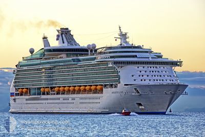
NAVIGATOR OF THE SEA
Passenger
Current Trip
| Time Travelled | 2 days |
|---|---|
| Remaining Time | 8 h, 55 mins |
| Distance Travelled | 939.77 nm |
| Remaining Distance | 386.40 nm |
| AVG Speed | 18.7 Knots |
| MAX Speed | 20 Knots |
| AVG Wind | 13.3 knots |
| MAX Wind | 21 knots |
| MIN Temp | 15.3°C / 59.54°F |
| MAX Temp | 28.6°C / 83.48°F |
| Draught | 9.1 m |
| Position Received | 1 d ago |
Current Position
| Longitude | -112.16048° |
|---|---|
| Latitude | 24.22237° |
| Status | Under way using engine |
| Speed | 18.5 Knots |
| Course | 309.5° |
| Area | North Pacific Ocean |
| Station | T-AIS |
| Position Received | 1 d ago |
Info
Information
The current position of NAVIGATOR OF THE SEA is in North Pacific Ocean with coordinates 24.22237° / -112.16048° as reported on 2024-05-16 00:16 by AIS to our vessel tracker app. The vessel's current speed is 18.5 Knots and is heading at the port of LOS ANGELES. The estimated time of arrival as calculated by vessel tracking app is 2024-05-17 11:20 LT
The vessel NAVIGATOR OF THE SEA (IMO: 9227508, MMSI: 311478000) is a Passenger It's sailing under the flag of [BS] Bahamas.
In this page you can find informations about the vessels current position, last detected port calls, and current voyage information. If the vessels is not in coverage by AIS you will find the latest position.
The current position of NAVIGATOR OF THE SEA is detected by our AIS receivers and we are not responsible for the reliability of the data. The last position was recorded while the vessel was in Coverage by the Ais receivers of our vessel tracking app.
The current draught of NAVIGATOR OF THE SEA as reported by AIS is 9.1 meters
Weather
| Temperature | 15.8°C / 60.44°F |
|---|---|
| Wind Speed | 13 knots |
| Direction | 319° NW |
| Pressure | 1013.8 hPa |
| Humidity | 86.7 % |
| Cloud Coverage | 100 % |
Featured Company
Last Port Calls
| Port | Arrival | Departure | Time In Port |
|---|---|---|---|
| 2024-05-14 13:18 | 2024-05-15 00:07 | 10 h | |
| 2024-05-13 14:08 | 2024-05-14 00:57 | 10 h | |
| 2024-05-10 12:39 | 2024-05-10 23:30 | 10 h | |
| 2024-05-09 14:12 | 2024-05-10 01:09 | 10 h | |
| 2024-05-06 12:38 | 2024-05-06 23:33 | 10 h | |
| 2024-05-05 14:13 | 2024-05-06 01:14 | 11 h | |
| 2024-05-03 11:37 | 2024-05-04 00:32 | 12 h | |
| 2024-05-02 14:13 | 2024-05-03 01:13 | 11 h | |
| 2024-04-29 12:36 | 2024-04-30 00:33 | 11 h | |
| 2024-04-28 14:14 | 2024-04-29 01:22 | 11 h |
Most Visited Ports (Last year)
| Port | Arrivals | |
|---|---|---|
| 70 | ||
| 52 | ||
| 19 | ||
| 18 | ||
| 3 | ||
| 2 |
Last Trips
| Origin | Departure | Destination | Arrival | Distance | |
|---|---|---|---|---|---|
| 2024-05-13 18:57 | 2024-05-14 08:18 | 195.29 nm | |||
| 2024-05-10 16:30 | 2024-05-13 08:08 | 1016.08 nm | |||
| 2024-05-09 18:09 | 2024-05-10 05:39 | 147.71 nm | |||
| 2024-05-06 16:33 | 2024-05-09 07:12 | 468.67 nm | |||
| 2024-05-05 18:14 | 2024-05-06 05:38 | 148.08 nm | |||
| 2024-05-03 17:32 | 2024-05-05 07:13 | 482.16 nm | |||
| 2024-05-02 18:13 | 2024-05-03 04:37 | 148.13 nm | |||
| 2024-04-29 17:33 | 2024-05-02 07:13 | 606.52 nm | |||
| 2024-04-28 18:22 | 2024-04-29 05:36 | 146.83 nm | |||
| 2024-04-26 17:42 | 2024-04-28 07:14 | 389.43 nm |
Events
| Time | Event | Details | Position / Dest | Info |
|---|---|---|---|---|
| 2024-05-16 00:20 | Status Changed | Default Under way using engine |
24.23500 / -112.17667
US LAX
|
Speed: 18.5 kn Course: 309.5° |
| 2024-05-16 00:16 | OUT of Coverage |
24.22237 / -112.16048
North Pacific Ocean
US LAX
|
Speed: 18.5 kn Course: 309.5° |
|
| 2024-05-16 00:14 | Status Changed | Under way using engine Default |
24.21608 / -112.15232
US LAX
|
Speed: 18.5 kn Course: 309° |
| 2024-05-16 00:10 | IN Coverage |
24.22237 / -112.16048
North Pacific Ocean
US LAX
|
Speed: 18.5 kn Course: 309.5° |
|
| 2024-05-15 23:02 | Status Changed | Default Under way using engine |
23.97167 / -111.84500
US LAX
|
Speed: 19.3 kn Course: 310.3° |
| 2024-05-15 22:56 | Status Changed | Under way using engine Default |
23.95132 / -111.82021
US LAX
|
Speed: 19.2 kn Course: 311° |
| 2024-05-15 22:56 | OUT of Coverage |
23.95132 / -111.82021
North Pacific Ocean
US LAX
|
Speed: 19.3 kn Course: 310.3° |
|
| 2024-05-15 22:08 | Status Changed | Default Under way using engine |
23.80156 / -111.59392
US LAX
|
Speed: 19 kn Course: 294° |
| 2024-05-15 22:02 | Status Changed | Under way using engine Default |
23.78836 / -111.56220
US LAX
|
Speed: 18.9 kn Course: 294° |
| 2024-05-15 21:57 | Status Changed | Default Under way using engine |
23.77796 / -111.53708
US LAX
|
Speed: 18.9 kn Course: 294.5° |