
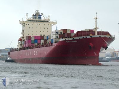
NAVIOS DOMINO
Container Ship
Current Trip
| Time Travelled | 7 days |
|---|---|
| Remaining Time | --- |
| Distance Travelled | 2758.91 nm |
| Remaining Distance | 1704.90 nm |
| AVG Speed | 15 Knots |
| MAX Speed | 20.4 Knots |
| AVG Wind | 8.1 knots |
| MAX Wind | 19 knots |
| MIN Temp | 23.7°C / 74.66°F |
| MAX Temp | 31°C / 87.8°F |
| Draught | 11 m |
| Position Received | 6 d ago |
Current Position
| Longitude | -42.84833° |
|---|---|
| Latitude | -23.09067° |
| Status | Under way using engine |
| Speed | 19.4 Knots |
| Course | 88° |
| Area | South Atlantic Ocean |
| Station | T-AIS |
| Position Received | 6 d ago |
Info
Information
The current position of NAVIOS DOMINO is in South Atlantic Ocean with coordinates -23.09067° / -42.84833° as reported on 2024-05-14 16:28 by AIS to our vessel tracker app. The vessel's current speed is 19.4 Knots and is heading at the port of ALGECIRAS. The estimated time of arrival as calculated by vessel tracking app is 2024-05-25 05:00 LT
The vessel NAVIOS DOMINO (IMO: 9478494, MMSI: 636023346) is a Container Ship that was built in 2008 ( 16 years old ). It's sailing under the flag of [LR] Liberia.
In this page you can find informations about the vessels current position, last detected port calls, and current voyage information. If the vessels is not in coverage by AIS you will find the latest position.
The current position of NAVIOS DOMINO is detected by our AIS receivers and we are not responsible for the reliability of the data. The last position was recorded while the vessel was in Coverage by the Ais receivers of our vessel tracking app.
The current draught of NAVIOS DOMINO as reported by AIS is 11 meters
Weather
| Temperature | 23.7°C / 74.66°F |
|---|---|
| Wind Speed | 13 knots |
| Direction | 22° NNE |
| Pressure | 1013.2 hPa |
| Humidity | 80.4 % |
| Cloud Coverage | 18 % |
Featured Company
Last Port Calls
| Port | Arrival | Departure | Time In Port |
|---|---|---|---|
| 2024-05-12 11:12 | 2024-05-13 08:12 | 21 h | |
| 2024-05-10 06:12 | 2024-05-10 16:03 | 9 h | |
| 2024-05-08 23:24 | 2024-05-09 13:54 | 14 h | |
| 2024-05-05 06:32 | 2024-05-05 22:34 | 16 h | |
| 2024-05-04 09:53 | 2024-05-04 19:15 | 9 h | |
| 2024-04-30 23:29 | 2024-05-01 04:24 | 4 h | |
| 2024-04-29 13:00 | 2024-04-30 07:00 | 17 h | |
| 2024-04-12 07:22 | 2024-04-12 19:39 | 12 h | |
| 2024-04-08 05:56 | 2024-04-08 17:58 | 12 h | |
| 2024-04-04 18:17 | 2024-04-05 07:43 | 13 h |
Most Visited Ports (Last year)
| Port | Arrivals | |
|---|---|---|
| 9 | ||
| 6 | ||
| 4 | ||
| 3 | ||
| 3 | ||
| 3 |
Last Trips
| Origin | Departure | Destination | Arrival | Distance | |
|---|---|---|---|---|---|
| 2024-05-10 13:03 | 2024-05-12 08:12 | 181.93 nm | |||
| 2024-05-09 10:54 | 2024-05-10 03:12 | 64.24 nm | |||
| 2024-05-05 19:34 | 2024-05-08 20:24 | 857.63 nm | |||
| 2024-05-04 16:15 | 2024-05-05 03:32 | 137.44 nm | |||
| 2024-05-01 01:24 | 2024-05-04 06:53 | 786.00 nm | |||
| 2024-04-30 04:00 | 2024-04-30 20:29 | 165.82 nm | |||
| 2024-04-12 21:39 | 2024-04-29 10:00 | 4439.10 nm | |||
| 2024-04-08 18:58 | 2024-04-12 09:22 | 499.80 nm | |||
| 2024-04-05 09:43 | 2024-04-08 06:56 | 1169.01 nm | |||
| 2024-04-03 16:09 | 2024-04-04 20:17 | 406.52 nm |
Events
| Time | Event | Details | Position / Dest | Info |
|---|---|---|---|---|
| 2024-05-14 16:30 | Status Changed | Default Under way using engine |
-23.09067 / -42.83550
ALGECIRAS
|
Speed: 19.4 kn Course: 88° |
| 2024-05-14 16:28 | OUT of Coverage |
-23.09067 / -42.84833
South Atlantic Ocean
ALGECIRAS
|
Speed: 19.4 kn Course: 88° |
|
| 2024-05-14 16:02 | Status Changed | Under way using engine Default |
-23.08217 / -42.99800
ALGECIRAS
|
Speed: 18.4 kn Course: 108° |
| 2024-05-14 16:00 | Status Changed | Default Under way using engine |
-23.07933 / -43.01033
ALGECIRAS
|
Speed: 17.8 kn Course: 118° |
| 2024-05-14 15:53 | Status Changed | Under way using engine Default |
-23.06333 / -43.04017
ALGECIRAS
|
Speed: 15 kn Course: 135° |
| 2024-05-14 15:21 | Status Changed | Default Under way using engine |
-22.96250 / -43.13966
ALGECIRAS
|
Speed: 10 kn Course: 184° |
| 2024-05-14 14:31 | START Moving | 2.63 nm, North West of RIO DE JANEIRO |
-22.87433 / -43.19983
ALGECIRAS
|
Speed: 3.3 kn Course: 141° |
| 2024-05-14 14:06 | Status Changed | Under way using engine Moored |
-22.87233 / -43.20183
ALGECIRAS
|
Speed: 0.1 kn Course: 221° |
| 2024-05-14 13:08 | Status Changed | Moored Default |
-22.87233 / -43.20183
ALGECIRAS
|
Speed: 0.1 kn Course: 221° |
| 2024-05-14 13:05 | Status Changed | Default Moored |
-22.87233 / -43.20183
ALGECIRAS
|
Speed: Course: 221° |