
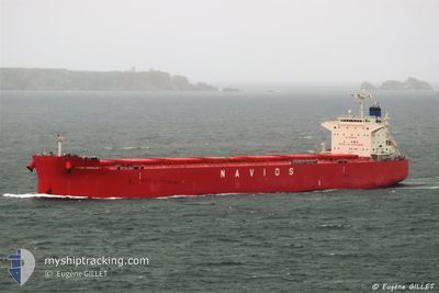
NAVIOS HERAKLES I
Cargo
Current Trip
| Time Travelled | 19 days |
|---|---|
| Remaining Time | 22 days |
| Distance Travelled | 4283.66 nm |
| Remaining Distance | 4235.93 nm |
| AVG Speed | 9.3 Knots |
| MAX Speed | 13.6 Knots |
| AVG Wind | 17.1 knots |
| MAX Wind | 33 knots |
| MIN Temp | 18.3°C / 64.94°F |
| MAX Temp | 31.3°C / 88.34°F |
| Draught | 7.2 m |
| Position Received | 1 d ago |
Current Position
| Longitude | 36.07408° |
|---|---|
| Latitude | -28.42021° |
| Status | Under way using engine |
| Speed | 9.5 Knots |
| Course | 246.2° |
| Area | Indian Ocean |
| Station | T-AIS |
| Position Received | 1 d ago |
Info
Information
The current position of NAVIOS HERAKLES I is in Indian Ocean with coordinates -28.42021° / 36.07408° as reported on 2024-06-06 17:13 by AIS to our vessel tracker app. The vessel's current speed is 9.5 Knots and is heading at the port of SANTOS. The estimated time of arrival as calculated by vessel tracking app is 2024-07-01 10:34 LT
The vessel NAVIOS HERAKLES I (IMO: 9852937, MMSI: 372011000) is a Cargo It's sailing under the flag of [PA] Panama.
In this page you can find informations about the vessels current position, last detected port calls, and current voyage information. If the vessels is not in coverage by AIS you will find the latest position.
The current position of NAVIOS HERAKLES I is detected by our AIS receivers and we are not responsible for the reliability of the data. The last position was recorded while the vessel was in Coverage by the Ais receivers of our vessel tracking app.
The current draught of NAVIOS HERAKLES I as reported by AIS is 7.2 meters
Weather
| Temperature | 18.1°C / 64.58°F |
|---|---|
| Wind Speed | 9 knots |
| Direction | 185° S |
| Pressure | 1033.4 hPa |
| Humidity | 50.7 % |
| Cloud Coverage | 1 % |
Featured Company
Last Port Calls
| Port | Arrival | Departure | Time In Port |
|---|---|---|---|
| 2024-05-18 01:39 | 2024-05-20 01:13 | 1 d | |
| 2024-05-12 12:49 | 2024-05-14 01:16 | 1 d | |
| 2024-05-03 19:00 | 2024-05-06 07:40 | 2 d |
Most Visited Ports (Last year)
| Port | Arrivals | |
|---|---|---|
| 3 | ||
| 2 | ||
| 1 | ||
| 1 | ||
| 1 | ||
| 1 |
Events
| Time | Event | Details | Position / Dest | Info |
|---|---|---|---|---|
| 2024-06-06 17:13 | OUT of Coverage |
-28.42021 / 36.07408
Indian Ocean
SANTOS
|
Speed: 9.5 kn Course: 246.2° |
|
| 2024-06-06 16:11 | Change Sea Area | South African part of the Indian Ocean High seas of the Indian Ocean |
-28.35455 / 36.24449
Indian Ocean
SANTOS
|
Speed: 9.4 kn Course: 246.1° |
| 2024-06-06 12:21 | IN Coverage |
-28.08286 / 36.86143
Indian Ocean
SANTOS
|
Speed: 10.2 kn Course: 239.7° |
|
| 2024-06-06 11:15 | OUT of Coverage |
-28.05164 / 37.06985
Indian Ocean
SANTOS
|
Speed: 10.2 kn Course: 258.2° |
|
| 2024-06-06 11:11 | Change Sea Area | High seas of the Indian Ocean R�union part of the Indian Ocean |
-28.04896 / 37.08449
Indian Ocean
SANTOS
|
Speed: 10.2 kn Course: 260.1° |
| 2024-06-06 11:09 | Draught Changed | 7.2 12.8 |
-28.04816 / 37.08913
SANTOS
|
Speed: 10.2 kn Course: 258.5° |
| 2024-06-06 11:09 | Destination Changed | SANTOS SINGAPORE |
-28.04816 / 37.08913
SANTOS
|
Speed: 10.2 kn Course: 258.5° |
| 2024-06-06 11:09 | ETA Changed | 2024/06/21 19:00 2024/03/26 12:30 |
-28.04816 / 37.08913
SANTOS
|
Speed: 10.2 kn Course: 258.5° |
| 2024-06-06 11:09 | IN Coverage |
-28.04896 / 37.08449
Indian Ocean
SANTOS
|
Speed: 10.2 kn Course: 260.1° |
|
| 2024-06-01 20:12 | OUT of Coverage |
-20.22495 / 54.83868
Indian Ocean
|
Speed: 9.5 kn Course: 236.2° |