
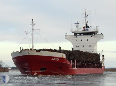
NAVITA
General Cargo
Current Trip
| Time Travelled | 1 day |
|---|---|
| Remaining Time | 6 h, 59 mins |
| Distance Travelled | 277.17 nm |
| Remaining Distance | 95.27 nm |
| AVG Speed | 11.8 Knots |
| MAX Speed | 13.5 Knots |
| AVG Wind | 17.8 knots |
| MAX Wind | 25.8 knots |
| MIN Temp | 9.5°C / 49.1°F |
| MAX Temp | 12.5°C / 54.5°F |
| Draught | 4.1 m |
| Position Received | 12 h, 41 m ago |
Current Position
| Longitude | 20.04391° |
|---|---|
| Latitude | 59.56980° |
| Status | Under way using engine |
| Speed | 11.4 Knots |
| Course | 154.4° |
| Area | Baltic Sea |
| Station | T-AIS |
| Position Received | 12 h, 41 m ago |
Info
Information
The current position of NAVITA is in Baltic Sea with coordinates 59.56980° / 20.04391° as reported on 2024-06-09 23:10 by AIS to our vessel tracker app. The vessel's current speed is 11.4 Knots and is heading at the port of RIGA. The estimated time of arrival as calculated by vessel tracking app is 2024-06-10 18:51 LT
The vessel NAVITA (IMO: 8324737, MMSI: 255805881) is a General Cargo that was built in 1984 ( 40 years old ). It's sailing under the flag of [PT] Portugal.
In this page you can find informations about the vessels current position, last detected port calls, and current voyage information. If the vessels is not in coverage by AIS you will find the latest position.
The current position of NAVITA is detected by our AIS receivers and we are not responsible for the reliability of the data. The last position was recorded while the vessel was in Coverage by the Ais receivers of our vessel tracking app.
The current draught of NAVITA as reported by AIS is 4.1 meters
Weather
| Temperature | 12.6°C / 54.68°F |
|---|---|
| Wind Speed | 19 knots |
| Direction | 229° SW |
| Pressure | 1003 hPa |
| Humidity | 78.8 % |
| Cloud Coverage | 80 % |
Featured Company
Last Port Calls
| Port | Arrival | Departure | Time In Port |
|---|---|---|---|
| 2024-06-08 19:18 | 2024-06-09 11:11 | 15 h | |
| 2024-06-07 21:21 | |||
| 2024-06-04 12:47 | 2024-06-05 11:59 | 23 h | |
| 2024-05-30 08:23 | 2024-06-01 17:27 | 2 d | |
| 2024-05-27 13:37 | 2024-05-29 16:59 | 2 d | |
| 2024-05-24 17:38 | 2024-05-25 18:13 | 1 d | |
| 2024-05-20 05:45 | 2024-05-22 16:57 | 2 d | |
| 2024-05-14 05:23 | 2024-05-15 10:06 | 1 d | |
| 2024-05-06 13:27 | 2024-05-07 18:00 | 1 d | |
| 2024-05-02 07:16 | 2024-05-03 03:48 | 20 h |
Most Visited Ports (Last year)
| Port | Arrivals | |
|---|---|---|
| 8 | ||
| 7 | ||
| 7 | ||
| 6 | ||
| 6 | ||
| 5 |
Last Trips
| Origin | Departure | Destination | Arrival | Distance | |
|---|---|---|---|---|---|
| 2024-06-08 00:21 | 2024-06-08 22:18 | 276.67 nm | |||
| 2024-06-01 19:27 | 2024-06-04 14:47 | 679.06 nm | |||
| 2024-05-29 18:59 | 2024-05-30 10:23 | 174.62 nm | |||
| 2024-05-25 21:13 | 2024-05-27 15:37 | 530.79 nm | |||
| 2024-05-22 18:57 | 2024-05-24 20:38 | 651.02 nm | |||
| 2024-05-15 13:06 | 2024-05-20 07:45 | 727.08 nm | |||
| 2024-05-07 21:00 | 2024-05-14 08:23 | 786.86 nm | |||
| 2024-05-03 06:48 | 2024-05-06 16:27 | 444.34 nm | |||
| 2024-04-30 17:05 | 2024-05-02 10:16 | 490.89 nm | |||
| 2024-04-28 09:36 | 2024-04-29 11:19 | 344.39 nm |
Events
| Time | Event | Details | Position / Dest | Info |
|---|---|---|---|---|
| 2024-06-09 23:17 | Status Changed | Default Under way using engine |
59.54845 / 20.06157
LVRIX
|
Speed: 11.4 kn Course: 154.4° |
| 2024-06-09 23:10 | OUT of Coverage |
59.56980 / 20.04391
Baltic Sea
LVRIX
|
Speed: 11.4 kn Course: 154.4° |
|
| 2024-06-09 21:38 | Change Sea Area | Finnish part of the Baltic Sea Finnish part of the Gulf of Bothnia |
59.79702 / 19.65498
Baltic Sea
LVRIX
|
Speed: 12 kn Course: 140.1° |
| 2024-06-09 21:32 | Change Sea Area | Finnish part of the Gulf of Bothnia Swedish part of the Gulf of Bothnia |
59.81277 / 19.62871
Gulf of Bothnia
LVRIX
|
Speed: 12.5 kn Course: 140.5° |
| 2024-06-09 17:42 | Status Changed | Under way using engine Default |
60.50626 / 19.00560
LVRIX
|
Speed: 12.5 kn Course: 238° |
| 2024-06-09 17:25 | Status Changed | Default Under way using engine |
60.53622 / 19.10456
LVRIX
|
Speed: 12.9 kn Course: 237.9° |
| 2024-06-09 17:17 | Change Sea Area | Swedish part of the Gulf of Bothnia Finnish part of the Gulf of Bothnia |
60.55262 / 19.15851
Gulf of Bothnia
LVRIX
|
Speed: 12.9 kn Course: 237.6° |
| 2024-06-09 17:14 | Status Changed | Under way using engine Default |
60.55708 / 19.17288
LVRIX
|
Speed: 12.8 kn Course: 238° |
| 2024-06-09 16:57 | Status Changed | Default Under way using engine |
60.58860 / 19.27622
LVRIX
|
Speed: 12.8 kn Course: 237.7° |
| 2024-06-09 16:47 | Status Changed | Under way using engine Default |
60.60890 / 19.34233
LVRIX
|
Speed: 12.8 kn Course: 237° |