
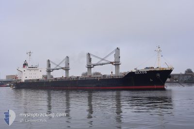
NAXOS
Bulk Carrier
Current Trip
| Time Travelled | 12 days |
|---|---|
| Remaining Time | --- |
| Distance Travelled | 2451.71 nm |
| Remaining Distance | --- |
| AVG Speed | 11.5 Knots |
| MAX Speed | 17.2 Knots |
| AVG Wind | 7.8 knots |
| MAX Wind | 27.6 knots |
| MIN Temp | 13.7°C / 56.66°F |
| MAX Temp | 23.7°C / 74.66°F |
| Draught | 10 m |
| Position Received | 3 m ago |
Current Position
| Longitude | -5.35712° |
|---|---|
| Latitude | 36.11407° |
| Status | At anchor |
| Speed | 0.2 Knots |
| Course | 49° |
| Area | Strait of Gibraltar |
| Station | T-AIS |
| Position Received | 3 m ago |
Info
Information
The current position of NAXOS is in Strait of Gibraltar with coordinates 36.11407° / -5.35712° as reported on 2024-05-31 10:11 by AIS to our vessel tracker app. The vessel's current speed is 0.2 Knots
The vessel NAXOS (IMO: 9610224, MMSI: 314601000) is a Bulk Carrier that was built in 2012 ( 12 years old ). It's sailing under the flag of [BB] Barbados.
In this page you can find informations about the vessels current position, last detected port calls, and current voyage information. If the vessels is not in coverage by AIS you will find the latest position.
The current position of NAXOS is detected by our AIS receivers and we are not responsible for the reliability of the data. The last position was recorded while the vessel was in Coverage by the Ais receivers of our vessel tracking app.
The current draught of NAXOS as reported by AIS is 10 meters
Weather
| Temperature | 19.4°C / 66.92°F |
|---|---|
| Wind Speed | 10 knots |
| Direction | 82° E |
| Pressure | 1011.2 hPa |
| Humidity | 82 % |
| Cloud Coverage | --- |
Featured Company
Most Visited Ports (Last year)
| Port | Arrivals | |
|---|---|---|
| 1 | ||
| 1 | ||
| 1 | ||
| 1 | ||
| 1 | ||
| 1 |
Events
| Time | Event | Details | Position / Dest | Info |
|---|---|---|---|---|
| 2024-05-31 08:17 | Status Changed | At anchor Default |
36.11403 / -5.35428
GIBRALTAR
|
Speed: 0.2 kn Course: 331° |
| 2024-05-31 08:14 | Status Changed | Default At anchor |
36.11393 / -5.35439
GIBRALTAR
|
Speed: 0.2 kn Course: 339° |
| 2024-05-31 04:44 | Status Changed | At anchor Default |
36.11619 / -5.35376
GIBRALTAR
|
Speed: 0.2 kn Course: 246° |
| 2024-05-31 04:38 | Status Changed | Default At anchor |
36.11642 / -5.35386
GIBRALTAR
|
Speed: 0.3 kn Course: 237° |
| 2024-05-31 00:44 | Status Changed | At anchor Under way using engine |
36.11418 / -5.35506
GIBRALTAR
|
Speed: 0.5 kn Course: 17° |
| 2024-05-31 00:42 | Status Changed | Under way using engine At anchor |
36.11431 / -5.35550
GIBRALTAR
|
Speed: 0.4 kn Course: 12° |
| 2024-05-31 00:41 | Status Changed | At anchor Under way using engine |
36.11430 / -5.35544
GIBRALTAR
|
Speed: 0.5 kn Course: 16° |
| 2024-05-31 00:34 | STOP Moving | 2.01 nm, South of GIBRALTAR |
36.11433 / -5.35633
GIBRALTAR
|
Speed: 0.3 kn Course: 29° |
| 2024-05-30 23:38 | Change Sea Area | Gibraltarian part of the Strait of Gibraltar Gibraltarian part of the Alboran Sea |
36.08609 / -5.33651
Strait of Gibraltar
|
Speed: 3.2 kn Course: 266.9° |
| 2024-05-30 22:06 | START Moving | 12.19 nm, East of GIBRALTAR |
36.10545 / -5.11727
GIBRALTAR
|
Speed: 3.2 kn Course: 142° |