
NAYADA
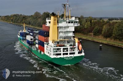
Container Ship
Current Trip
| Time Travelled | 2 days |
|---|---|
| Remaining Time | --- |
| Distance Travelled | 6.53 nm |
| Remaining Distance | --- |
| AVG Speed | 4.7 Knots |
| MAX Speed | 5.9 Knots |
| AVG Wind | 6.9 knots |
| MAX Wind | 9.8 knots |
| MIN Temp | 9.5°C / 49.1°F |
| MAX Temp | 13.3°C / 55.94°F |
| Draught | 5.3 m |
| Position Received | 2 m ago |
Current Position
| Longitude | 131.85333° |
|---|---|
| Latitude | 43.07932° |
| Status | Moored |
| Speed | |
| Course | 168° |
| Area | Japan Sea |
| Station | T-AIS |
| Position Received | 2 m ago |
Info
Information
The current position of NAYADA is in Japan Sea with coordinates 43.07932° / 131.85333° as reported on 2024-06-02 19:13 by AIS to our vessel tracker app. The vessel's current speed is 0 Knots
The vessel NAYADA (IMO: 9208459, MMSI: 273374720) is a Container Ship that was built in 2000 ( 24 years old ). It's sailing under the flag of [RU] Russia.
In this page you can find informations about the vessels current position, last detected port calls, and current voyage information. If the vessels is not in coverage by AIS you will find the latest position.
The current position of NAYADA is detected by our AIS receivers and we are not responsible for the reliability of the data. The last position was recorded while the vessel was in Coverage by the Ais receivers of our vessel tracking app.
The current draught of NAYADA as reported by AIS is 5.3 meters
Weather
| Temperature | 11.4°C / 52.52°F |
|---|---|
| Wind Speed | 3 knots |
| Direction | 140° SE |
| Pressure | 1011.7 hPa |
| Humidity | 90.7 % |
| Cloud Coverage | 2 % |
Featured Company
Last Port Calls
| Port | Arrival | Departure | Time In Port |
|---|---|---|---|
| 2024-05-30 20:11 | 2024-05-31 18:27 | 22 h | |
| 2024-05-26 10:29 | 2024-05-29 04:02 | 2 d | |
| 2024-05-22 10:42 | 2024-05-23 22:38 | 1 d | |
| 2024-05-20 08:53 | 2024-05-20 19:05 | 10 h | |
| 2024-05-14 20:28 | 2024-05-18 05:31 | 3 d | |
| 2024-05-11 11:48 | 2024-05-13 02:09 | 1 d | |
| 2024-05-08 22:48 | 2024-05-09 14:38 | 15 h | |
| 2024-05-01 20:43 | 2024-05-05 06:13 | 3 d | |
| 2024-04-28 02:07 | 2024-04-29 07:54 | 1 d | |
| 2024-04-26 04:09 | 2024-04-26 12:04 | 7 h |
Most Visited Ports (Last year)
| Port | Arrivals | |
|---|---|---|
| 25 | ||
| 23 | ||
| 19 | ||
| 4 |
Last Trips
| Origin | Departure | Destination | Arrival | Distance | |
|---|---|---|---|---|---|
| 2024-05-29 15:02 | 2024-05-31 06:11 | 556.55 nm | |||
| 2024-05-24 08:38 | 2024-05-26 21:29 | 564.72 nm | |||
| 2024-05-21 05:05 | 2024-05-22 20:42 | 67.76 nm | |||
| 2024-05-18 16:31 | 2024-05-20 18:53 | 516.82 nm | |||
| 2024-05-13 12:09 | 2024-05-15 07:28 | 568.13 nm | |||
| 2024-05-10 00:38 | 2024-05-11 21:48 | 68.16 nm | |||
| 2024-05-05 17:13 | 2024-05-09 08:48 | 527.29 nm | |||
| 2024-04-29 17:54 | 2024-05-02 07:43 | 566.26 nm | |||
| 2024-04-26 22:04 | 2024-04-28 12:07 | 63.44 nm | |||
| 2024-04-25 00:13 | 2024-04-26 14:09 | 507.67 nm |
Events
| Time | Event | Details | Position / Dest | Info |
|---|---|---|---|---|
| 2024-06-01 04:42 | Status Changed | Moored Under way using engine |
43.07893 / 131.85358
RU VVO
|
Speed: 0.3 kn Course: 172° |
| 2024-06-01 04:33 | STOP Moving | 2.05 nm, North East of ISLYAMOVA |
43.07748 / 131.85383
RU VVO
|
Speed: 0.3 kn Course: 164° |
| 2024-06-01 04:00 | START Moving | 1.97 nm, North of ISLYAMOVA |
43.08238 / 131.82527
RU VVO
|
Speed: 4.3 kn Course: 150° |
| 2024-06-01 03:53 | Status Changed | Under way using engine At anchor |
43.08478 / 131.82587
RU VVO
|
Speed: 0.4 kn Course: 297° |
| 2024-06-01 00:05 | ETA Changed | 2025/05/31 06:00 2024/05/31 06:00 |
43.08540 / 131.82703
RU VVO
|
Speed: 0.1 kn Course: 243° |
| 2024-05-31 18:52 | Status Changed | At anchor Under way using engine |
43.08415 / 131.82588
RU VVO
|
Speed: 0.2 kn Course: 337° |
| 2024-05-31 18:51 | STOP Moving | 2.07 nm, North of ISLYAMOVA |
43.08415 / 131.82588
RU VVO
|
Speed: 0.2 kn Course: 332° |
| 2024-05-31 18:27 | PORT DEPARTURE |
|
43.07747 / 131.86558
RU VVO
|
Speed: 9 kn Course: 220° |
| 2024-05-31 18:17 | START Moving |
43.09543 / 131.87940
[RU] VLADIVOSTOK
|
Speed: 4.1 kn Course: 233° |
|
| 2024-05-31 18:07 | Draught Changed | 5.3 5.8 |
43.09472 / 131.88195
[RU] VLADIVOSTOK
|
Speed: Course: 18° |