
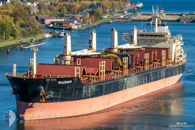
NAZENIN
Bulk Carrier
Current Trip
| Time Travelled | 7 days |
|---|---|
| Remaining Time | 1 day |
| Distance Travelled | 812.17 nm |
| Remaining Distance | 526.23 nm |
| AVG Speed | 10.6 Knots |
| MAX Speed | 12.2 Knots |
| AVG Wind | 15.3 knots |
| MAX Wind | 27.7 knots |
| MIN Temp | 27.2°C / 80.96°F |
| MAX Temp | 29.9°C / 85.82°F |
| Draught | 6.9 m |
| Position Received | 1 d ago |
Current Position
| Longitude | 76.61074° |
|---|---|
| Latitude | 8.14666° |
| Status | Under way using engine |
| Speed | 10.8 Knots |
| Course | 308.5° |
| Area | Laccadive Sea |
| Station | T-AIS |
| Position Received | 1 d ago |
Info
Information
The current position of NAZENIN is in Laccadive Sea with coordinates 8.14666° / 76.61074° as reported on 2024-06-14 07:23 by AIS to our vessel tracker app. The vessel's current speed is 10.8 Knots and is heading at the port of KANDLA. The estimated time of arrival as calculated by vessel tracking app is 2024-06-18 05:31 LT
The vessel NAZENIN (IMO: 9545508, MMSI: 538004124) is a Bulk Carrier that was built in 2010 ( 14 years old ). It's sailing under the flag of [MH] Marshall Is.
In this page you can find informations about the vessels current position, last detected port calls, and current voyage information. If the vessels is not in coverage by AIS you will find the latest position.
The current position of NAZENIN is detected by our AIS receivers and we are not responsible for the reliability of the data. The last position was recorded while the vessel was in Coverage by the Ais receivers of our vessel tracking app.
The current draught of NAZENIN as reported by AIS is 6.9 meters
Weather
| Temperature | 28.5°C / 83.3°F |
|---|---|
| Wind Speed | 3 knots |
| Direction | 317° NW |
| Pressure | 1008.1 hPa |
| Humidity | 74 % |
| Cloud Coverage | 84 % |
Featured Company
Most Visited Ports (Last year)
| Port | Arrivals | |
|---|---|---|
| 1 | ||
| 1 | ||
| 1 | ||
| 1 | ||
| 1 | ||
| 1 |
Events
| Time | Event | Details | Position / Dest | Info |
|---|---|---|---|---|
| 2024-06-14 07:37 | Status Changed | Default Under way using engine |
8.17333 / 76.57833
KANDLA
|
Speed: 10.8 kn Course: 308.5° |
| 2024-06-14 07:23 | OUT of Coverage |
8.14666 / 76.61074
Laccadive Sea
KANDLA
|
Speed: 10.8 kn Course: 308.5° |
|
| 2024-06-14 07:22 | Status Changed | Under way using engine Default |
8.14575 / 76.61190
KANDLA
|
Speed: 10 kn Course: 307° |
| 2024-06-14 07:12 | Status Changed | Default Under way using engine |
8.12667 / 76.63500
KANDLA
|
Speed: 11 kn Course: 304.4° |
| 2024-06-14 07:09 | Status Changed | Under way using engine Default |
8.12101 / 76.64513
KANDLA
|
Speed: 11 kn Course: 288° |
| 2024-06-14 06:48 | Status Changed | Default Under way using engine |
8.09833 / 76.70333
KANDLA
|
Speed: 10.7 kn Course: 291.9° |
| 2024-06-14 06:21 | Status Changed | Under way using engine At anchor |
8.06793 / 76.77915
KANDLA
|
Speed: 10.6 kn Course: 291° |
| 2024-06-13 22:27 | Status Changed | At anchor Default |
8.10766 / 78.07490
KANDLA
|
Speed: 10 kn Course: 240° |
| 2024-06-13 22:18 | Status Changed | Default At anchor |
8.11833 / 78.09666
KANDLA
|
Speed: 10.5 kn Course: 241.1° |
| 2024-06-13 22:14 | Status Changed | At anchor Default |
8.12611 / 78.10911
KANDLA
|
Speed: 10 kn Course: 239° |