
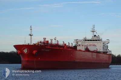
NCC NOOR
Oil/Chemical Tanker
Current Trip
| Trip Time | 19 days |
|---|---|
| Trip Distance | 4790.89 nm |
| AVG Speed | 12 Knots |
| MAX Speed | 16.1 Knots |
| Draught | 12 m |
| AVG Wind | 12.2 knots |
| MAX Wind | 25.9 knots |
| MIN Temp | 14°C / 57.2°F |
| MAX Temp | 29.9°C / 85.82°F |
| Position Received | 2 d ago |
Current Position
| Longitude | -38.09699° |
|---|---|
| Latitude | -12.83114° |
| Status | Under way using engine |
| Speed | 12.5 Knots |
| Course | 227.4° |
| Area | South Atlantic Ocean |
| Station | T-AIS |
| Position Received | 2 d ago |
Info
Information
The current position of NCC NOOR is in South Atlantic Ocean with coordinates -12.83114° / -38.09699° as reported on 2024-05-12 07:48 by AIS to our vessel tracker app. The vessel's current speed is 12.5 Knots and is currently inside the port of ARATU.
The vessel NCC NOOR (IMO: 9399260, MMSI: 403512001) is a Oil/Chemical Tanker that was built in 2011 ( 13 years old ). It's sailing under the flag of [SA] Saudi Arabia.
In this page you can find informations about the vessels current position, last detected port calls, and current voyage information. If the vessels is not in coverage by AIS you will find the latest position.
The current position of NCC NOOR is detected by our AIS receivers and we are not responsible for the reliability of the data. The last position was recorded while the vessel was in Coverage by the Ais receivers of our vessel tracking app.
The current draught of NCC NOOR as reported by AIS is 12 meters
Weather
| Temperature | 23.4°C / 74.12°F |
|---|---|
| Wind Speed | 2 knots |
| Direction | 319° NW |
| Pressure | 1013.1 hPa |
| Humidity | 94.8 % |
| Cloud Coverage | 30 % |
Featured Company
Last Port Calls
| Port | Arrival | Departure | Time In Port |
|---|---|---|---|
| 2024-05-14 05:05 | |||
| 2024-04-23 15:34 | 2024-04-24 06:10 | 14 h | |
| 2024-04-19 21:22 | 2024-04-21 15:46 | 1 d | |
| 2024-04-04 07:15 | 2024-04-06 03:01 | 1 d | |
| 2024-04-01 12:29 | 2024-04-02 19:17 | 1 d | |
| 2024-03-14 18:35 | 2024-03-16 23:38 | 2 d | |
| 2024-03-07 14:29 | 2024-03-07 18:28 | 3 h | |
| 2024-03-05 17:32 | 2024-03-06 19:30 | 1 d | |
| 2024-03-03 04:17 | 2024-03-04 09:40 | 1 d |
Most Visited Ports (Last year)
| Port | Arrivals | |
|---|---|---|
| 3 | ||
| 3 | ||
| 2 | ||
| 2 | ||
| 2 | ||
| 1 |
Last Trips
| Origin | Departure | Destination | Arrival | Distance | |
|---|---|---|---|---|---|
| 2024-04-24 01:10 | 2024-05-14 02:05 | 4790.89 nm | |||
| 2024-04-21 10:46 | 2024-04-23 10:34 | 558.37 nm | |||
| 2024-04-06 00:01 | 2024-04-19 16:22 | 3804.13 nm | |||
| 2024-04-02 16:17 | 2024-04-04 04:15 | 272.66 nm | |||
| 2024-03-16 18:38 | 2024-04-01 09:29 | 3931.48 nm | |||
| 2024-03-07 12:28 | 2024-03-14 13:35 | 511.87 nm | |||
| 2024-03-06 13:30 | 2024-03-07 08:29 | 146.21 nm | |||
| 2024-03-04 04:40 | 2024-03-05 11:32 | 354.27 nm | |||
| 2024-02-25 07:33 | 2024-03-02 23:17 | 1857.53 nm |
Events
| Time | Event | Details | Position / Dest | Info |
|---|---|---|---|---|
| 2024-05-14 05:05 | PORT ARRIVAL |
|
-12.78266 / -38.50088
[BR] ARATU
|
Speed: 0.3 kn Course: 40° |
| 2024-05-14 05:02 | STOP Moving | 1.71 nm, West of ARATU |
-12.78274 / -38.50122
BRARB
|
Speed: 0.3 kn Course: 40° |
| 2024-05-14 02:41 | START Moving | 7.59 nm, South West of SALVADOR |
-13.05830 / -38.60509
BRARB
|
Speed: 4.2 kn Course: 95° |
| 2024-05-12 11:03 | STOP Moving | 7.66 nm, South West of SALVADOR |
-13.05643 / -38.60867
BRARB
|
Speed: 0.3 kn Course: 196° |
| 2024-05-12 07:53 | Status Changed | Default Under way using engine |
-12.84336 / -38.11060
BRARB
|
Speed: 12.5 kn Course: 227.4° |
| 2024-05-12 07:48 | OUT of Coverage |
-12.83114 / -38.09699
South Atlantic Ocean
|
Speed: 12.5 kn Course: 227.4° |
|
| 2024-05-12 07:47 | Status Changed | Under way using engine Default |
-12.82838 / -38.09391
BRARB
|
Speed: 12.5 kn Course: 228° |
| 2024-05-12 07:34 | IN Coverage |
-12.83114 / -38.09699
South Atlantic Ocean
|
Speed: 12.5 kn Course: 227.4° |
|
| 2024-05-12 05:51 | Status Changed | Default Under way using engine |
-12.52202 / -37.82979
BRARB
|
Speed: 12 kn Course: 223° |
| 2024-05-12 05:48 | OUT of Coverage |
-12.51634 / -37.82430
South Atlantic Ocean
|
Speed: 12 kn Course: 223° |