
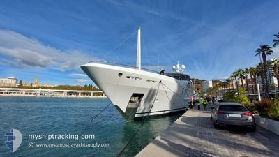
NENINKA
Pleasure Craft
Current Trip
PAMPELONNE BEACH
| Time Travelled | 3 days |
|---|---|
| Remaining Time | --- |
| Distance Travelled | 61.63 nm |
| Remaining Distance | --- |
| AVG Speed | 12.5 Knots |
| MAX Speed | 16.3 Knots |
| AVG Wind | 9.4 knots |
| MAX Wind | 32 knots |
| MIN Temp | 14.3°C / 57.74°F |
| MAX Temp | 25°C / 77°F |
| Draught | 3.8 m |
| Position Received | 3 m ago |
Current Position
| Longitude | 6.67372° |
|---|---|
| Latitude | 43.21803° |
| Status | At anchor |
| Speed | 0.3 Knots |
| Course | 317° |
| Area | Mediterranean Sea - Western Basin |
| Station | T-AIS |
| Position Received | 3 m ago |
Info
Information
The current position of NENINKA is in Mediterranean Sea - Western Basin with coordinates 43.21803° / 6.67372° as reported on 2024-06-01 02:39 by AIS to our vessel tracker app. The vessel's current speed is 0.3 Knots
The vessel NENINKA (IMO: 9794575, MMSI: 319157200) is a Pleasure Craft It's sailing under the flag of [KY] Cayman Is.
In this page you can find informations about the vessels current position, last detected port calls, and current voyage information. If the vessels is not in coverage by AIS you will find the latest position.
The current position of NENINKA is detected by our AIS receivers and we are not responsible for the reliability of the data. The last position was recorded while the vessel was in Coverage by the Ais receivers of our vessel tracking app.
The current draught of NENINKA as reported by AIS is 3.8 meters
Weather
| Temperature | 16.9°C / 62.42°F |
|---|---|
| Wind Speed | 9 knots |
| Direction | 303° WNW |
| Pressure | 1008.1 hPa |
| Humidity | 60 % |
| Cloud Coverage | --- |
Featured Company
Last Port Calls
| Port | Arrival | Departure | Time In Port |
|---|---|---|---|
| 2024-05-19 10:21 | 2024-05-28 04:11 | 8 d | |
| 2024-05-04 06:00 | 2024-05-19 06:59 | 15 d | |
| 2024-05-01 08:46 | 2024-05-01 15:03 | 6 h | |
| 2024-04-05 13:41 | 2024-04-17 12:41 | 11 d |
Last Trips
| Origin | Departure | Destination | Arrival | Distance | |
|---|---|---|---|---|---|
| 2024-05-19 08:59 | 2024-05-19 12:21 | 41.47 nm | |||
| 2024-05-01 17:03 | 2024-05-04 08:00 | 779.26 nm | |||
| 2024-04-17 08:41 | 2024-05-01 10:46 | 3242.69 nm | |||
| 2024-03-29 08:39 | 2024-04-05 09:41 | 118.88 nm |
Events
| Time | Event | Details | Position / Dest | Info |
|---|---|---|---|---|
| 2024-05-31 16:36 | ETA Changed | 2024/05/28 19:22 |
43.21829 / 6.67434
PAMPELONNE BEACH
|
Speed: Course: 324° |
| 2024-05-31 07:16 | ETA Changed | 2024/05/28 19:22 |
43.21687 / 6.67429
PAMPELONNE BEACH
|
Speed: 0.2 kn Course: 315° |
| 2024-05-30 16:37 | STOP Moving | 3.71 nm, South East of SAINT TROPEZ |
43.21720 / 6.67298
PAMPELONNE BEACH
|
Speed: 0.2 kn Course: 234° |
| 2024-05-30 16:16 | IN Coverage |
43.21682 / 6.67316
Mediterranean Sea - Western Basin
|
Speed: 0.6 kn Course: 353.9° |
|
| 2024-05-30 13:43 | OUT of Coverage |
43.21659 / 6.67300
Mediterranean Sea - Western Basin
|
Speed: 0.7 kn Course: 20.4° |
|
| 2024-05-30 13:09 | IN Coverage |
43.21695 / 6.67300
Mediterranean Sea - Western Basin
|
Speed: 0.2 kn Course: 318.8° |
|
| 2024-05-30 07:12 | OUT of Coverage |
43.21634 / 6.67245
Mediterranean Sea - Western Basin
|
Speed: 0.3 kn Course: 267.4° |
|
| 2024-05-30 06:21 | IN Coverage |
43.21644 / 6.67264
Mediterranean Sea - Western Basin
|
Speed: 0.1 kn Course: 51.9° |
|
| 2024-05-30 06:07 | ETA Changed | 2024/05/28 19:22 |
43.21641 / 6.67239
PAMPELONNE BEACH
|
Speed: Course: 337° |
| 2024-05-30 05:18 | OUT of Coverage |
43.21641 / 6.67239
Mediterranean Sea - Western Basin
|
Speed: Course: 103.7° |