
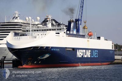
NEPTUNE DYNAMIS
Vehicles Carrier
Current Trip
| Time Travelled | 1 day |
|---|---|
| Remaining Time | 10 h, 30 mins |
| Distance Travelled | 316.91 nm |
| Remaining Distance | 94.20 nm |
| AVG Speed | 10.8 Knots |
| MAX Speed | 17.1 Knots |
| AVG Wind | 12.9 knots |
| MAX Wind | 19 knots |
| MIN Temp | 11.9°C / 53.42°F |
| MAX Temp | 15.2°C / 59.36°F |
| Draught | 5.9 m |
| Position Received | Now |
Current Position
| Longitude | -4.87343° |
|---|---|
| Latitude | 50.92542° |
| Status | Under way using engine |
| Speed | 9.4 Knots |
| Course | 45.4° |
| Area | Celtic Sea |
| Station | T-AIS |
| Position Received | Now |
Info
Information
The current position of NEPTUNE DYNAMIS is in Celtic Sea with coordinates 50.92542° / -4.87343° as reported on 2024-06-05 03:50 by AIS to our vessel tracker app. The vessel's current speed is 9.4 Knots and is heading at the port of PORTBURY. The estimated time of arrival as calculated by vessel tracking app is 2024-06-05 14:20 LT
The vessel NEPTUNE DYNAMIS (IMO: 9240976, MMSI: 215188000) is a Vehicles Carrier that was built in 2002 ( 22 years old ). It's sailing under the flag of [MT] Malta.
In this page you can find informations about the vessels current position, last detected port calls, and current voyage information. If the vessels is not in coverage by AIS you will find the latest position.
The current position of NEPTUNE DYNAMIS is detected by our AIS receivers and we are not responsible for the reliability of the data. The last position was recorded while the vessel was in Coverage by the Ais receivers of our vessel tracking app.
The current draught of NEPTUNE DYNAMIS as reported by AIS is 5.9 meters
Weather
| Temperature | 12.2°C / 53.96°F |
|---|---|
| Wind Speed | 15 knots |
| Direction | 346° NNW |
| Pressure | 1015.4 hPa |
| Humidity | 61.8 % |
| Cloud Coverage | 3 % |
Featured Company
Last Port Calls
| Port | Arrival | Departure | Time In Port |
|---|---|---|---|
| 2024-06-03 08:21 | 2024-06-03 22:22 | 14 h | |
| 2024-05-31 17:46 | 2024-06-01 21:55 | 1 d | |
| 2024-05-29 04:00 | 2024-05-29 11:57 | 7 h | |
| 2024-05-27 08:24 | 2024-05-27 11:10 | 2 h | |
| 2024-05-25 20:37 | 2024-05-26 17:46 | 21 h | |
| 2024-05-23 20:54 | 2024-05-24 15:57 | 19 h | |
| 2024-05-21 23:18 | 2024-05-23 00:45 | 1 d | |
| 2024-05-19 03:15 | 2024-05-19 11:39 | 8 h | |
| 2024-05-16 22:39 | 2024-05-17 16:29 | 17 h | |
| 2024-05-15 02:52 | 2024-05-15 20:50 | 17 h |
Last Trips
| Origin | Departure | Destination | Arrival | Distance | |
|---|---|---|---|---|---|
| 2024-06-01 23:55 | 2024-06-03 10:21 | 211.23 nm | |||
| 2024-05-29 13:57 | 2024-05-31 19:46 | 744.47 nm | |||
| 2024-05-27 12:10 | 2024-05-29 06:00 | 548.95 nm | |||
| 2024-05-26 18:46 | 2024-05-27 09:24 | 170.20 nm | |||
| 2024-05-24 17:57 | 2024-05-25 21:37 | 403.54 nm | |||
| 2024-05-23 02:45 | 2024-05-23 22:54 | 213.27 nm | |||
| 2024-05-19 13:39 | 2024-05-22 01:18 | 718.36 nm | |||
| 2024-05-17 17:29 | 2024-05-19 05:15 | 579.88 nm | |||
| 2024-05-15 22:50 | 2024-05-16 23:39 | 403.87 nm | |||
| 2024-05-14 15:51 | 2024-05-15 04:52 | 173.53 nm |
Events
| Time | Event | Details | Position / Dest | Info |
|---|---|---|---|---|
| 2024-06-04 21:29 | Status Changed | Under way using engine Default |
50.31206 / -5.88498
GBPRU
|
Speed: 7.2 kn Course: 0° |
| 2024-06-04 21:26 | Status Changed | Default Under way using engine |
50.30483 / -5.88503
GBPRU
|
Speed: 7.4 kn Course: 0.7° |
| 2024-06-04 21:11 | Status Changed | Under way using engine Default |
50.27630 / -5.88504
GBPRU
|
Speed: 7.2 kn Course: 359° |
| 2024-06-04 21:10 | Status Changed | Default Under way using engine |
50.27258 / -5.88499
GBPRU
|
Speed: 7.3 kn Course: 1.5° |
| 2024-06-04 19:55 | Status Changed | Under way using engine Default |
50.12520 / -5.88282
GBPRU
|
Speed: 7.1 kn Course: 359° |
| 2024-06-04 19:38 | Status Changed | Default Under way using engine |
50.09131 / -5.88057
GBPRU
|
Speed: 6.4 kn Course: 0.1° |
| 2024-06-04 19:30 | Status Changed | Under way using engine Default |
50.07792 / -5.88055
GBPRU
|
Speed: 6.4 kn Course: 358° |
| 2024-06-04 19:10 | Status Changed | Default Under way using engine |
50.04218 / -5.87880
GBPRU
|
Speed: 6.2 kn Course: 359° |
| 2024-06-04 19:05 | Change Sea Area | United Kingdom part of the Celtic Sea United Kingdom part of the English Channel |
50.03346 / -5.87843
Celtic Sea
GBPRU
|
Speed: 6.2 kn Course: 359° |
| 2024-06-04 19:05 | Status Changed | Under way using engine Default |
50.03346 / -5.87843
GBPRU
|
Speed: 6.2 kn Course: 358° |