
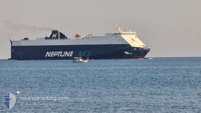
NEPTUNE OKEANIS
Vehicles Carrier
Current Trip
| Trip Time | 1 day |
|---|---|
| Trip Distance | 255.52 nm |
| AVG Speed | 9.5 Knots |
| MAX Speed | 14.8 Knots |
| Draught | 5.7 m |
| AVG Wind | 6 knots |
| MAX Wind | 20 knots |
| MIN Temp | 15.2°C / 59.36°F |
| MAX Temp | 18.6°C / 65.48°F |
| Position Received | 2 h, 19 m ago |
Current Position
| Longitude | 5.12225° |
|---|---|
| Latitude | 43.17343° |
| Status | Under way using engine |
| Speed | 9.4 Knots |
| Course | 296° |
| Area | Mediterranean Sea - Western Basin |
| Station | T-AIS |
| Position Received | 2 h, 19 m ago |
Info
Information
The current position of NEPTUNE OKEANIS is in Mediterranean Sea - Western Basin with coordinates 43.17343° / 5.12225° as reported on 2024-05-17 00:09 by AIS to our vessel tracker app. The vessel's current speed is 9.4 Knots and is currently inside the port of FOS.
The vessel NEPTUNE OKEANIS (IMO: 9306706, MMSI: 215912000) is a Vehicles Carrier that was built in 2005 ( 19 years old ). It's sailing under the flag of [MT] Malta.
In this page you can find informations about the vessels current position, last detected port calls, and current voyage information. If the vessels is not in coverage by AIS you will find the latest position.
The current position of NEPTUNE OKEANIS is detected by our AIS receivers and we are not responsible for the reliability of the data. The last position was recorded while the vessel was in Coverage by the Ais receivers of our vessel tracking app.
The current draught of NEPTUNE OKEANIS as reported by AIS is 5.7 meters
Weather
| Temperature | 15.2°C / 59.36°F |
|---|---|
| Wind Speed | 1 knots |
| Direction | 168° SSE |
| Pressure | 1009 hPa |
| Humidity | 66.9 % |
| Cloud Coverage | 2 % |
Featured Company
Last Port Calls
| Port | Arrival | Departure | Time In Port |
|---|---|---|---|
| 2024-05-17 02:12 | |||
| 2024-05-15 10:46 | 2024-05-15 23:23 | 12 h | |
| 2024-05-11 11:33 | 2024-05-12 16:05 | 1 d | |
| 2024-05-07 16:40 | 2024-05-08 18:20 | 1 d | |
| 2024-05-06 04:08 | 2024-05-06 12:15 | 8 h | |
| 2024-05-03 23:21 | 2024-05-04 04:06 | 4 h | |
| 2024-05-03 03:25 | 2024-05-03 17:08 | 13 h | |
| 2024-05-01 21:31 | 2024-05-02 13:42 | 16 h | |
| 2024-04-30 13:24 | |||
| 2024-04-30 00:22 | 2024-04-30 08:36 | 8 h |
Last Trips
| Origin | Departure | Destination | Arrival | Distance | |
|---|---|---|---|---|---|
| 2024-05-16 01:23 | 2024-05-17 04:12 | 255.52 nm | |||
| 2024-05-12 17:05 | 2024-05-15 12:46 | 890.84 nm | |||
| 2024-05-08 20:20 | 2024-05-11 12:33 | 913.08 nm | |||
| 2024-05-06 14:15 | 2024-05-07 18:40 | 436.01 nm | |||
| 2024-05-04 05:06 | 2024-05-06 06:08 | 502.83 nm | |||
| 2024-05-03 19:08 | 2024-05-04 00:21 | 80.48 nm | |||
| 2024-05-02 14:42 | 2024-05-03 05:25 | 102.32 nm | |||
| 2024-04-30 10:36 | 2024-04-30 15:24 | 74.88 nm | |||
| 2024-04-29 12:25 | 2024-04-30 02:22 | 199.10 nm | |||
| 2024-04-27 15:42 | 2024-04-29 07:54 | 531.17 nm |
Events
| Time | Event | Details | Position / Dest | Info |
|---|---|---|---|---|
| 2024-05-17 02:12 | PORT ARRIVAL |
|
43.39550 / 4.92302
[FR] FOS
|
Speed: 13.9 kn Course: 305° |
| 2024-05-17 00:22 | Status Changed | Default Under way using engine |
43.18663 / 5.08518
FRFOS
|
Speed: 9.4 kn Course: 296° |
| 2024-05-17 00:09 | OUT of Coverage |
43.17343 / 5.12225
Mediterranean Sea - Western Basin
|
Speed: 9.4 kn Course: 296° |
|
| 2024-05-17 00:05 | Status Changed | Under way using engine Default |
43.16935 / 5.13353
FRFOS
|
Speed: 9.5 kn Course: 296° |
| 2024-05-17 00:04 | Status Changed | Default Under way using engine |
43.16818 / 5.13677
FRFOS
|
Speed: 9.2 kn Course: 297° |
| 2024-05-16 23:15 | Status Changed | Under way using engine Default |
43.10847 / 5.28908
FRFOS
|
Speed: 8.7 kn Course: 299° |
| 2024-05-16 22:33 | Status Changed | Default Under way using engine |
43.05863 / 5.41505
FRFOS
|
Speed: 9 kn Course: 294° |
| 2024-05-16 21:56 | IN Coverage |
43.02182 / 5.52362
Mediterranean Sea - Western Basin
|
Speed: 9.1 kn Course: 296° |
|
| 2024-05-16 20:53 | OUT of Coverage |
42.94485 / 5.72970
Mediterranean Sea - Western Basin
|
Speed: 9.2 kn Course: 296° |
|
| 2024-05-16 20:39 | IN Coverage |
42.92993 / 5.77092
Mediterranean Sea - Western Basin
|
Speed: 9.2 kn Course: 296° |