
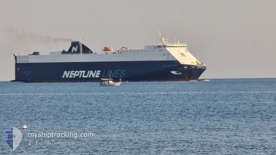
NEPTUNE OKEANIS
Vehicles Carrier
Current Trip
| Time Travelled | 9 h, 39 mins |
|---|---|
| Remaining Time | --- |
| Distance Travelled | 139.92 nm |
| Remaining Distance | --- |
| AVG Speed | 14.7 Knots |
| MAX Speed | 16.3 Knots |
| AVG Wind | 19.3 knots |
| MAX Wind | 24.1 knots |
| MIN Temp | 14.3°C / 57.74°F |
| MAX Temp | 19.7°C / 67.46°F |
| Draught | 5.7 m |
| Position Received | Now |
Current Position
| Longitude | 26.42602° |
|---|---|
| Latitude | 40.21305° |
| Status | Under way using engine |
| Speed | 15.4 Knots |
| Course | 247° |
| Area | Sea of Marmara |
| Station | T-AIS |
| Position Received | Now |
Info
Information
The current position of NEPTUNE OKEANIS is in Sea of Marmara with coordinates 40.21305° / 26.42602° as reported on 2024-05-26 19:31 by AIS to our vessel tracker app. The vessel's current speed is 15.4 Knots and is heading at the port of CIVITAVECCHIA. The estimated time of arrival as calculated by vessel tracking app is 2024-05-29 11:00 LT
The vessel NEPTUNE OKEANIS (IMO: 9306706, MMSI: 215912000) is a Vehicles Carrier that was built in 2005 ( 19 years old ). It's sailing under the flag of [MT] Malta.
In this page you can find informations about the vessels current position, last detected port calls, and current voyage information. If the vessels is not in coverage by AIS you will find the latest position.
The current position of NEPTUNE OKEANIS is detected by our AIS receivers and we are not responsible for the reliability of the data. The last position was recorded while the vessel was in Coverage by the Ais receivers of our vessel tracking app.
The current draught of NEPTUNE OKEANIS as reported by AIS is 5.7 meters
Weather
| Temperature | 16.1°C / 60.98°F |
|---|---|
| Wind Speed | 16 knots |
| Direction | 56° NE |
| Pressure | 1016.3 hPa |
| Humidity | 62.3 % |
| Cloud Coverage | --- |
Featured Company
Last Port Calls
| Port | Arrival | Departure | Time In Port |
|---|---|---|---|
| 2024-05-25 17:24 | 2024-05-26 09:53 | 16 h | |
| 2024-05-24 03:11 | 2024-05-24 14:08 | 10 h | |
| 2024-05-22 19:58 | 2024-05-23 12:46 | 16 h | |
| 2024-05-18 01:22 | 2024-05-18 19:57 | 18 h | |
| 2024-05-17 02:12 | 2024-05-17 10:32 | 8 h | |
| 2024-05-15 10:46 | 2024-05-15 23:23 | 12 h | |
| 2024-05-11 11:33 | 2024-05-12 16:05 | 1 d | |
| 2024-05-07 16:40 | 2024-05-08 18:20 | 1 d | |
| 2024-05-06 04:08 | 2024-05-06 12:15 | 8 h | |
| 2024-05-03 23:21 | 2024-05-04 04:06 | 4 h |
Last Trips
| Origin | Departure | Destination | Arrival | Distance | |
|---|---|---|---|---|---|
| 2024-05-24 17:08 | 2024-05-25 20:24 | 78.13 nm | |||
| 2024-05-23 15:46 | 2024-05-24 06:11 | 19.45 nm | |||
| 2024-05-18 21:57 | 2024-05-22 22:58 | 1498.80 nm | |||
| 2024-05-17 12:32 | 2024-05-18 03:22 | 184.60 nm | |||
| 2024-05-16 01:23 | 2024-05-17 04:12 | 255.52 nm | |||
| 2024-05-12 17:05 | 2024-05-15 12:46 | 890.84 nm | |||
| 2024-05-08 20:20 | 2024-05-11 12:33 | 913.08 nm | |||
| 2024-05-06 14:15 | 2024-05-07 18:40 | 436.01 nm | |||
| 2024-05-04 05:06 | 2024-05-06 06:08 | 502.83 nm | |||
| 2024-05-03 19:08 | 2024-05-04 00:21 | 80.48 nm |
Events
| Time | Event | Details | Position / Dest | Info |
|---|---|---|---|---|
| 2024-05-26 19:10 | Status Changed | Under way using engine Default |
40.26475 / 26.52090
ITCVV
|
Speed: 15.6 kn Course: 228° |
| 2024-05-26 19:10 | IN Coverage |
40.26475 / 26.52090
Sea of Marmara
ITCVV
|
Speed: 15.6 kn Course: 231° |
|
| 2024-05-26 17:08 | Status Changed | Default Under way using engine |
40.53622 / 27.01705
ITCVV
|
Speed: 14.9 kn Course: 243° |
| 2024-05-26 16:59 | OUT of Coverage |
40.55353 / 27.06413
Sea of Marmara
ITCVV
|
Speed: 14.9 kn Course: 243° |
|
| 2024-05-26 16:44 | Status Changed | Under way using engine Default |
40.58088 / 27.13548
ITCVV
|
Speed: 14.6 kn Course: 243° |
| 2024-05-26 16:23 | Status Changed | Default Under way using engine |
40.61957 / 27.23770
ITCVV
|
Speed: 15.1 kn Course: 243° |
| 2024-05-26 13:22 | ETA Changed | 2024/05/29 11:00 2024/05/24 19:45 |
40.82538 / 28.20305
ITCVV
|
Speed: 14.1 kn Course: 262° |
| 2024-05-26 13:15 | Status Changed | Under way using engine Default |
40.81953 / 28.24377
ITCVV
|
Speed: 15.9 kn Course: 301° |
| 2024-05-26 13:15 | IN Coverage |
40.82143 / 28.23485
Sea of Marmara
|
Speed: 16.1 kn Course: 283° |
|
| 2024-05-26 10:24 | OUT of Coverage |
40.43773 / 28.97370
Sea of Marmara
|
Speed: 11.8 kn Course: 281° |