
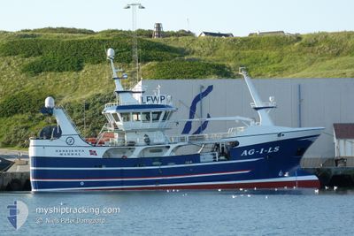
NESEJENTA
Fishing
Current Trip
FISHIN N STUFF
| Time Travelled | 8 days |
|---|---|
| Remaining Time | --- |
| Distance Travelled | 970.12 nm |
| Remaining Distance | --- |
| AVG Speed | 7.9 Knots |
| MAX Speed | 11.5 Knots |
| AVG Wind | 14.6 knots |
| MAX Wind | 27 knots |
| MIN Temp | 6.7°C / 44.06°F |
| MAX Temp | 15.4°C / 59.72°F |
| Draught | 5.5 m |
| Position Received | 23 h, 57 m ago |
Current Position
| Longitude | 1.84538° |
|---|---|
| Latitude | 61.18775° |
| Status | Engaged in Fishing |
| Speed | 6.5 Knots |
| Course | 306.7° |
| Area | Norwegian Sea |
| Station | T-AIS |
| Position Received | 23 h, 57 m ago |
Info
Information
The current position of NESEJENTA is in Norwegian Sea with coordinates 61.18775° / 1.84538° as reported on 2024-05-16 02:25 by AIS to our vessel tracker app. The vessel's current speed is 6.5 Knots
The vessel NESEJENTA (IMO: 9856397, MMSI: 257127360) is a Fishing It's sailing under the flag of [NO] Norway.
In this page you can find informations about the vessels current position, last detected port calls, and current voyage information. If the vessels is not in coverage by AIS you will find the latest position.
The current position of NESEJENTA is detected by our AIS receivers and we are not responsible for the reliability of the data. The last position was recorded while the vessel was in Coverage by the Ais receivers of our vessel tracking app.
The current draught of NESEJENTA as reported by AIS is 5.5 meters
Weather
| Temperature | 11.3°C / 52.34°F |
|---|---|
| Wind Speed | 14 knots |
| Direction | 144° SE |
| Pressure | 1015.8 hPa |
| Humidity | 83.2 % |
| Cloud Coverage | 13 % |
Featured Company
Last Port Calls
| Port | Arrival | Departure | Time In Port |
|---|---|---|---|
| 2024-05-08 23:51 | 2024-05-09 01:23 | 1 h | |
| 2024-04-25 19:56 | 2024-05-03 14:12 | 7 d | |
| 2024-04-14 18:29 | 2024-04-14 21:37 | 3 h | |
| 2024-04-08 05:10 | 2024-04-08 07:41 | 2 h | |
| 2024-04-02 14:17 | 2024-04-02 16:36 | 2 h | |
| 2024-04-02 12:45 | 2024-04-02 13:33 | 47 m | |
| 2024-04-02 02:31 | 2024-04-02 11:59 | 9 h | |
| 2024-03-30 13:21 | 2024-03-30 15:48 | 2 h | |
| 2024-03-28 19:47 | 2024-03-29 10:13 | 14 h | |
| 2024-03-21 15:24 | 2024-03-21 16:32 | 1 h |
Last Trips
| Origin | Departure | Destination | Arrival | Distance | |
|---|---|---|---|---|---|
| 2024-05-03 16:12 | 2024-05-09 01:51 | 436.33 nm | |||
| 2024-04-14 23:37 | 2024-04-25 21:56 | 910.82 nm | |||
| 2024-04-08 09:41 | 2024-04-14 20:29 | 541.30 nm | |||
| 2024-04-02 18:36 | 2024-04-08 07:10 | 395.97 nm | |||
| 2024-04-02 15:33 | 2024-04-02 16:17 | 5.85 nm | |||
| 2024-04-02 13:59 | 2024-04-02 14:45 | 5.60 nm | |||
| 2024-03-30 16:48 | 2024-04-02 04:31 | 480.93 nm | |||
| 2024-03-29 11:13 | 2024-03-30 14:21 | 146.43 nm | |||
| 2024-03-21 17:32 | 2024-03-28 20:47 | 811.22 nm | |||
| 2024-03-21 15:39 | 2024-03-21 16:24 | 5.70 nm |
Events
| Time | Event | Details | Position / Dest | Info |
|---|---|---|---|---|
| 2024-05-16 02:25 | OUT of Coverage |
61.18775 / 1.84538
Norwegian Sea
|
Speed: 6.5 kn Course: 306.7° |
|
| 2024-05-16 02:25 | Detected in Sea | Norwegian part of the Norwegian Sea |
61.18775 / 1.84538
Norwegian Sea
|
Speed: 6.5 kn Course: 306.7° |
| 2024-05-16 00:34 | Detected in Sea | United Kingdom part of the Norwegian Sea |
61.02325 / 1.80435
Norwegian Sea
|
Speed: 8.6 kn Course: 344.7° |
| 2024-05-16 00:34 | IN Coverage |
61.02325 / 1.80435
Norwegian Sea
|
Speed: 8.6 kn Course: 344.7° |
|
| 2024-05-15 23:15 | OUT of Coverage |
60.86258 / 2.00927
North Sea
|
Speed: 8.9 kn Course: 340.6° |
|
| 2024-05-15 23:12 | Status Changed | Engaged in Fishing Under way using engine |
60.85390 / 2.01527
FISHIN N STUFF
|
Speed: 8.9 kn Course: 341.4° |
| 2024-05-15 22:28 | IN Coverage |
60.75435 / 2.08630
North Sea
|
Speed: 8.9 kn Course: 341.4° |
|
| 2024-05-15 20:28 | OUT of Coverage |
60.48258 / 2.27905
North Sea
|
Speed: 8.6 kn Course: 341.6° |
|
| 2024-05-15 17:25 | IN Coverage |
60.46792 / 2.59147
North Sea
|
Speed: 6.6 kn Course: 173.9° |
|
| 2024-05-15 14:35 | OUT of Coverage |
60.48038 / 2.57925
North Sea
|
Speed: 1.4 kn Course: 206.5° |