
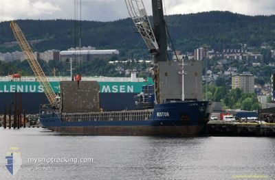
NESTOR
General Cargo
Current Trip
| Time Travelled | 8 days |
|---|---|
| Remaining Time | 18 h, 52 mins |
| Distance Travelled | 1357.07 nm |
| Remaining Distance | 196.88 nm |
| AVG Speed | 9.4 Knots |
| MAX Speed | 12.2 Knots |
| AVG Wind | 13.4 knots |
| MAX Wind | 26 knots |
| MIN Temp | 4.9°C / 40.82°F |
| MAX Temp | 16.4°C / 61.52°F |
| Draught | 4 m |
| Position Received | 1 m ago |
Current Position
| Longitude | 6.28370° |
|---|---|
| Latitude | 58.14663° |
| Status | Under way using engine |
| Speed | 10.7 Knots |
| Course | 140.6° |
| Area | North Sea |
| Station | T-AIS |
| Position Received | 1 m ago |
Info
Information
The current position of NESTOR is in North Sea with coordinates 58.14663° / 6.28370° as reported on 2024-05-31 15:34 by AIS to our vessel tracker app. The vessel's current speed is 10.7 Knots and is heading at the port of HOLMESTRAND. The estimated time of arrival as calculated by vessel tracking app is 2024-06-01 10:27 LT
The vessel NESTOR (IMO: 9234305, MMSI: 304011028) is a General Cargo that was built in 2000 ( 24 years old ). It's sailing under the flag of [AG] Antigua Barbuda.
In this page you can find informations about the vessels current position, last detected port calls, and current voyage information. If the vessels is not in coverage by AIS you will find the latest position.
The current position of NESTOR is detected by our AIS receivers and we are not responsible for the reliability of the data. The last position was recorded while the vessel was in Coverage by the Ais receivers of our vessel tracking app.
The current draught of NESTOR as reported by AIS is 4 meters
Weather
| Temperature | 13.9°C / 57.02°F |
|---|---|
| Wind Speed | 6 knots |
| Direction | 331° NNW |
| Pressure | 1015.4 hPa |
| Humidity | 82.2 % |
| Cloud Coverage | 100 % |
Featured Company
Last Port Calls
| Port | Arrival | Departure | Time In Port |
|---|---|---|---|
| 2024-05-22 18:38 | 2024-05-22 21:21 | 2 h | |
| 2024-05-16 21:57 | 2024-05-17 14:40 | 16 h | |
| 2024-05-16 15:46 | 2024-05-16 21:43 | 5 h | |
| 2024-05-12 08:24 | 2024-05-13 13:51 | 1 d | |
| 2024-05-08 13:10 | 2024-05-10 14:08 | 2 d | |
| 2024-05-06 13:47 | 2024-05-07 00:14 | 10 h | |
| 2024-05-04 04:04 | 2024-05-04 18:06 | 14 h | |
| 2024-04-29 17:23 | 2024-04-30 10:05 | 16 h | |
| 2024-04-28 23:47 | 2024-04-29 13:42 | 13 h | |
| 2024-04-24 02:58 | 2024-04-24 14:45 | 11 h |
Last Trips
| Origin | Departure | Destination | Arrival | Distance | |
|---|---|---|---|---|---|
| 2024-05-17 16:40 | 2024-05-22 20:38 | 499.30 nm | |||
| 2024-05-16 23:43 | 2024-05-16 23:57 | 0.05 nm | |||
| 2024-05-13 15:51 | 2024-05-16 17:46 | 718.56 nm | |||
| 2024-05-10 16:08 | 2024-05-12 10:24 | 138.18 nm | |||
| 2024-05-07 02:14 | 2024-05-08 15:10 | 333.02 nm | |||
| 2024-05-04 20:06 | 2024-05-06 15:47 | 429.89 nm | |||
| 2024-04-30 12:05 | 2024-05-04 06:04 | 868.53 nm | |||
| 2024-04-29 15:42 | 2024-04-29 19:23 | 33.84 nm | |||
| 2024-04-24 16:45 | 2024-04-29 01:47 | 1039.92 nm | |||
| 2024-04-11 16:41 | 2024-04-24 04:58 | 1459.59 nm |
Events
| Time | Event | Details | Position / Dest | Info |
|---|---|---|---|---|
| 2024-05-30 21:20 | Change Sea Area | Norwegian part of the North Sea Norwegian part of the Norwegian Sea |
60.99125 / 4.25773
North Sea
NOHOL
|
Speed: 9.9 kn Course: 174.9° |
| 2024-05-30 15:47 | Draught Changed | 4 4.9 |
61.45137 / 2.76557
NOHOL
|
Speed: 8.8 kn Course: 117.9° |
| 2024-05-30 15:47 | Destination Changed | NOHOL ISRFJ |
61.45137 / 2.76557
NOHOL
|
Speed: 8.8 kn Course: 117.9° |
| 2024-05-30 15:47 | ETA Changed | 2024/06/02 17:00 2024/05/25 17:00 |
61.45137 / 2.76557
NOHOL
|
Speed: 8.8 kn Course: 117.9° |
| 2024-05-30 14:57 | Status Changed | Under way using engine Default |
61.51299 / 2.52443
ISRFJ
|
Speed: 10 kn Course: 118° |
| 2024-05-30 14:49 | Status Changed | Default Under way using engine |
61.52334 / 2.48500
ISRFJ
|
Speed: 10 kn Course: 117.2° |
| 2024-05-30 14:43 | Status Changed | Under way using engine Default |
61.53075 / 2.45528
ISRFJ
|
Speed: 9 kn Course: 116° |
| 2024-05-30 14:16 | Status Changed | Default Under way using engine |
61.56500 / 2.31500
ISRFJ
|
Speed: 9.9 kn Course: 115.5° |
| 2024-05-30 14:14 | Status Changed | Under way using engine Default |
61.56667 / 2.30649
ISRFJ
|
Speed: 10 kn Course: 114° |
| 2024-05-30 13:40 | Status Changed | Default Under way using engine |
61.60833 / 2.12333
ISRFJ
|
Speed: 10.1 kn Course: 117.8° |