
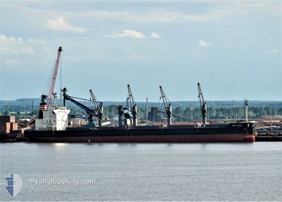
NEW NOBLE
Cargo
Current Trip
CEDROS ISLAND
| Time Travelled | 3 days |
|---|---|
| Remaining Time | --- |
| Distance Travelled | 855.67 nm |
| Remaining Distance | --- |
| AVG Speed | 10.6 Knots |
| MAX Speed | 12.9 Knots |
| AVG Wind | 11.9 knots |
| MAX Wind | 22.8 knots |
| MIN Temp | 16.3°C / 61.34°F |
| MAX Temp | 26.7°C / 80.06°F |
| Draught | 6.3 m |
| Position Received | 2 d ago |
Current Position
| Longitude | -108.28218° |
|---|---|
| Latitude | 21.09469° |
| Status | Under way using engine |
| Speed | 10 Knots |
| Course | 305.2° |
| Area | North Pacific Ocean |
| Station | T-AIS |
| Position Received | 2 d ago |
Info
Information
The current position of NEW NOBLE is in North Pacific Ocean with coordinates 21.09469° / -108.28218° as reported on 2024-06-04 01:12 by AIS to our vessel tracker app. The vessel's current speed is 10 Knots
The vessel NEW NOBLE (IMO: 9836892, MMSI: 636018843) is a Cargo It's sailing under the flag of [LR] Liberia.
In this page you can find informations about the vessels current position, last detected port calls, and current voyage information. If the vessels is not in coverage by AIS you will find the latest position.
The current position of NEW NOBLE is detected by our AIS receivers and we are not responsible for the reliability of the data. The last position was recorded while the vessel was in Coverage by the Ais receivers of our vessel tracking app.
The current draught of NEW NOBLE as reported by AIS is 6.3 meters
Weather
| Temperature | 16.3°C / 61.34°F |
|---|---|
| Wind Speed | 8 knots |
| Direction | 313° NW |
| Pressure | 1011.3 hPa |
| Humidity | 95.4 % |
| Cloud Coverage | 55 % |
Featured Company
Last Port Calls
| Port | Arrival | Departure | Time In Port |
|---|---|---|---|
| 2024-05-26 00:35 | 2024-06-03 02:27 | 8 d | |
| 2024-05-23 21:17 | 2024-05-24 20:00 | 22 h | |
| 2024-05-19 04:02 | 2024-05-19 15:16 | 11 h | |
| 2024-04-26 23:31 | 2024-04-29 07:08 | 2 d | |
| 2024-04-19 22:52 | 2024-04-25 21:11 | 5 d | |
| 2024-04-11 20:34 | 2024-04-13 23:02 | 2 d |
Last Trips
| Origin | Departure | Destination | Arrival | Distance | |
|---|---|---|---|---|---|
| 2024-05-24 14:00 | 2024-05-25 19:35 | 337.88 nm | |||
| 2024-05-19 08:16 | 2024-05-23 15:17 | 937.67 nm | |||
| 2024-04-29 16:08 | 2024-05-18 21:02 | 5129.84 nm | |||
| 2024-04-26 06:11 | 2024-04-27 08:31 | 23.08 nm | |||
| 2024-04-14 08:02 | 2024-04-20 07:52 | 597.47 nm | |||
| 2024-03-16 17:22 | 2024-04-12 05:34 | 2331.48 nm |
Events
| Time | Event | Details | Position / Dest | Info |
|---|---|---|---|---|
| 2024-06-04 01:17 | Status Changed | Default Under way using engine |
21.10162 / -108.29264
CEDROS ISLAND
|
Speed: 10 kn Course: 305.2° |
| 2024-06-04 01:12 | Status Changed | Under way using engine Default |
21.09469 / -108.28218
CEDROS ISLAND
|
Speed: 9.9 kn Course: 304° |
| 2024-06-04 01:12 | OUT of Coverage |
21.09469 / -108.28218
North Pacific Ocean
CEDROS ISLAND
|
Speed: 10 kn Course: 305.2° |
|
| 2024-06-04 00:55 | Status Changed | Default Under way using engine |
21.06794 / -108.24040
CEDROS ISLAND
|
Speed: 10 kn Course: 304.1° |
| 2024-06-04 00:51 | Status Changed | Under way using engine Default |
21.06084 / -108.22903
CEDROS ISLAND
|
Speed: 10.2 kn Course: 304° |
| 2024-06-04 00:36 | IN Coverage |
21.06312 / -108.23261
North Pacific Ocean
CEDROS ISLAND
|
Speed: 10 kn Course: 304.1° |
|
| 2024-06-03 23:40 | Status Changed | Default Under way using engine |
20.95141 / -108.04622
CEDROS ISLAND
|
Speed: 10.5 kn Course: 302.4° |
| 2024-06-03 23:36 | OUT of Coverage |
20.94528 / -108.03558
North Pacific Ocean
CEDROS ISLAND
|
Speed: 10.5 kn Course: 302.4° |
|
| 2024-06-03 23:30 | Status Changed | Under way using engine Default |
20.93608 / -108.01986
CEDROS ISLAND
|
Speed: 10.4 kn Course: 302° |
| 2024-06-03 22:39 | Status Changed | Default Under way using engine |
20.85767 / -107.88453
CEDROS ISLAND
|
Speed: 10.6 kn Course: 301.3° |