
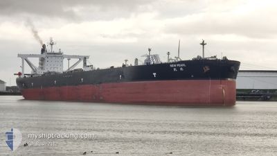
NEW PEARL
Crude Oil Tanker
Current Trip
| Time Travelled | 4 days |
|---|---|
| Remaining Time | 5 days |
| Distance Travelled | 1241.77 nm |
| Remaining Distance | 1724.59 nm |
| AVG Speed | 10.4 Knots |
| MAX Speed | 15.7 Knots |
| AVG Wind | 10.2 knots |
| MAX Wind | 18 knots |
| MIN Temp | 14.7°C / 58.46°F |
| MAX Temp | 26.7°C / 80.06°F |
| Draught | 10.8 m |
| Position Received | 9 h, 32 m ago |
Current Position
| Longitude | -105.60268° |
|---|---|
| Latitude | 19.20568° |
| Status | Under way using engine |
| Speed | 9.6 Knots |
| Course | 123° |
| Area | North Pacific Ocean |
| Station | T-AIS |
| Position Received | 9 h, 32 m ago |
Info
Information
The current position of NEW PEARL is in North Pacific Ocean with coordinates 19.20568° / -105.60268° as reported on 2024-06-03 08:12 by AIS to our vessel tracker app. The vessel's current speed is 9.6 Knots and is heading at the port of BALBOA. The estimated time of arrival as calculated by vessel tracking app is 2024-06-09 01:14 LT
The vessel NEW PEARL (IMO: 9468322, MMSI: 477477900) is a Crude Oil Tanker that was built in 2011 ( 13 years old ). It's sailing under the flag of [HK] Hong Kong.
In this page you can find informations about the vessels current position, last detected port calls, and current voyage information. If the vessels is not in coverage by AIS you will find the latest position.
The current position of NEW PEARL is detected by our AIS receivers and we are not responsible for the reliability of the data. The last position was recorded while the vessel was in Coverage by the Ais receivers of our vessel tracking app.
The current draught of NEW PEARL as reported by AIS is 10.8 meters
Weather
| Temperature | 26.6°C / 79.88°F |
|---|---|
| Wind Speed | 8 knots |
| Direction | 271° W |
| Pressure | 1011.4 hPa |
| Humidity | 70.7 % |
| Cloud Coverage | 7 % |
Featured Company
Last Port Calls
| Port | Arrival | Departure | Time In Port |
|---|---|---|---|
| 2024-05-28 11:59 | 2024-05-29 19:42 | 1 d | |
| 2024-05-23 03:58 | 2024-05-24 07:16 | 1 d | |
| 2024-05-16 00:53 | 2024-05-17 04:50 | 1 d |
Most Visited Ports (Last year)
| Port | Arrivals | |
|---|---|---|
| 3 | ||
| 2 | ||
| 1 |
Last Trips
| Origin | Departure | Destination | Arrival | Distance | |
|---|---|---|---|---|---|
| 2024-05-24 00:16 | 2024-05-28 04:59 | 27.45 nm | |||
| 2024-05-16 21:50 | 2024-05-22 20:58 | 24.27 nm |
Events
| Time | Event | Details | Position / Dest | Info |
|---|---|---|---|---|
| 2024-06-03 08:15 | Status Changed | Default Under way using engine |
19.20007 / -105.59420
BALBOA
|
Speed: 9.6 kn Course: 123° |
| 2024-06-03 08:12 | OUT of Coverage |
19.20568 / -105.60268
North Pacific Ocean
BALBOA
|
Speed: 9.6 kn Course: 123° |
|
| 2024-06-03 07:47 | Status Changed | Under way using engine Default |
19.24328 / -105.66230
BALBOA
|
Speed: 10 kn Course: 123° |
| 2024-06-03 07:42 | Status Changed | Default Under way using engine |
19.25048 / -105.67367
BALBOA
|
Speed: 10 kn Course: 124° |
| 2024-06-03 07:26 | Status Changed | Under way using engine Default |
19.27623 / -105.71352
BALBOA
|
Speed: 9.9 kn Course: 123° |
| 2024-06-03 07:23 | Status Changed | Default Under way using engine |
19.27962 / -105.71880
BALBOA
|
Speed: 10 kn Course: 124° |
| 2024-06-03 06:45 | Status Changed | Under way using engine Default |
19.34245 / -105.81265
BALBOA
|
Speed: 10.4 kn Course: 127° |
| 2024-06-03 06:35 | Status Changed | Default Under way using engine |
19.35950 / -105.83610
BALBOA
|
Speed: 10.4 kn Course: 127° |
| 2024-06-03 06:31 | Status Changed | Under way using engine Default |
19.36593 / -105.84513
BALBOA
|
Speed: 10.5 kn Course: 127° |
| 2024-06-03 06:28 | Status Changed | Default Under way using engine |
19.37141 / -105.85290
BALBOA
|
Speed: 10.5 kn Course: 127° |