
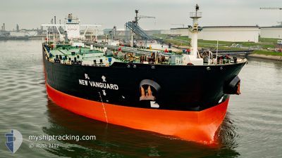
NEW VANGUARD
Crude Oil Tanker
Current Trip
| Time Travelled | 13 days |
|---|---|
| Remaining Time | --- |
| Distance Travelled | 3604.96 nm |
| Remaining Distance | --- |
| AVG Speed | 11.7 Knots |
| MAX Speed | 16.8 Knots |
| AVG Wind | 11.3 knots |
| MAX Wind | 29 knots |
| MIN Temp | 12.1°C / 53.78°F |
| MAX Temp | 27.9°C / 82.22°F |
| Draught | 11 m |
| Position Received | 5 d ago |
Current Position
| Longitude | -41.76850° |
|---|---|
| Latitude | 33.01522° |
| Status | Under way using engine |
| Speed | 10.9 Knots |
| Course | 238.2° |
| Area | North Atlantic Ocean |
| Station | T-AIS |
| Position Received | 5 d ago |
Info
Information
The current position of NEW VANGUARD is in North Atlantic Ocean with coordinates 33.01522° / -41.76850° as reported on 2024-05-29 17:18 by AIS to our vessel tracker app. The vessel's current speed is 10.9 Knots and is heading at the port of COVENAS. The estimated time of arrival as calculated by vessel tracking app is 2024-06-09 23:00 LT
The vessel NEW VANGUARD (IMO: 9445631, MMSI: 636014989) is a Crude Oil Tanker that was built in 2011 ( 13 years old ). It's sailing under the flag of [LR] Liberia.
In this page you can find informations about the vessels current position, last detected port calls, and current voyage information. If the vessels is not in coverage by AIS you will find the latest position.
The current position of NEW VANGUARD is detected by our AIS receivers and we are not responsible for the reliability of the data. The last position was recorded while the vessel was in Coverage by the Ais receivers of our vessel tracking app.
The current draught of NEW VANGUARD as reported by AIS is 11 meters
Weather
| Temperature | 27.2°C / 80.96°F |
|---|---|
| Wind Speed | 15 knots |
| Direction | 131° SE |
| Pressure | 1013.9 hPa |
| Humidity | 81.8 % |
| Cloud Coverage | 100 % |
Featured Company
Most Visited Ports (Last year)
| Port | Arrivals | |
|---|---|---|
| 4 | ||
| 1 | ||
| 1 |
Events
| Time | Event | Details | Position / Dest | Info |
|---|---|---|---|---|
| 2024-05-29 17:30 | Status Changed | Default Under way using engine |
32.99690 / -41.80385
COVENAS,COLOMBIA
|
Speed: 10.9 kn Course: 238.2° |
| 2024-05-29 17:18 | OUT of Coverage |
33.01522 / -41.76850
North Atlantic Ocean
COVENAS,COLOMBIA
|
Speed: 10.9 kn Course: 238.2° |
|
| 2024-05-29 16:24 | Status Changed | Under way using engine Default |
33.09584 / -41.60209
COVENAS,COLOMBIA
|
Speed: 10.7 kn Course: 238° |
| 2024-05-29 16:15 | Status Changed | Default Under way using engine |
33.11083 / -41.57316
COVENAS,COLOMBIA
|
Speed: 10.8 kn Course: 237.5° |
| 2024-05-29 16:05 | Status Changed | Under way using engine Default |
33.12631 / -41.54386
COVENAS,COLOMBIA
|
Speed: 10.9 kn Course: 238° |
| 2024-05-29 16:02 | Status Changed | Default Under way using engine |
33.13077 / -41.53524
COVENAS,COLOMBIA
|
Speed: 10.9 kn Course: 238.1° |
| 2024-05-29 15:54 | Status Changed | Under way using engine Default |
33.14349 / -41.51132
COVENAS,COLOMBIA
|
Speed: 10.9 kn Course: 238° |
| 2024-05-29 15:48 | Status Changed | Default Under way using engine |
33.15448 / -41.49045
COVENAS,COLOMBIA
|
Speed: 10.9 kn Course: 238.7° |
| 2024-05-29 15:40 | Change Sea Area | High seas of the North Atlantic Ocean Portuguese (Azores) part of the North Atlantic Ocean |
33.16604 / -41.46833
North Atlantic Ocean
COVENAS,COLOMBIA
|
Speed: 10.9 kn Course: 238.7° |
| 2024-05-29 15:40 | Status Changed | Under way using engine Default |
33.16604 / -41.46833
COVENAS,COLOMBIA
|
Speed: 10.8 kn Course: 240° |