
NG RESOLUTION
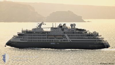
Passenger
Current Trip
| Time Travelled | 10 days |
|---|---|
| Remaining Time | --- |
| Distance Travelled | 1761.44 nm |
| Remaining Distance | --- |
| AVG Speed | 9.9 Knots |
| MAX Speed | 16.1 Knots |
| AVG Wind | 10.2 knots |
| MAX Wind | 24 knots |
| MIN Temp | -6.2°C / 20.84°F |
| MAX Temp | 4.8°C / 40.64°F |
| Draught | 5.6 m |
| Position Received | 1 d ago |
Current Position
| Longitude | 20.30582° |
|---|---|
| Latitude | 80.58905° |
| Status | Under way using engine |
| Speed | 12.5 Knots |
| Course | 11.1° |
| Area | Arctic Ocean |
| Station | T-AIS |
| Position Received | 1 d ago |
Info
Information
The current position of NG RESOLUTION is in Arctic Ocean with coordinates 80.58905° / 20.30582° as reported on 2024-06-02 06:30 by AIS to our vessel tracker app. The vessel's current speed is 12.5 Knots and is heading at the port of SEPT-ILES. The estimated time of arrival as calculated by vessel tracking app is 2024-06-02 08:00 LT
The vessel NG RESOLUTION (IMO: 9880685, MMSI: 311000893) is a Passenger It's sailing under the flag of [BS] Bahamas.
In this page you can find informations about the vessels current position, last detected port calls, and current voyage information. If the vessels is not in coverage by AIS you will find the latest position.
The current position of NG RESOLUTION is detected by our AIS receivers and we are not responsible for the reliability of the data. The last position was recorded while the vessel was in Coverage by the Ais receivers of our vessel tracking app.
The current draught of NG RESOLUTION as reported by AIS is 5.6 meters
Weather
| Temperature | -0.1°C / 31.82°F |
|---|---|
| Wind Speed | 7 knots |
| Direction | 107° ESE |
| Pressure | 1013.7 hPa |
| Humidity | 95.9 % |
| Cloud Coverage | 100 % |
Featured Company
Last Port Calls
| Port | Arrival | Departure | Time In Port |
|---|---|---|---|
| 2024-05-24 05:39 | 2024-05-24 16:14 | 10 h | |
| 2024-05-21 17:20 | 2024-05-21 21:12 | 3 h | |
| 2024-05-17 02:39 | 2024-05-17 15:11 | 12 h | |
| 2024-05-13 17:38 | 2024-05-13 21:16 | 3 h | |
| 2024-05-10 10:59 | 2024-05-10 17:10 | 6 h | |
| 2024-04-14 05:10 | 2024-04-28 07:17 | 14 d | |
| 2024-04-07 05:52 | 2024-04-07 12:17 | 6 h |
Last Trips
| Origin | Departure | Destination | Arrival | Distance | |
|---|---|---|---|---|---|
| 2024-05-21 23:12 | 2024-05-24 07:39 | 413.10 nm | |||
| 2024-05-17 17:11 | 2024-05-21 19:20 | 745.01 nm | |||
| 2024-05-13 23:16 | 2024-05-17 04:39 | 670.87 nm | |||
| 2024-05-10 19:10 | 2024-05-13 19:38 | 504.39 nm | |||
| 2024-04-28 09:17 | 2024-05-10 12:59 | 2937.09 nm | |||
| 2024-04-07 13:17 | 2024-04-14 07:10 | 2343.35 nm | |||
| 2024-03-15 04:54 | 2024-04-07 06:52 | 6512.28 nm |
Events
| Time | Event | Details | Position / Dest | Info |
|---|---|---|---|---|
| 2024-06-03 15:37 | STOP Moving |
80.09152 / 31.36521
SEVEN ISLANDS
|
Speed: 0.2 kn Course: 132° |
|
| 2024-06-03 15:19 | START Moving |
80.07500 / 31.33667
SEVEN ISLANDS
|
Speed: 14 kn Course: 281° |
|
| 2024-06-03 14:52 | STOP Moving |
80.07420 / 31.41069
SEVEN ISLANDS
|
Speed: 0.2 kn Course: 121° |
|
| 2024-06-03 13:46 | START Moving |
80.12907 / 30.79215
SEVEN ISLANDS
|
Speed: 6.9 kn Course: 194° |
|
| 2024-06-03 13:43 | STOP Moving |
80.13167 / 30.79500
SEVEN ISLANDS
|
Speed: Course: -1° |
|
| 2024-06-03 10:43 | START Moving |
80.14967 / 28.09925
SEVEN ISLANDS
|
Speed: 8.4 kn Course: 104° |
|
| 2024-06-03 05:41 | STOP Moving |
80.14667 / 28.02167
SEVEN ISLANDS
|
Speed: Course: -1° |
|
| 2024-06-03 05:10 | START Moving |
80.17001 / 27.91820
SEVEN ISLANDS
|
Speed: 8.1 kn Course: 27° |
|
| 2024-06-03 04:32 | STOP Moving |
80.16167 / 27.88667
SEVEN ISLANDS
|
Speed: Course: -1° |
|
| 2024-06-02 15:53 | START Moving |
80.66798 / 23.55265
SEVEN ISLANDS
|
Speed: 9.2 kn Course: 359° |