
NIENKE
Dredging or underwater ops
Current Trip
BUITENLAND
| Time Travelled | 7 h, 0 mins |
|---|---|
| Remaining Time | --- |
| Distance Travelled | 26.45 nm |
| Remaining Distance | --- |
| AVG Speed | 7.7 Knots |
| MAX Speed | 8.1 Knots |
| AVG Wind | 4.4 knots |
| MAX Wind | 5.2 knots |
| MIN Temp | 16.1°C / 60.98°F |
| MAX Temp | 18.6°C / 65.48°F |
| Draught | 2 m |
| Position Received | 1 m ago |
Current Position
| Longitude | 4.88445° |
|---|---|
| Latitude | 51.72023° |
| Status | Under way using engine |
| Speed | 7.1 Knots |
| Course | 279.8° |
| Area | North Sea |
| Station | T-AIS |
| Position Received | 1 m ago |
Info
Information
The current position of NIENKE is in North Sea with coordinates 51.72023° / 4.88445° as reported on 2024-06-18 12:50 by AIS to our vessel tracker app. The vessel's current speed is 7.1 Knots
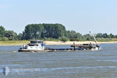
The vessel NIENKE (MMSI: 244100611) is a Dredging or underwater ops It's sailing under the flag of [NL] Netherlands.
In this page you can find informations about the vessels current position, last detected port calls, and current voyage information. If the vessels is not in coverage by AIS you will find the latest position.
The current position of NIENKE is detected by our AIS receivers and we are not responsible for the reliability of the data. The last position was recorded while the vessel was in Coverage by the Ais receivers of our vessel tracking app.
The current draught of NIENKE as reported by AIS is 2 meters
Weather
| Temperature | 17.8°C / 64.04°F |
|---|---|
| Wind Speed | 4 knots |
| Direction | 80° E |
| Pressure | 1012.9 hPa |
| Humidity | 86.5 % |
| Cloud Coverage | 100 % |
Featured Company
Last Port Calls
| Port | Arrival | Departure | Time In Port |
|---|---|---|---|
| 2024-06-17 16:33 | 2024-06-18 05:51 | 13 h | |
| 2024-06-11 07:43 | 2024-06-11 13:09 | 5 h | |
| 2024-06-10 17:18 | 2024-06-11 05:08 | 11 h | |
| 2024-06-05 11:46 | 2024-06-10 13:36 | 5 d | |
| 2024-06-05 09:04 | 2024-06-05 09:59 | 55 m | |
| 2024-06-04 18:44 | 2024-06-05 06:37 | 11 h | |
| 2024-06-03 18:40 | 2024-06-04 06:45 | 12 h | |
| 2024-05-31 12:29 | 2024-06-03 06:35 | 2 d | |
| 2024-05-29 06:54 | 2024-05-29 09:38 | 2 h | |
| 2024-05-27 17:02 | 2024-05-28 07:21 | 14 h |
Most Visited Ports (Last year)
| Port | Arrivals | |
|---|---|---|
| 48 | ||
| 47 | ||
| 22 | ||
| 13 | ||
| 12 | ||
| 10 |
Last Trips
| Origin | Departure | Destination | Arrival | Distance | |
|---|---|---|---|---|---|
| 2024-06-11 15:09 | 2024-06-17 18:33 | 66.03 nm | |||
| 2024-06-11 07:08 | 2024-06-11 09:43 | 16.10 nm | |||
| 2024-06-10 15:36 | 2024-06-10 19:18 | 12.19 nm | |||
| 2024-06-05 11:59 | 2024-06-05 13:46 | 4.05 nm | |||
| 2024-06-05 08:37 | 2024-06-05 11:04 | 13.17 nm | |||
| 2024-06-04 08:45 | 2024-06-04 20:44 | 59.29 nm | |||
| 2024-06-03 08:35 | 2024-06-03 20:40 | 55.45 nm | |||
| 2024-05-29 11:38 | 2024-05-31 14:29 | 79.43 nm | |||
| 2024-05-28 09:21 | 2024-05-29 08:54 | 77.84 nm | |||
| 2024-05-27 06:43 | 2024-05-27 19:02 | 57.76 nm |
Events
| Time | Event | Details | Position / Dest | Info |
|---|---|---|---|---|
| 2024-06-18 10:16 | IN Coverage |
51.77152 / 5.36047
North Sea
|
Speed: 7.8 kn Course: 184° |
|
| 2024-06-18 08:44 | OUT of Coverage |
51.80832 / 5.44908
North Sea
|
Speed: Course: 75.2° |
|
| 2024-06-18 06:58 | STOP Moving | 0.98 nm, West of LITHOIJEN |
51.80830 / 5.44887
BUITENLAND
|
Speed: 0.3 kn Course: 511° |
| 2024-06-18 05:51 | PORT DEPARTURE |
|
51.82177 / 5.40322
BUITENLAND
|
Speed: 5.8 kn Course: 134.5° |
| 2024-06-18 05:47 | IN Coverage |
51.77035 / 5.35698
North Sea
[NL] KERKDRIEL
|
Speed: 5.8 kn Course: 134.5° |
|
| 2024-06-17 16:35 | OUT of Coverage |
51.76987 / 5.34882
North Sea
[NL] KERKDRIEL
|
Speed: 2.8 kn Course: 244.7° |
|
| 2024-06-17 16:33 | PORT ARRIVAL |
|
51.77113 / 5.35213
[NL] KERKDRIEL
|
Speed: 4.4 kn Course: 321.2° |
| 2024-06-17 13:18 | IN Coverage |
51.71158 / 4.81437
North Sea
|
Speed: 7.1 kn Course: 91.4° |
|
| 2024-06-17 11:52 | OUT of Coverage |
51.79450 / 4.77202
North Sea
|
Speed: 8 kn Course: 236.4° |
|
| 2024-06-17 10:17 | START Moving | 1.1 nm, North West of ZUILICHEM |
51.82347 / 5.10450
BUITENLAND
|
Speed: 5 kn Course: 286.4° |