
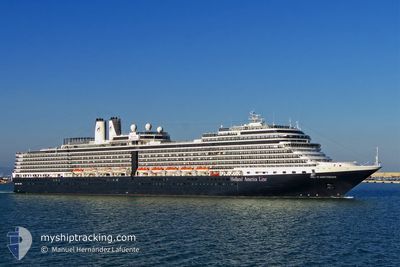
NIEUW AMSTERDAM
Passengers Ship
Current Trip
| Time Travelled | 7 h, 52 mins |
|---|---|
| Remaining Time | 1 day |
| Distance Travelled | 120.59 nm |
| Remaining Distance | 412.05 nm |
| AVG Speed | 15.8 Knots |
| MAX Speed | 17.4 Knots |
| AVG Wind | 7.6 knots |
| MAX Wind | 15 knots |
| MIN Temp | 7.3°C / 45.14°F |
| MAX Temp | 9.3°C / 48.74°F |
| Draught | 8.1 m |
| Position Received | Now |
Current Position
| Longitude | -130.82514° |
|---|---|
| Latitude | 53.41850° |
| Status | Under way using engine |
| Speed | 17 Knots |
| Course | 169.9° |
| Area | The Coastal Waters of Southeast Alaska and British Columbia |
| Station | T-AIS |
| Position Received | Now |
Info
Information
The current position of NIEUW AMSTERDAM is in The Coastal Waters of Southeast Alaska and British Columbia with coordinates 53.41850° / -130.82514° as reported on 2024-05-18 08:53 by AIS to our vessel tracker app. The vessel's current speed is 17 Knots and is heading at the port of VANCOUVER. The estimated time of arrival as calculated by vessel tracking app is 2024-05-19 10:09 LT
The vessel NIEUW AMSTERDAM (IMO: 9378450, MMSI: 246648000) is a Passengers Ship that was built in 2010 ( 14 years old ). It's sailing under the flag of [NL] Netherlands.
In this page you can find informations about the vessels current position, last detected port calls, and current voyage information. If the vessels is not in coverage by AIS you will find the latest position.
The current position of NIEUW AMSTERDAM is detected by our AIS receivers and we are not responsible for the reliability of the data. The last position was recorded while the vessel was in Coverage by the Ais receivers of our vessel tracking app.
The current draught of NIEUW AMSTERDAM as reported by AIS is 8.1 meters
Weather
| Temperature | 7.6°C / 45.68°F |
|---|---|
| Wind Speed | 5 knots |
| Direction | 349° N |
| Pressure | 1019.8 hPa |
| Humidity | 73.4 % |
| Cloud Coverage | 100 % |
Featured Company
Last Port Calls
| Port | Arrival | Departure | Time In Port |
|---|---|---|---|
| 2024-05-17 14:38 | 2024-05-18 01:02 | 10 h | |
| 2024-05-16 15:38 | 2024-05-17 02:58 | 11 h | |
| 2024-05-14 12:54 | 2024-05-15 04:50 | 15 h | |
| 2024-05-13 15:06 | 2024-05-14 05:22 | 14 h | |
| 2024-05-11 18:50 | 2024-05-12 04:06 | 9 h | |
| 2024-05-10 17:02 | 2024-05-11 02:22 | 9 h | |
| 2024-05-09 15:22 | 2024-05-10 01:54 | 10 h | |
| 2024-05-08 13:42 | 2024-05-08 23:06 | 9 h | |
| 2024-05-05 13:23 | 2024-05-05 23:38 | 10 h | |
| 2024-05-03 17:26 | 2024-05-04 03:06 | 9 h |
Most Visited Ports (Last year)
| Port | Arrivals | |
|---|---|---|
| 25 | ||
| 21 | ||
| 21 | ||
| 20 | ||
| 19 | ||
| 17 |
Last Trips
| Origin | Departure | Destination | Arrival | Distance | |
|---|---|---|---|---|---|
| 2024-05-16 18:58 | 2024-05-17 06:38 | 85.56 nm | |||
| 2024-05-14 20:50 | 2024-05-16 07:38 | 429.56 nm | |||
| 2024-05-13 21:22 | 2024-05-14 04:54 | 97.81 nm | |||
| 2024-05-11 20:06 | 2024-05-13 07:06 | 518.52 nm | |||
| 2024-05-10 18:22 | 2024-05-11 10:50 | 291.26 nm | |||
| 2024-05-09 17:54 | 2024-05-10 09:02 | 273.11 nm | |||
| 2024-05-08 15:06 | 2024-05-09 07:22 | 294.74 nm | |||
| 2024-05-05 16:38 | 2024-05-08 05:42 | 1161.68 nm | |||
| 2024-05-03 19:06 | 2024-05-05 06:23 | 531.15 nm | |||
| 2024-05-02 17:02 | 2024-05-03 09:26 | 227.20 nm |
Events
| Time | Event | Details | Position / Dest | Info |
|---|---|---|---|---|
| 2024-05-18 04:23 | Change Sea Area | Canadian part of the The Coastal Waters of Southeast Alaska and British Columbia United States (Alaska) part of the The Coastal Waters of Southeast Alaska and British Columbia |
54.56640 / -131.40266
The Coastal Waters of Southeast Alaska and British Columbia
CA VAN
|
Speed: 16.2 kn Course: 148.5° |
| 2024-05-18 02:48 | Destination Changed | CA VAN US SWD |
54.96878 / -131.67916
CA VAN
|
Speed: 15.7 kn Course: 174.3° |
| 2024-05-18 02:48 | ETA Changed | 2024/05/19 13:15 2024/05/08 11:30 |
54.96878 / -131.67916
CA VAN
|
Speed: 15.7 kn Course: 174.3° |
| 2024-05-18 02:11 | Status Changed | Under way using engine Default |
55.11063 / -131.67811
US SWD
|
Speed: 15.8 kn Course: 185° |
| 2024-05-18 02:11 | Status Changed | Default Under way using engine |
55.11201 / -131.67789
US SWD
|
Speed: 15.8 kn Course: 185.1° |
| 2024-05-18 02:04 | Status Changed | Under way using engine Default |
55.14190 / -131.67305
US SWD
|
Speed: 15.2 kn Course: 185° |
| 2024-05-18 01:34 | Status Changed | Default Under way using engine |
55.24639 / -131.63448
US SWD
|
Speed: 11.6 kn Course: 197.1° |
| 2024-05-18 01:28 | Status Changed | Under way using engine Default |
55.26320 / -131.62762
US SWD
|
Speed: 12 kn Course: 207° |
| 2024-05-18 01:23 | Status Changed | Default Under way using engine |
55.27988 / -131.61130
US SWD
|
Speed: 10.7 kn Course: 214.6° |
| 2024-05-18 01:17 | Change Sea Area | United States (Alaska) part of the The Coastal Waters of Southeast Alaska and British Columbia Canadian part of the The Coastal Waters of Southeast Alaska and British Columbia |
55.29322 / -131.59165
The Coastal Waters of Southeast Alaska and British Columbia
|
Speed: 10.7 kn Course: 214.6° |