
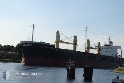
NIKOLAOS A
Bulk Carrier
Current Trip
| Time Travelled | --- |
|---|---|
| Remaining Time | --- |
| Distance Travelled | 7857.37 nm |
| Remaining Distance | --- |
| AVG Speed | 11.4 Knots |
| MAX Speed | 11.4 Knots |
| AVG Wind | 12.4 knots |
| MAX Wind | 32.5 knots |
| MIN Temp | 13.8°C / 56.84°F |
| MAX Temp | 30.8°C / 87.44°F |
| Draught | 6.5 m |
| Position Received | 16 h, 46 m ago |
Current Position
| Longitude | -9.84313° |
|---|---|
| Latitude | 39.99204° |
| Status | Under way using engine |
| Speed | 10.9 Knots |
| Course | 0.6° |
| Area | North Atlantic Ocean |
| Station | T-AIS |
| Position Received | 16 h, 46 m ago |
Info
Information
The current position of NIKOLAOS A is in North Atlantic Ocean with coordinates 39.99204° / -9.84313° as reported on 2024-05-19 10:42 by AIS to our vessel tracker app. The vessel's current speed is 10.9 Knots and is heading at the port of SKAGEN. The estimated time of arrival as calculated by vessel tracking app is 2024-05-24 00:30 LT
The vessel NIKOLAOS A (IMO: 9493949, MMSI: 538005791) is a Bulk Carrier that was built in 2009 ( 15 years old ). It's sailing under the flag of [MH] Marshall Is.
In this page you can find informations about the vessels current position, last detected port calls, and current voyage information. If the vessels is not in coverage by AIS you will find the latest position.
The current position of NIKOLAOS A is detected by our AIS receivers and we are not responsible for the reliability of the data. The last position was recorded while the vessel was in Coverage by the Ais receivers of our vessel tracking app.
The current draught of NIKOLAOS A as reported by AIS is 6.5 meters
Weather
| Temperature | 13.8°C / 56.84°F |
|---|---|
| Wind Speed | 6 knots |
| Direction | 357° N |
| Pressure | 1014.7 hPa |
| Humidity | 83.8 % |
| Cloud Coverage | 6 % |
Featured Company
Last Port Calls
| Port | Arrival | Departure | Time In Port |
|---|---|---|---|
| 2024-05-06 03:36 | 2024-05-06 12:30 | 8 h | |
| 2024-03-11 05:45 | 2024-03-11 14:45 | 9 h |
Most Visited Ports (Last year)
| Port | Arrivals | |
|---|---|---|
| 5 | ||
| 1 | ||
| 1 | ||
| 1 | ||
| 1 |
Last Trips
| Origin | Departure | Destination | Arrival | Distance | |
|---|---|---|---|---|---|
| 2024-02-29 07:25 | 2024-05-06 05:36 | 4986.40 nm | |||
| 2024-02-29 07:25 | 2024-03-11 07:45 | 1322.17 nm |
Events
| Time | Event | Details | Position / Dest | Info |
|---|---|---|---|---|
| 2024-05-19 10:47 | Status Changed | Default Under way using engine |
40.00619 / -9.84325
DK SKA
|
Speed: 10.9 kn Course: 0.6° |
| 2024-05-19 10:42 | OUT of Coverage |
39.99204 / -9.84313
North Atlantic Ocean
DK SKA
|
Speed: 10.9 kn Course: 0.6° |
|
| 2024-05-19 10:30 | Status Changed | Under way using engine Default |
39.95490 / -9.84309
DK SKA
|
Speed: 10.5 kn Course: 1° |
| 2024-05-19 10:22 | Status Changed | Default Under way using engine |
39.93317 / -9.84303
DK SKA
|
Speed: 10.8 kn Course: 359.8° |
| 2024-05-18 21:06 | Status Changed | Under way using engine Default |
37.50080 / -9.52424
DK SKA
|
Speed: 10.6 kn Course: 351° |
| 2024-05-18 20:38 | Status Changed | Default Under way using engine |
37.41988 / -9.50386
DK SKA
|
Speed: 10.8 kn Course: 335.8° |
| 2024-05-18 20:22 | Status Changed | Under way using engine Default |
37.37556 / -9.48055
DK SKA
|
Speed: 10.6 kn Course: 336° |
| 2024-05-18 20:15 | Status Changed | Default Under way using engine |
37.35609 / -9.47029
DK SKA
|
Speed: 10.2 kn Course: 338.2° |
| 2024-05-18 20:07 | Status Changed | Under way using engine Default |
37.33523 / -9.46001
DK SKA
|
Speed: 10.2 kn Course: 340° |
| 2024-05-18 19:55 | Status Changed | Default Under way using engine |
37.30155 / -9.44670
DK SKA
|
Speed: 10.7 kn Course: 346.6° |