
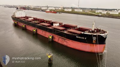
NIKOLAS D
Cargo
Current Trip
| Time Travelled | 6 days |
|---|---|
| Remaining Time | 6 days |
| Distance Travelled | 2043.19 nm |
| Remaining Distance | 1636.25 nm |
| AVG Speed | 12.1 Knots |
| MAX Speed | 17.6 Knots |
| AVG Wind | 9.6 knots |
| MAX Wind | 21 knots |
| MIN Temp | 7.6°C / 45.68°F |
| MAX Temp | 17.8°C / 64.04°F |
| Draught | 7.7 m |
| Position Received | 4 d ago |
Current Position
| Longitude | -4.80185° |
|---|---|
| Latitude | 58.69783° |
| Status | Under way using engine |
| Speed | 10.8 Knots |
| Course | 268.1° |
| Area | North Atlantic Ocean |
| Station | T-AIS |
| Position Received | 4 d ago |
Info
Information
The current position of NIKOLAS D is in North Atlantic Ocean with coordinates 58.69783° / -4.80185° as reported on 2024-05-27 10:54 by AIS to our vessel tracker app. The vessel's current speed is 10.8 Knots and is heading at the port of NORFOLK. The estimated time of arrival as calculated by vessel tracking app is 2024-06-07 22:17 LT
The vessel NIKOLAS D (IMO: 9474723, MMSI: 352993000) is a Cargo It's sailing under the flag of [PA] Panama.
In this page you can find informations about the vessels current position, last detected port calls, and current voyage information. If the vessels is not in coverage by AIS you will find the latest position.
The current position of NIKOLAS D is detected by our AIS receivers and we are not responsible for the reliability of the data. The last position was recorded while the vessel was in Coverage by the Ais receivers of our vessel tracking app.
The current draught of NIKOLAS D as reported by AIS is 7.7 meters
Weather
| Temperature | 12.2°C / 53.96°F |
|---|---|
| Wind Speed | 13 knots |
| Direction | 175° S |
| Pressure | 1018.8 hPa |
| Humidity | 90.5 % |
| Cloud Coverage | 93 % |
Featured Company
Events
| Time | Event | Details | Position / Dest | Info |
|---|---|---|---|---|
| 2024-05-27 10:59 | Status Changed | Default Under way using engine |
58.69721 / -4.82964
US NNS
|
Speed: 10.8 kn Course: 268.1° |
| 2024-05-27 10:54 | OUT of Coverage |
58.69783 / -4.80185
North Atlantic Ocean
US NNS
|
Speed: 10.8 kn Course: 268.1° |
|
| 2024-05-27 07:16 | Change Sea Area | United Kingdom part of the North Atlantic Ocean United Kingdom part of the North Sea |
58.71406 / -3.41979
North Atlantic Ocean
US NNS
|
Speed: 14 kn Course: 268.9° |
| 2024-05-27 05:26 | Status Changed | Under way using engine Default |
58.53270 / -2.69402
US NNS
|
Speed: 13.4 kn Course: 313° |
| 2024-05-27 05:23 | Status Changed | Default Under way using engine |
58.52617 / -2.68127
US NNS
|
Speed: 13.3 kn Course: 315.5° |
| 2024-05-27 05:07 | Status Changed | Under way using engine Default |
58.48384 / -2.59899
US NNS
|
Speed: 13.2 kn Course: 314° |
| 2024-05-27 04:59 | Status Changed | Default Under way using engine |
58.46453 / -2.56010
US NNS
|
Speed: 13 kn Course: 318.4° |
| 2024-05-27 04:37 | Status Changed | Under way using engine Default |
58.40634 / -2.45587
US NNS
|
Speed: 12.8 kn Course: 317° |
| 2024-05-27 04:19 | IN Coverage |
58.40634 / -2.45587
North Sea
US NNS
|
Speed: 12.8 kn Course: 317.4° |
|
| 2024-05-27 02:22 | OUT of Coverage |
58.10436 / -1.79289
North Sea
US NNS
|
Speed: 12.2 kn Course: 313.2° |